File:Mississippi River Lock and Dam number 5A.jpg
Size of this preview: 600 × 600 pixels. Other resolutions: 240 × 240 pixels | 480 × 480 pixels | 768 × 768 pixels | 1,024 × 1,024 pixels | 1,500 × 1,500 pixels.
Original file (1,500 × 1,500 pixels, file size: 692 KB, MIME type: image/jpeg)
Captions
Captions
Add a one-line explanation of what this file represents
| Description |
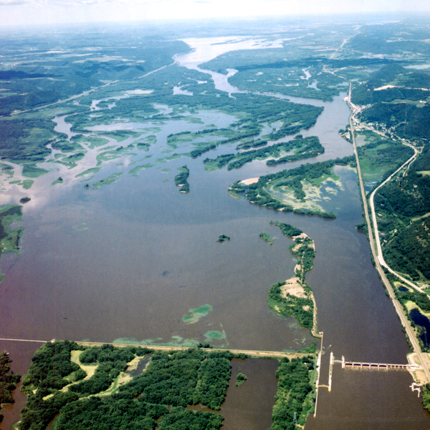
English: Aerial view of Lock and Dam #5A on the Mississippi River near Fountain City, Wisconsin. The view is upriver to the northwest. |
|||
| Date | not specified or unknown | |||
| Source |
U.S. Army Corps of Engineers Digital Visual Library Image page Image description page Digital Visual Library home page |
|||
| Author | U.S. Army Corps of Engineers, photographer not specified or unknown | |||
| Permission (Reusing this file) |
|
|||
| Location | Fountain City, Wisconsin, USA |
| Camera location | | View this and other nearby images on: OpenStreetMap |
|---|
File history
Click on a date/time to view the file as it appeared at that time.
| Date/Time | Thumbnail | Dimensions | User | Comment | |
|---|---|---|---|---|---|
| current | 20:44, 1 April 2007 | | 1,500 × 1,500 (692 KB) | DanMS (talk | contribs) | {{Information | Description = {{en|Aerial view of Lock and Dam #5A on the Mississippi River near Fountain City, Wisconsin. The view is upriver to the northwest.}} | Source = U.S. Army Corps of Engineers Digital Visual Library<br />[http://image |
You cannot overwrite this file.
File usage on Commons
The following page uses this file:
File usage on other wikis
The following other wikis use this file:
- Usage on ceb.wikipedia.org
- Usage on www.wikidata.org