File:Miyagi-sendai-Miyaginohara-park-1984.jpg

Size of this preview: 600 × 600 pixels. Other resolutions: 240 × 240 pixels | 480 × 480 pixels | 768 × 768 pixels | 1,024 × 1,024 pixels | 2,048 × 2,048 pixels | 3,000 × 3,000 pixels.
Original file (3,000 × 3,000 pixels, file size: 4.2 MB, MIME type: image/jpeg)
Captions
Captions
Add a one-line explanation of what this file represents
| Description |
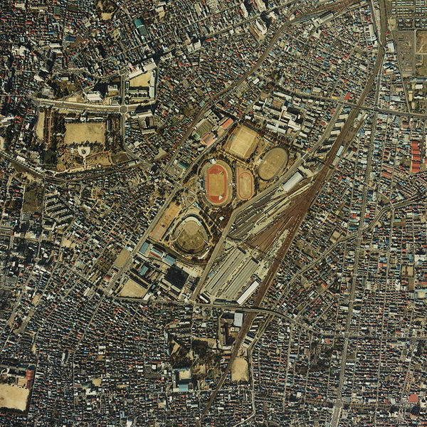
English: Miyaginohara park in Sendai, Miyagi from satellite. Taken in 1984 日本語: 宮城野原公園(宮城野原公園総合運動場)の衛星写真。1984年(昭和59年)撮影 한국어: 미야기노하라 공원 종합 운동장 (현영 미야기 구장 있음) 인공위성 사진. 1984년 찍음 |
|||||
| Date | ||||||
| Source | here | |||||
| Author | The Ministry of Land, Infrastructure and Transport of Japan | |||||
| Permission (Reusing this file) |
|


File history
Click on a date/time to view the file as it appeared at that time.
| Date/Time | Thumbnail | Dimensions | User | Comment | |
|---|---|---|---|---|---|
| current | 08:23, 26 December 2006 | | 3,000 × 3,000 (4.2 MB) | LERK (talk | contribs) | {{Information| Description={{en|Miyaginohara park in Sendai, Miyagi from satellite. Taken in 1984}}{{ja|宮城野原公園(ja:宮城野原公園総合運動場)の衛星写真。1984年(昭和59年)撮影}}{{ko|미야기노하라 공원 종� |
You cannot overwrite this file.
File usage on Commons
There are no pages that use this file.
File usage on other wikis
The following other wikis use this file:
- Usage on ja.wikipedia.org
- Usage on ko.wikipedia.org