File:Miyazaki Kagoshima prefectural route 2 (OpenStreetMap).png
No higher resolution available.
Miyazaki_Kagoshima_prefectural_route_2_(OpenStreetMap).png (290 × 200 pixels, file size: 27 KB, MIME type: image/png)
Captions
Captions
Add a one-line explanation of what this file represents
Summary
edit.png&action=edit§ion=1)
| Description |
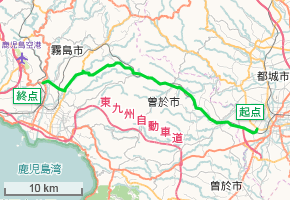
日本語: 宮崎県道・鹿児島県道2号都城隼人線 路線図 (OpenStreetMapの画像を一部修正) |
| Date | |
| Source | OpenStreetMap |
| Author | OpenStreetMap contributors and Krypton (talk · contribs) |
Licensing
edit.png&action=edit§ion=2)
| Description |
This map was created from OpenStreetMap project data, collected by the community. This map may be incomplete, and may contain errors. Don't rely solely on it for navigation. |
|||
| Date | (see file history) | |||
| Source | openstreetmap.org | |||
| Creator |
OpenStreetMap contributors |
|||
| Permission (Reusing this file) |
OpenStreetMap data is available under the Open Database License (details). Map tiles are licensed under the Creative Commons Attribution-ShareAlike 2.0 license (CC-BY-SA 2.0).
This file is licensed under the Creative Commons Attribution-Share Alike 2.0 Generic license.
|
|||
| Georeferencing | If inappropriate please set warp_status = skip to hide. |
File history
Click on a date/time to view the file as it appeared at that time.
| Date/Time | Thumbnail | Dimensions | User | Comment | |
|---|---|---|---|---|---|
| current | 07:14, 9 January 2016 | | 290 × 200 (27 KB) | Krypton (talk | contribs) | User created page with UploadWizard |
You cannot overwrite this file.
File usage on Commons
The following page uses this file:
File usage on other wikis
The following other wikis use this file:
- Usage on ja.wikipedia.org
- Usage on www.wikidata.org
.png&oldid=602919133)