File:Mogollon Mountains viewed from Aldo Leopold Vista.jpg
Size of this preview: 800 × 455 pixels. Other resolutions: 320 × 182 pixels | 640 × 364 pixels | 1,080 × 614 pixels.
Original file (1,080 × 614 pixels, file size: 548 KB, MIME type: image/jpeg)
File information
Structured data
Captions
Summary
editDescriptionMogollon Mountains viewed from Aldo Leopold Vista.jpg |
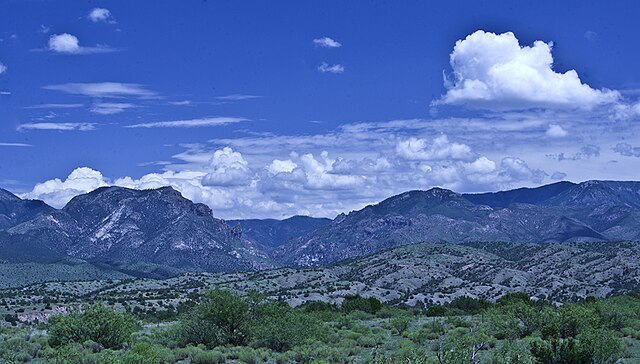
English: Looking NE from Leopold Vista, just off US 180.
Español: Las Montañas Mogollones al noreste de vista escénica Aldo Leopold. |
Date | |
Source | Own work |
Author | Matthew Timothy Bradley |
Camera location | 33° 10′ 54.7″ N, 108° 49′ 32.65″ W | View this and other nearby images on: OpenStreetMap | 33.181862; -108.825737 |
---|
Licensing
editI, the copyright holder of this work, hereby publish it under the following license:
This file is licensed under the Creative Commons Attribution-Share Alike 4.0 International license.
- You are free:
- to share – to copy, distribute and transmit the work
- to remix – to adapt the work
- Under the following conditions:
- attribution – You must give appropriate credit, provide a link to the license, and indicate if changes were made. You may do so in any reasonable manner, but not in any way that suggests the licensor endorses you or your use.
- share alike – If you remix, transform, or build upon the material, you must distribute your contributions under the same or compatible license as the original.
File history
Click on a date/time to view the file as it appeared at that time.
Date/Time | Thumbnail | Dimensions | User | Comment | |
---|---|---|---|---|---|
current | 16:28, 1 January 2018 | 1,080 × 614 (548 KB) | MateoTimateo (talk | contribs) | User created page with UploadWizard |
You cannot overwrite this file.
File usage on Commons
The following page uses this file:
File usage on other wikis
The following other wikis use this file:
- Usage on cs.wikipedia.org
- Usage on en.wikipedia.org
Metadata
This file contains additional information such as Exif metadata which may have been added by the digital camera, scanner, or software program used to create or digitize it. If the file has been modified from its original state, some details such as the timestamp may not fully reflect those of the original file. The timestamp is only as accurate as the clock in the camera, and it may be completely wrong.
Camera manufacturer | RICOH IMAGING COMPANY, LTD. |
---|---|
Camera model | PENTAX K-3 II |
Author | Matthew Timothy Bradley |
Copyright holder |
|
Exposure time | 1/5 sec (0.2) |
F-number | f/32 |
ISO speed rating | 100 |
Date and time of data generation | 13:18, 4 August 2017 |
Lens focal length | 40 mm |
Latitude | 33° 10′ 54.7″ N |
Longitude | 108° 49′ 32.65″ W |
Altitude | 1,603.5 meters above sea level |
Short title |
|
Width | 5,280 px |
Height | 3,002 px |
Bits per component |
|
Pixel composition | RGB |
Orientation | Normal |
Number of components | 3 |
Horizontal resolution | 240 dpi |
Vertical resolution | 240 dpi |
Software used | Adobe Photoshop Camera Raw 6.7.1 (Macintosh) |
File change date and time | 16:31, 4 August 2017 |
Exposure Program | Aperture priority |
Exif version | 2.3 |
Date and time of digitizing | 13:18, 4 August 2017 |
APEX shutter speed | 2.321928 |
APEX aperture | 10 |
APEX exposure bias | 0 |
Metering mode | Pattern |
Flash | Flash did not fire, compulsory flash suppression |
Color space | Uncalibrated |
Sensing method | One-chip color area sensor |
Custom image processing | Custom process |
Exposure mode | Manual exposure |
White balance | Manual white balance |
Focal length in 35 mm film | 60 mm |
Scene capture type | Standard |
Contrast | Normal |
Saturation | Normal |
Sharpness | Normal |
Subject distance range | Distant view |
GPS time (atomic clock) | 19:18 |
Satellites used for measurement | 09 |
Receiver status | Measurement in progress |
Measurement mode | 3-dimensional measurement |
Speed unit | Kilometers per hour |
Speed of GPS receiver | 0.04 |
Reference for direction of movement | True direction |
Direction of movement | 0 |
Reference for direction of image | True direction |
Direction of image | 39.33 |
Geodetic survey data used | WGS-84 |
GPS date | 4 August 2017 |
GPS tag version | 0.0.3.2 |
Date metadata was last modified | 04:12, 1 January 2018 |
Unique ID of original document | 7FD9841246C45F6D51907B40811566A8 |
Keywords | Gila National Forest |
Province or state shown | US-NM |
Country shown | United States |
Code for country shown | US |
IIM version | 4 |