File:Moho EU.png
Size of this preview: 446 × 600 pixels. Other resolutions: 178 × 240 pixels | 357 × 480 pixels | 571 × 768 pixels | 762 × 1,024 pixels | 2,021 × 2,717 pixels.
Original file (2,021 × 2,717 pixels, file size: 260 KB, MIME type: image/png)
Captions
Captions
Add a one-line explanation of what this file represents
Summary
edit
| Description |
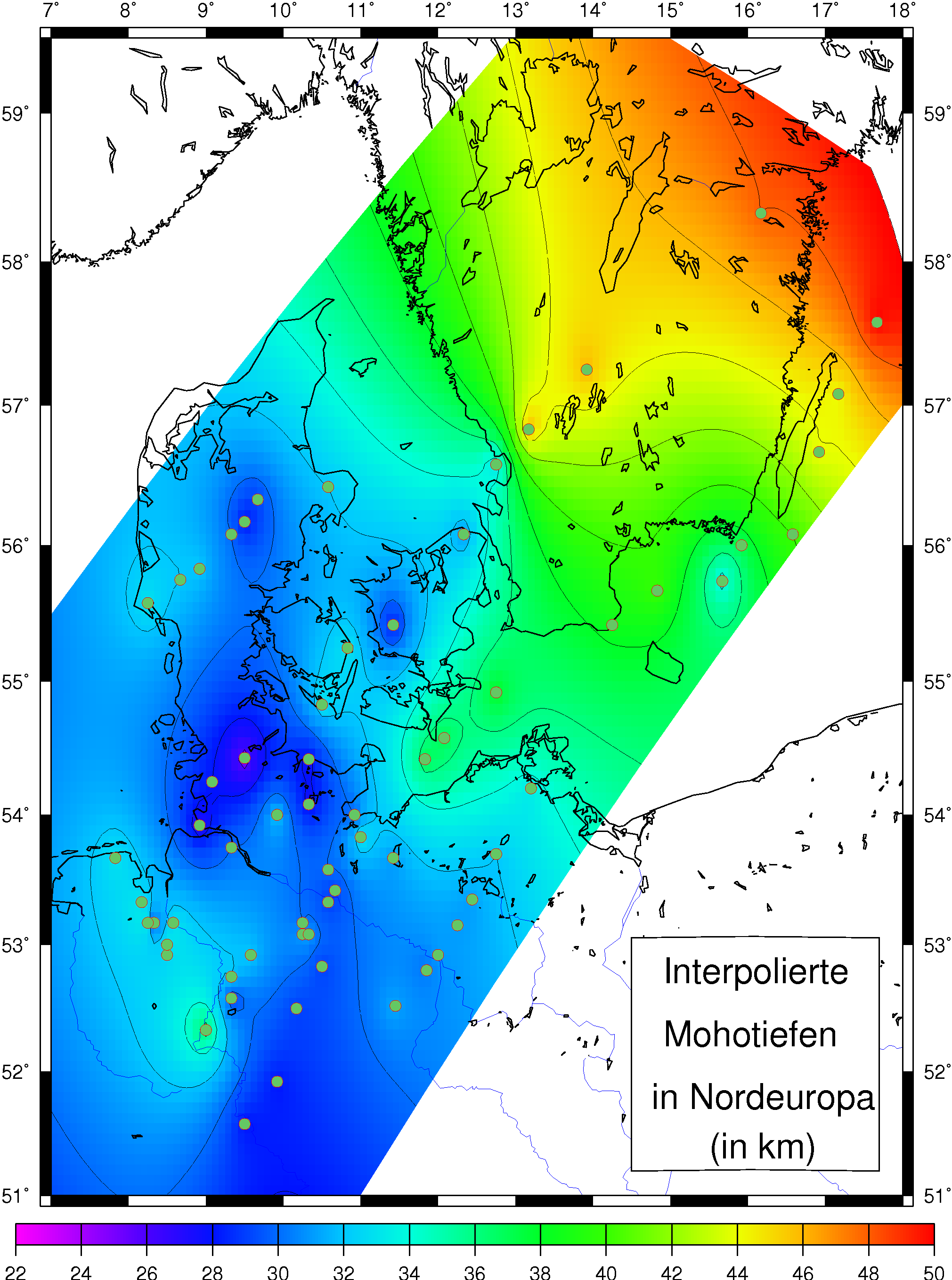
English: map showing depth to Moho between northern Germany and southern Sweden
Deutsch: Karte mit interpolierten Mohotiefen für Norddeutschland bis Südschweden |
| Date | 1999, modified 2006 |
| Source | own work taken from my diploma thesis |
| Author | Ingo Wölbern |
| Permission (Reusing this file) |
I, the author, provide this figure to be used in the public domain |
Licensing
edit
| I, the copyright holder of this work, release this work into the public domain. This applies worldwide. In some countries this may not be legally possible; if so: I grant anyone the right to use this work for any purpose, without any conditions, unless such conditions are required by law. |
File history
Click on a date/time to view the file as it appeared at that time.
| Date/Time | Thumbnail | Dimensions | User | Comment | |
|---|---|---|---|---|---|
| current | 01:33, 23 August 2006 | | 2,021 × 2,717 (260 KB) | Iwoelbern (talk | contribs) | {{Information |Description=map showing depth to Moho between northern Germany and southern Sweden / Karte mit interpolierten Mohotiefen für Norddeutschland bis Südschweden |Source=own work taken from my diploma thesis |Date= 1999, modified 2006 |Author |
You cannot overwrite this file.
File usage on Commons
The following page uses this file: