File:Mokelumne-aqueduct.jpg

Size of this preview: 523 × 599 pixels. Other resolutions: 209 × 240 pixels | 419 × 480 pixels | 681 × 780 pixels.
Original file (681 × 780 pixels, file size: 288 KB, MIME type: image/jpeg)
Captions
Captions
Add a one-line explanation of what this file represents
Summary edit
| Description |
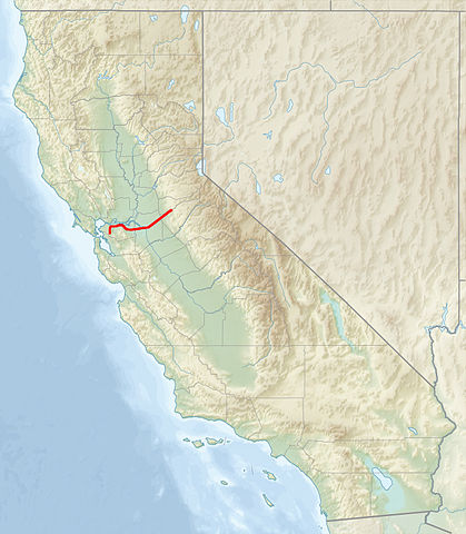
English: Map of California showing location of Mokelumne Aqueduct |
| Date | |
| Source | File:Relief_map_of_California.png |
| Author | Shannon1 |
| Permission (Reusing this file) |
Derivative of another work on Commons |
Important Design Problems
the typical horizontal spacing of expansion in joints for the older pipes(buried pipe lines) is 2,600 ft. in comparison to the newer line (above ground)which is 992 ft. this different obeys to some of the upgrade in design incorporated to the new above ground segments.
Licensing edit
I, the copyright holder of this work, hereby publish it under the following licenses:

|
Permission is granted to copy, distribute and/or modify this document under the terms of the GNU Free Documentation License, Version 1.2 or any later version published by the Free Software Foundation; with no Invariant Sections, no Front-Cover Texts, and no Back-Cover Texts. A copy of the license is included in the section entitled GNU Free Documentation License. |
This file is licensed under the Creative Commons Attribution-Share Alike Attribution-Share Alike 4.0 International, 3.0 Unported, 2.5 Generic, 2.0 Generic and 1.0 Generic license.
- You are free:
- to share – to copy, distribute and transmit the work
- to remix – to adapt the work
- Under the following conditions:
- attribution – You must give appropriate credit, provide a link to the license, and indicate if changes were made. You may do so in any reasonable manner, but not in any way that suggests the licensor endorses you or your use.
- share alike – If you remix, transform, or build upon the material, you must distribute your contributions under the same or compatible license as the original.
You may select the license of your choice.
File history
Click on a date/time to view the file as it appeared at that time.
| Date/Time | Thumbnail | Dimensions | User | Comment | |
|---|---|---|---|---|---|
| current | 00:45, 18 January 2014 | | 681 × 780 (288 KB) | Shannon1 (talk | contribs) | {{Information |Description ={{en|1=Map of California showing location of en:Mokelumne Aqueduct}} |Source =File:Relief_map_of_California.png |Author =Shannon1 |Date =2014-01-17 |Permission =Der... |
You cannot overwrite this file.
File usage on Commons
The following page uses this file:
File usage on other wikis
The following other wikis use this file:
- Usage on ceb.wikipedia.org
- Usage on en.wikipedia.org
- Usage on fr.wikipedia.org
- Usage on nl.wikipedia.org
- Usage on uz.wikipedia.org
- Usage on www.wikidata.org