File:Moline lock and steamboat canal.jpg

Size of this preview: 800 × 533 pixels. Other resolutions: 320 × 213 pixels | 640 × 427 pixels | 1,024 × 683 pixels | 1,280 × 853 pixels | 2,560 × 1,707 pixels | 6,000 × 4,000 pixels.
Original file (6,000 × 4,000 pixels, file size: 4.01 MB, MIME type: image/jpeg)
Captions
Captions
Moline lock and steamboat canal, Moline, Illinois
Summary
edit
| Description |
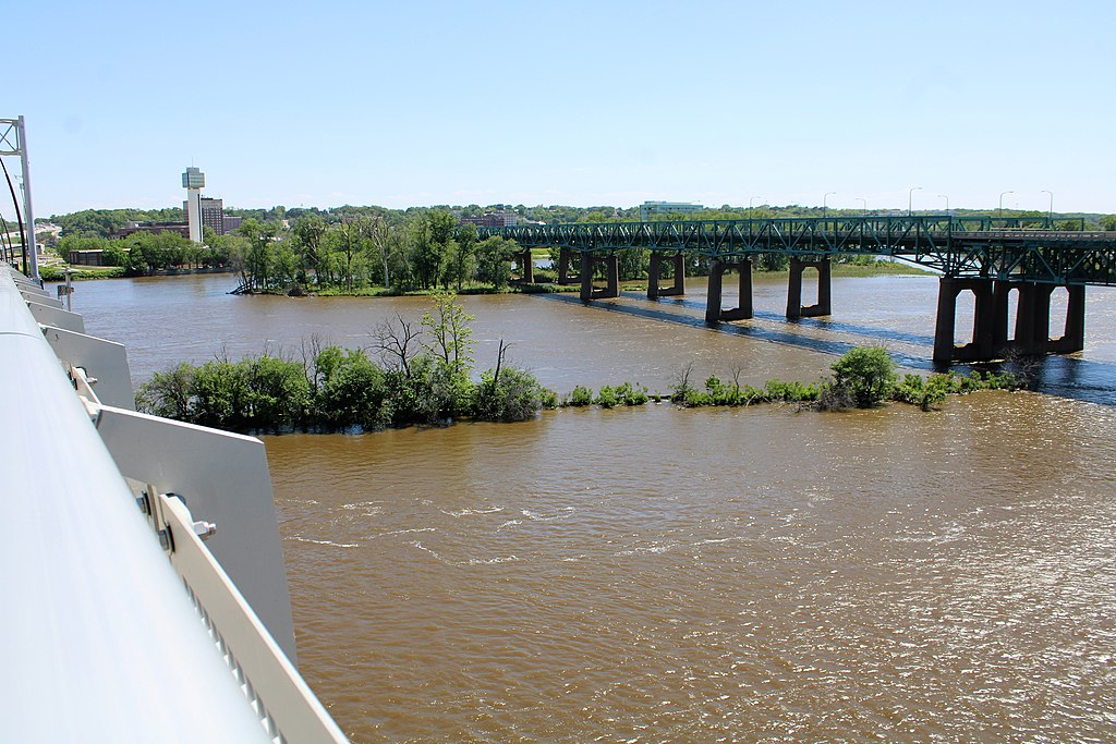
English: The trees in the river mark the remnants of the Moline lock and steamboat canal in Moline, Illinois. It was built in 1907 as a way to by-pass the Rock Island Rapids on the Mississippi River. It was abandoned after Lock and Dam No. 15 was completed downstream in the early 1930s. The view is from the I-74 Bridge with the old bridge in the background. |
| Date | Taken on 3 June 2022 15:07:52 |
| Source | Own work |
| Author | Farragutful |
| Camera location | | View this and other nearby images on: OpenStreetMap |
|---|
Licensing
edit
I, the copyright holder of this work, hereby publish it under the following license:
This file is licensed under the Creative Commons Attribution-Share Alike 4.0 International license.
- You are free:
- to share – to copy, distribute and transmit the work
- to remix – to adapt the work
- Under the following conditions:
- attribution – You must give appropriate credit, provide a link to the license, and indicate if changes were made. You may do so in any reasonable manner, but not in any way that suggests the licensor endorses you or your use.
- share alike – If you remix, transform, or build upon the material, you must distribute your contributions under the same or compatible license as the original.
File history
Click on a date/time to view the file as it appeared at that time.
| Date/Time | Thumbnail | Dimensions | User | Comment | |
|---|---|---|---|---|---|
| current | 17:43, 23 June 2022 | | 6,000 × 4,000 (4.01 MB) | Farragutful (talk | contribs) | Uploaded own work with UploadWizard |
You cannot overwrite this file.
File usage on Commons
There are no pages that use this file.