File:Monorierdő II. katonai felmérés 1806–1869.jpg
Size of this preview: 800 × 511 pixels. Other resolutions: 320 × 204 pixels | 640 × 409 pixels | 936 × 598 pixels.
Original file (936 × 598 pixels, file size: 177 KB, MIME type: image/jpeg)
Captions
Captions
Add a one-line explanation of what this file represents
Summary
edit
| Description |
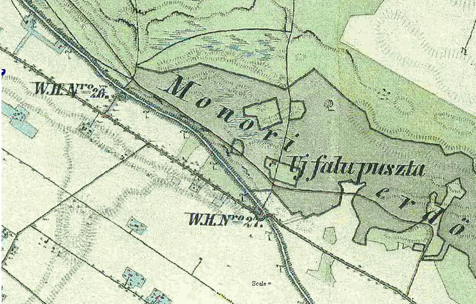
Magyar: Monorierdő – II. katonai felmérés térképe (1806–1869) |
| Date | 1806–1869 |
| Source | http://archivportal.arcanum.hu/maps/html/katfelm2b_google.html[dead link] |
| Author | Katonai Térképészet |
| Other versions | mapire.eu |
Licensing
edit
|
This is a faithful photographic reproduction of a two-dimensional, public domain work of art. The work of art itself is in the public domain for the following reason:
The official position taken by the Wikimedia Foundation is that "faithful reproductions of two-dimensional public domain works of art are public domain".
This photographic reproduction is therefore also considered to be in the public domain in the United States. In other jurisdictions, re-use of this content may be restricted; see Reuse of PD-Art photographs for details. |
File history
Click on a date/time to view the file as it appeared at that time.
| Date/Time | Thumbnail | Dimensions | User | Comment | |
|---|---|---|---|---|---|
| current | 19:32, 20 November 2012 | | 936 × 598 (177 KB) | Cervus (talk | contribs) | {{Információ | leírás = Monorierdő – III. katonai felmérés térképe (1869-1887) | forrás = arcanum.hu | dátum = 2012. 11. 20. | helyszín = Monorierdő | szerző = III. katonai felmérés térképe (1… |
You cannot overwrite this file.
File usage on Commons
There are no pages that use this file.
File usage on other wikis
The following other wikis use this file:
- Usage on hu.wikipedia.org