File:Monroe County (New York) - Towns, Villages, and City.svg

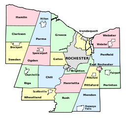
Size of this PNG preview of this SVG file: 640 × 600 pixels. Other resolutions: 256 × 240 pixels | 819 × 768 pixels | 1,092 × 1,024 pixels | 2,185 × 2,048 pixels | 1,500 × 1,406 pixels.
Original file (SVG file, nominally 1,500 × 1,406 pixels, file size: 73 KB)
Captions
Captions
Add a one-line explanation of what this file represents
Summary
edit_-_Towns,_Villages,_and_City.svg&action=edit§ion=1)
| Description |
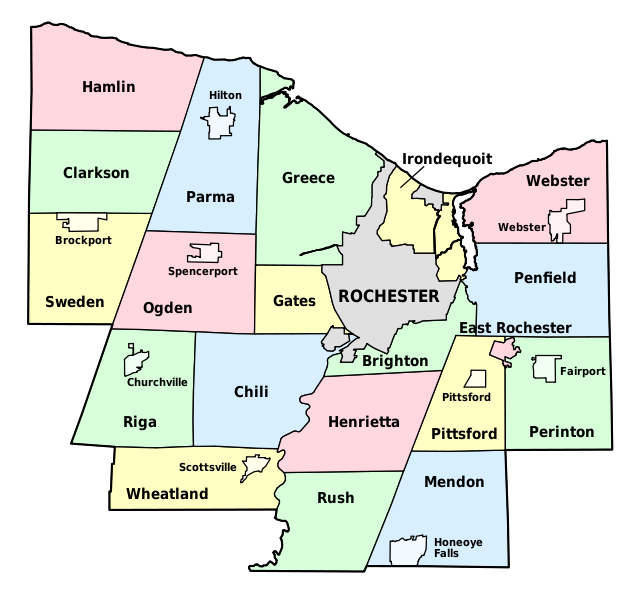
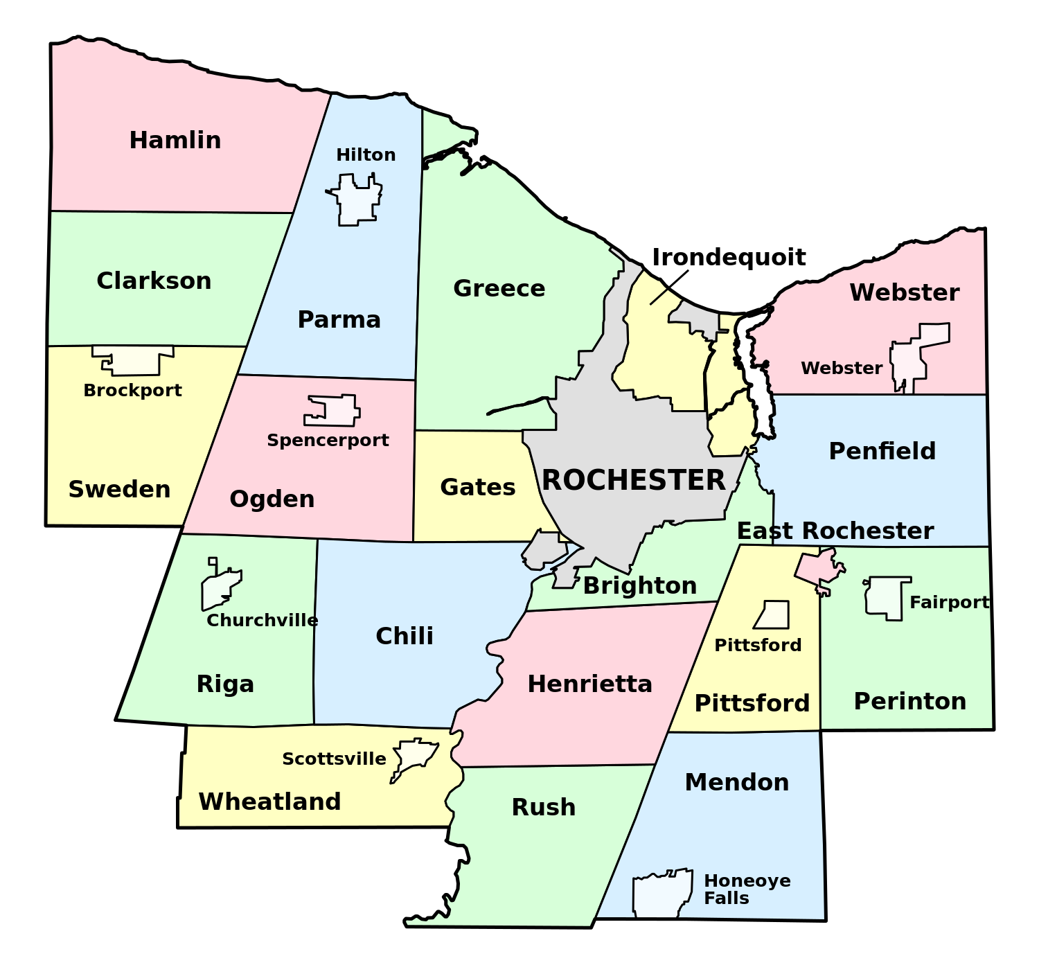
English: Map of Monroe County, New York, showing its constituent towns, villages, and city. Labels in English. |
| Date | |
| Source | Own work by uploader, based on public domain USGS topographic maps |
| Author | LtPowers |
This W3C-unspecified vector image was created with Inkscape .
Licensing
edit_-_Towns,_Villages,_and_City.svg&action=edit§ion=2)
I, the copyright holder of this work, hereby publish it under the following license:
This file is licensed under the Creative Commons Attribution-Share Alike 3.0 Unported license.
- You are free:
- to share – to copy, distribute and transmit the work
- to remix – to adapt the work
- Under the following conditions:
- attribution – You must give appropriate credit, provide a link to the license, and indicate if changes were made. You may do so in any reasonable manner, but not in any way that suggests the licensor endorses you or your use.
- share alike – If you remix, transform, or build upon the material, you must distribute your contributions under the same or compatible license as the original.
File history
Click on a date/time to view the file as it appeared at that time.
| Date/Time | Thumbnail | Dimensions | User | Comment | |
|---|---|---|---|---|---|
| current | 16:58, 30 November 2008 | | 1,500 × 1,406 (73 KB) | LtPowers (talk | contribs) | {{Information |Description={{en|1=Map of Monroe County, New York, showing its constituent towns, villages, and city. Labels in English.}} |Source=Own work by uploader, based on public domain USGS topographic maps |Author=[[U |
You cannot overwrite this file.
File usage on Commons
The following page uses this file:
File usage on other wikis
The following other wikis use this file:
- Usage on en.wikipedia.org
- Monroe County, New York
- Irondequoit Bay State Marine Park
- Honeoye Creek
- University of Rochester Arboretum
- North Chili, New York
- Genesee Junction, New York
- Maplewood Park
- Gates Center, New York
- Cobbs Hill Reservoir
- Irondequoit Gully
- Black Creek Park
- Hart's Woods
- Template:MonroeCountyNY-geo-stub
- Adams Basin, New York
- Black Creek (Genesee River tributary)
- High Falls (Rochester, New York)
- Gates (CDP), New York
- Hamlin (CDP), New York
- Clarkson (CDP), New York
- Union Hill, New York
- North Greece, New York
- Usage on es.wikipedia.org
- Usage on fr.wikipedia.org
- Usage on ja.wikipedia.org
- Usage on la.wikipedia.org
- Usage on pt.wikipedia.org
- Usage on www.wikidata.org
_-_Towns,_Villages,_and_City.svg&oldid=505180476)