File:Mont Pigier.JPG

Size of this preview: 800 × 500 pixels. Other resolutions: 320 × 200 pixels | 640 × 400 pixels | 1,024 × 640 pixels | 1,280 × 799 pixels | 2,048 × 1,279 pixels.
Original file (2,048 × 1,279 pixels, file size: 438 KB, MIME type: image/jpeg)
Captions
Captions
Add a one-line explanation of what this file represents
Summary
edit
| Description |
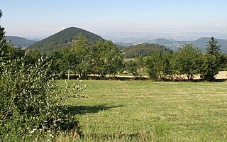
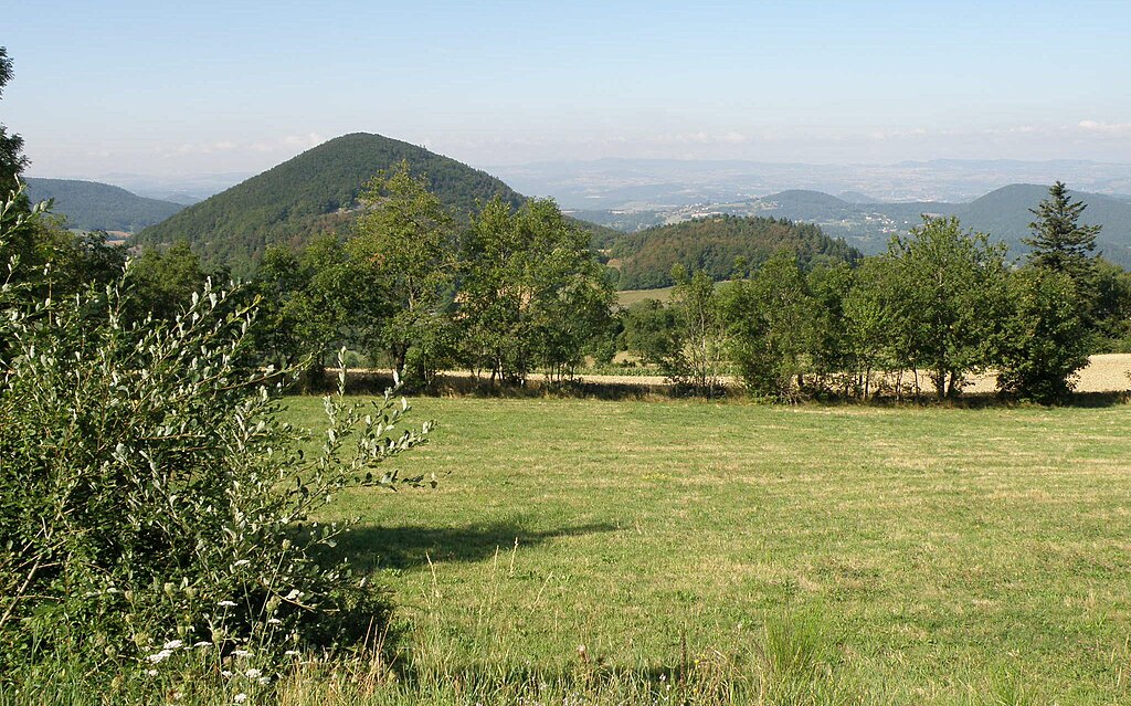
Français : Saint-Hostien, comm. de la Haute-Loire, France. À gauche, le mont Pigier (ou mont Pidgier, graphie utilisée par l'IGN ; alt. 1074m), avec sa silhouette presque parfaitement conique, et dont on voit ici le flanc nord-est. Vue prise depuis la route départementale n° 28 (le Pertuis - Saint-Julien-Chapteuil), non loin du Pertuis. |
| Date | |
| Source | Self-photographed |
| Author | Torsade de Pointes |
Licensing
edit
| I, the copyright holder of this work, release this work into the public domain. This applies worldwide. In some countries this may not be legally possible; if so: I grant anyone the right to use this work for any purpose, without any conditions, unless such conditions are required by law. |
File history
Click on a date/time to view the file as it appeared at that time.
| Date/Time | Thumbnail | Dimensions | User | Comment | |
|---|---|---|---|---|---|
| current | 09:00, 2 January 2010 | | 2,048 × 1,279 (438 KB) | Torsade de Pointes (talk | contribs) | {{Information |Description={{fr|1=Saint-Hostien, comm. de la Haute-Loire, France. Le mont Pigier.}} |Source=Photographie personnelle |Author=Torsade de Pointes |Date=Août 2009 |Permission= |other_versions= }} Category:Saint-Hostien |
You cannot overwrite this file.
File usage on Commons
There are no pages that use this file.
File usage on other wikis
The following other wikis use this file:
- Usage on fr.wikipedia.org
- Usage on sv.wikipedia.org
- Usage on uk.wikipedia.org