File:Monte Carlo Formula 1 track map with streets.svg

Size of this PNG preview of this SVG file: 800 × 546 pixels. Other resolutions: 320 × 218 pixels | 640 × 437 pixels | 1,024 × 699 pixels | 1,280 × 874 pixels | 2,560 × 1,748 pixels | 1,781 × 1,216 pixels.
Original file (SVG file, nominally 1,781 × 1,216 pixels, file size: 330 KB)
Captions
Captions
Add a one-line explanation of what this file represents
Summary
edit| Description |
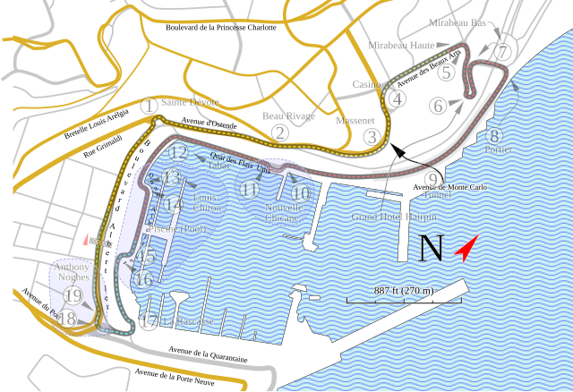
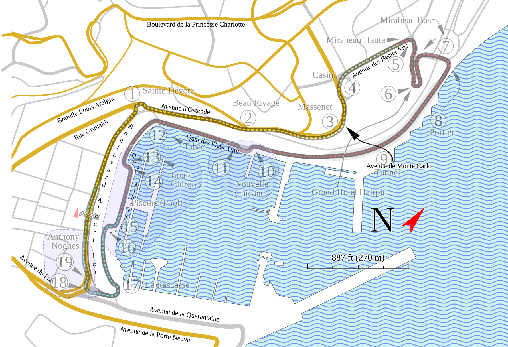
English: This version of my Monte Carlo track map has more information, but is less accurate in the placement of elements. |
| Date | |
| Source | Own work |
| Author | Will Pittenger |
| Other versions |
|


This W3C-unspecified vector image was created with Inkscape .
| Camera location | | View this and other nearby images on: OpenStreetMap |
|---|
Licensing
edit
I, the copyright holder of this work, hereby publish it under the following license:
This file is licensed under the Creative Commons Attribution-Share Alike 3.0 Unported license.
- You are free:
- to share – to copy, distribute and transmit the work
- to remix – to adapt the work
- Under the following conditions:
- attribution – You must give appropriate credit, provide a link to the license, and indicate if changes were made. You may do so in any reasonable manner, but not in any way that suggests the licensor endorses you or your use.
- share alike – If you remix, transform, or build upon the material, you must distribute your contributions under the same or compatible license as the original.
File history
Click on a date/time to view the file as it appeared at that time.
| Date/Time | Thumbnail | Dimensions | User | Comment | |
|---|---|---|---|---|---|
| current | 02:25, 25 September 2009 | | 1,781 × 1,216 (330 KB) | Will Pittenger (talk | contribs) | {{Information |Description={{en|1=This version of my Monte Carlo track map has more information, but is less accurate in the placement of elements.}} |Source=Own work by uploader |Author=Will Pittenger |Date=2009-09-24 |Permission= |
You cannot overwrite this file.
File usage on Commons
The following 10 pages use this file:
File usage on other wikis
The following other wikis use this file:
- Usage on en.wikipedia.org
- Usage on es.wikipedia.org
- Usage on fr.wikipedia.org
- Usage on gl.wikipedia.org
- Usage on hu.wikipedia.org
- Usage on hyw.wikipedia.org
- Usage on ja.wikipedia.org
- Usage on nl.wikipedia.org
- Usage on no.wikipedia.org
- Usage on sk.wikipedia.org
- Usage on zh.wikipedia.org