File:Mornshausen und Marburg vom Koppeturm (Elop).jpg
Size of this preview: 800 × 600 pixels. Other resolutions: 320 × 240 pixels | 640 × 480 pixels | 1,024 × 768 pixels | 1,280 × 960 pixels | 2,560 × 1,920 pixels | 3,584 × 2,688 pixels.
Original file (3,584 × 2,688 pixels, file size: 1.18 MB, MIME type: image/jpeg)
Captions
Captions
Add a one-line explanation of what this file represents
Summary edit
.jpg&action=edit§ion=1)
| Description |
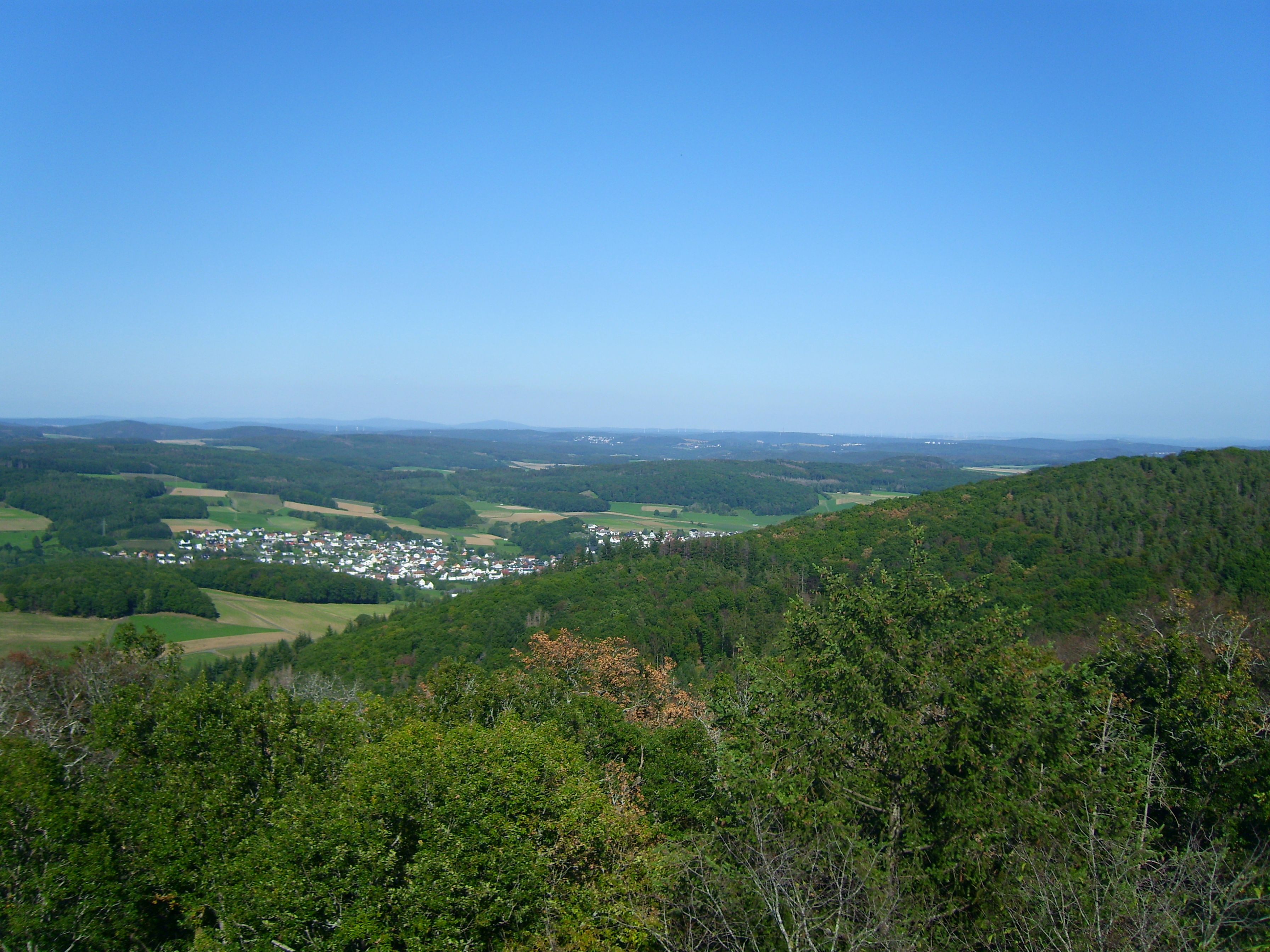
Deutsch: Blick vom Koppeturm im Höhenzug Zollbuche bei Erdhausen auf Mornshausen (Vordergrund) und verschiedene Teile Marburgs; im Hintergrund (von links nach rechts) die Damshäuser Kuppen Hungert (412 m; 12,8 km), Auersberg (gut 390 m; 10,1 km) und Donnerberg (370 m; 7,3 km), hinter Letzterem im Kellerwald Hohes Lohr (657 m; 44,7 km) und weiter rechts der Wüstegarten (675 m; 47,3 km); rechts vor dem der Vogelheerd (370 m; 15,2 km) im Marburger Rücken, weiter rechts und dahinter auf den Lahnbergen Ortenberg (380 m; 18,5 km), Lichter Küppel (368 m; 16,8 km), Stempel (365 m; 17 km) und Frauenberg (379 m; 15,4 km) am äußersten Rand, hinter dem nahen Dreisberg). Bei besserer Sicht wäre unmittelbar rechts hinter dem Stempel die Amöneburg (365 m; 25,4 ) erkennbar, dahinter der Eisenberg im Knüll (635 m; 68,5 km)
Zwischen Wehrshausen und Marbach die Wehrshäuser Höhe (349 m; 13,7 km), zwischen Marbach und Merburger Schloss der Dammelsberg (318 m; 15,5 km) und zwischen Schloss und Tannenberg der gerodete Hasenkopf (320 m; 13,1 km), siehe in umgekehrter Richtung Gladenbacher Bergland vom Hasenkopf.jpg! Siehe Udeuschle |
| Date | |
| Source | Own work |
| Author | Elop |
| Camera location | | View this and other nearby images on: OpenStreetMap |
|---|
.jpg¶ms=050.740650_N_0008.570450_E_globe:Earth_type:camera__&language=en)
Licensing edit
.jpg&action=edit§ion=2)
I, the copyright holder of this work, hereby publish it under the following licenses:

|
Permission is granted to copy, distribute and/or modify this document under the terms of the GNU Free Documentation License, Version 1.2 or any later version published by the Free Software Foundation; with no Invariant Sections, no Front-Cover Texts, and no Back-Cover Texts. A copy of the license is included in the section entitled GNU Free Documentation License. |
This file is licensed under the Creative Commons Attribution-Share Alike 3.0 Unported license.
- You are free:
- to share – to copy, distribute and transmit the work
- to remix – to adapt the work
- Under the following conditions:
- attribution – You must give appropriate credit, provide a link to the license, and indicate if changes were made. You may do so in any reasonable manner, but not in any way that suggests the licensor endorses you or your use.
- share alike – If you remix, transform, or build upon the material, you must distribute your contributions under the same or compatible license as the original.
You may select the license of your choice.
File history
Click on a date/time to view the file as it appeared at that time.
| Date/Time | Thumbnail | Dimensions | User | Comment | |
|---|---|---|---|---|---|
| current | 12:45, 12 September 2020 | | 3,584 × 2,688 (1.18 MB) | Elop (talk | contribs) | == {{int:filedesc}} == {{Information |Description={{de|1= Blick vom Koppeturm im Höhenzug Zollbuche bei Erdhausen auf Mornshausen (Vordergrund) und verschiedene Teile Marburgd;<br />im Hintergrund (von links nach rechts) die Damshäuser Kuppe de:Hungert (412 m; 12,8 km), im de:Kellerwald de:Hohes Lohr (657 m; 44,7 km) un... |
You cannot overwrite this file.
File usage on Commons
The following 2 pages use this file:
.jpg&oldid=631019614)