File:Mosport.svg

Size of this PNG preview of this SVG file: 800 × 554 pixels. Other resolutions: 320 × 221 pixels | 640 × 443 pixels | 1,024 × 709 pixels | 1,280 × 886 pixels | 2,560 × 1,772 pixels | 1,341 × 928 pixels.
Original file (SVG file, nominally 1,341 × 928 pixels, file size: 36 KB)
Captions
Captions
Add a one-line explanation of what this file represents
Summary
edit| Description |
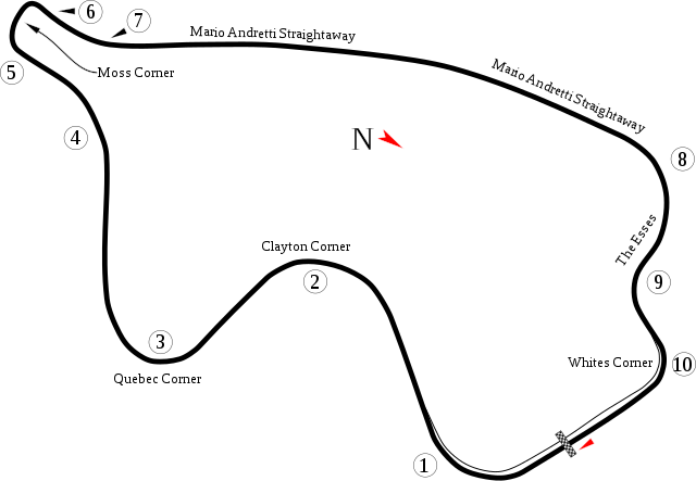
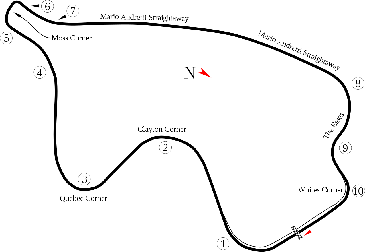
English: Track map for Mosport International Raceway |
| Date | |
| Source | Own work |
| Author | Will Pittenger |
| Other versions |
|

| Camera location | | View this and other nearby images on: OpenStreetMap |
|---|
Licensing
edit
| I, the copyright holder of this work, release this work into the public domain. This applies worldwide. In some countries this may not be legally possible; if so: I grant anyone the right to use this work for any purpose, without any conditions, unless such conditions are required by law. |
File history
Click on a date/time to view the file as it appeared at that time.
| Date/Time | Thumbnail | Dimensions | User | Comment | |
|---|---|---|---|---|---|
| current | 05:28, 20 July 2008 | | 1,341 × 928 (36 KB) | Will Pittenger (talk | contribs) | New version adds name that I didn't see before. |
| 05:14, 20 July 2008 |  | 1,341 × 928 (36 KB) | Will Pittenger (talk | contribs) | {{Information |Description={{en|1=Track map for w:Mosport International Raceway}} |Source=Own work by uploader |Author=Will Pittenger |Date=7-20-2008 |Permission= |other_versions=<gallery>Image:Circuit Mostport Park.png|Old ve |
You cannot overwrite this file.
File usage on Commons
The following 3 pages use this file:
File usage on other wikis
The following other wikis use this file:
- Usage on af.wikipedia.org
- Usage on ar.wikipedia.org
- Usage on ast.wikipedia.org
- Usage on bg.wikipedia.org
- Usage on bn.wikipedia.org
- Usage on ca.wikipedia.org
- Usage on cs.wikipedia.org
- Usage on de.wikipedia.org
- Usage on en.wikipedia.org
- List of Formula One circuits
- 1967 Canadian Grand Prix
- 1969 Canadian Grand Prix
- 1971 Canadian Grand Prix
- 1972 Canadian Grand Prix
- 1973 Canadian Grand Prix
- 1974 Canadian Grand Prix
- 1976 Canadian Grand Prix
- 1977 Canadian Grand Prix
- 2006 Grand Prix of Mosport
- 2005 Grand Prix of Mosport
- 2004 Grand Prix of Mosport
- 2003 Grand Prix of Mosport
- 2007 Grand Prix of Mosport
- 2002 Grand Prix of Mosport
View more global usage of this file.