File:Moudros Bay chart.jpg
Original file (1,244 × 894 pixels, file size: 179 KB, MIME type: image/jpeg)
Captions
Captions
Summary
edit
| Description |
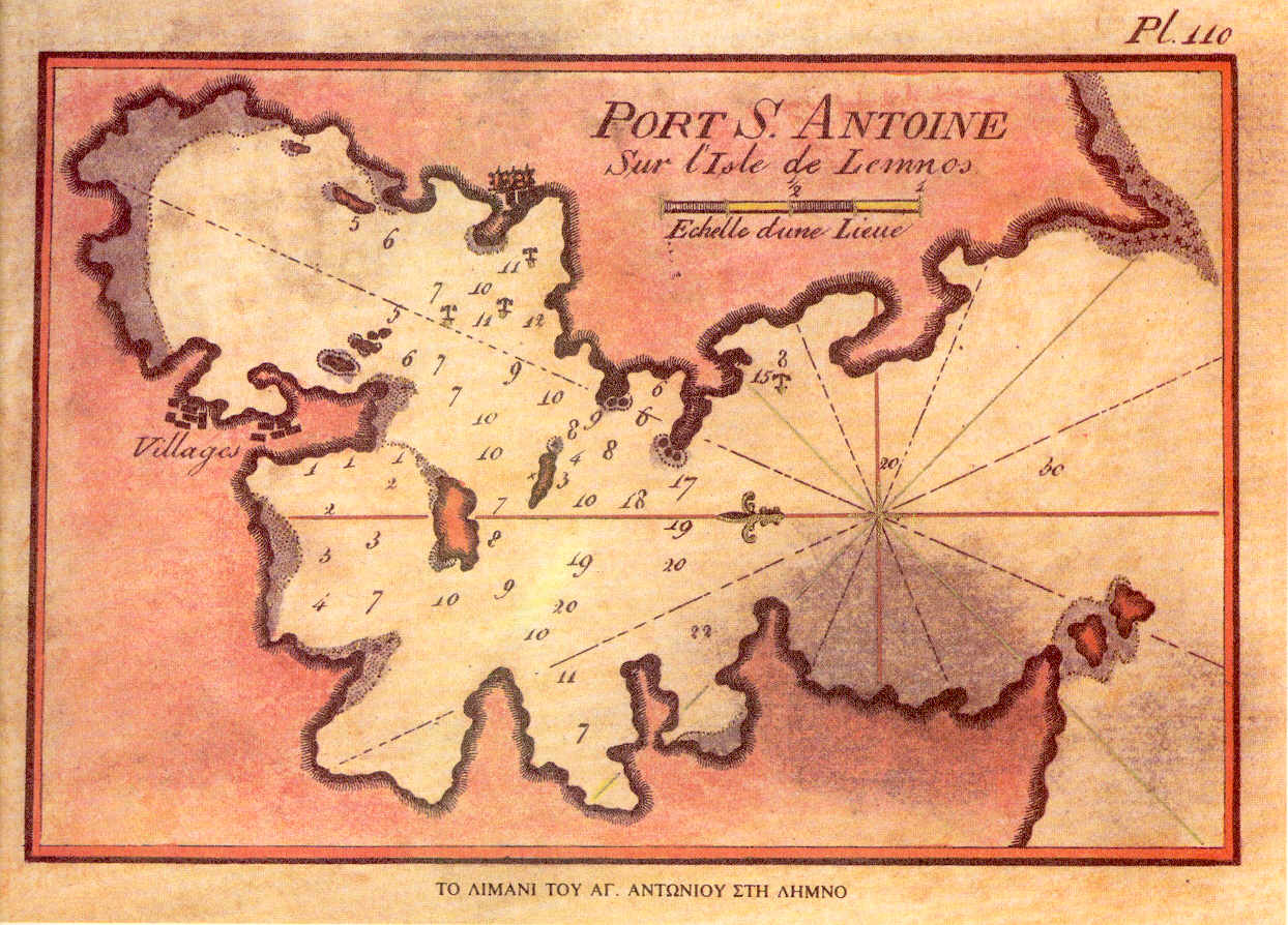
English: Old chart of Moudros Bay, Limnos Island, Greece. In the past it was also called Port St. Antonio (See New piloting directions for the Mediterranean sea, the Adriatic, or Gulf of Venice, the Black sea, Grecian archipelago, and the seas of Marmara and Azof by John William Norie, 1831, p. 226.) |
| Date | |
| Source |
Recueil des principaux plans des ports et rades de la mer Mediterranée (Pl. 110). Copied from the website of the Hellenic Navy: http://www.hellenicnavy.gr/upload/TO_LIMANI_THS_LHMNOY.jpg New URL: https://www.hellenicnavy.gr/images/polumesa/palaioi_xartes/to_limani_ths_lhmnoy.jpg |
| Author | Joseph Roux (1725-1793), Hidrographe du Roi |
Licensing
edit
This image is in the public domain because it is a mere mechanical scan or photocopy of a public domain original, or – from the available evidence – is so similar to such a scan or photocopy that no copyright protection can be expected to arise. The original itself is in the public domain for the following reason:
This tag is designed for use where there may be a need to assert that any enhancements (eg brightness, contrast, colour-matching, sharpening) are in themselves insufficiently creative to generate a new copyright. It can be used where it is unknown whether any enhancements have been made, as well as when the enhancements are clear but insufficient. For known raw unenhanced scans you can use an appropriate {{PD-old}} tag instead. For usage, see Commons:When to use the PD-scan tag.  | ||||
File history
Click on a date/time to view the file as it appeared at that time.
| Date/Time | Thumbnail | Dimensions | User | Comment | |
|---|---|---|---|---|---|
| current | 07:23, 27 June 2009 | | 1,244 × 894 (179 KB) | Sv1xv (talk | contribs) | {{Information |Description={{en|1=Old chart of Moudros Bay, Limnos Island, in the past called Port St. Antonio (See ''New piloting directions for the Mediterranean sea, the Adriatic, or Gulf of Venice, the Black sea, Grecian archipelago, and the seas of M |
You cannot overwrite this file.
File usage on Commons
The following page uses this file:
File usage on other wikis
The following other wikis use this file:
- Usage on ceb.wikipedia.org
- Usage on ru.wikipedia.org
- Usage on www.wikidata.org