File:Mount Tabor 1714.jpg
Size of this preview: 338 × 598 pixels. Other resolutions: 135 × 240 pixels | 271 × 480 pixels | 434 × 768 pixels | 1,077 × 1,907 pixels.
Original file (1,077 × 1,907 pixels, file size: 1,017 KB, MIME type: image/jpeg)
Captions
Captions
Add a one-line explanation of what this file represents
Summary edit
| Description |
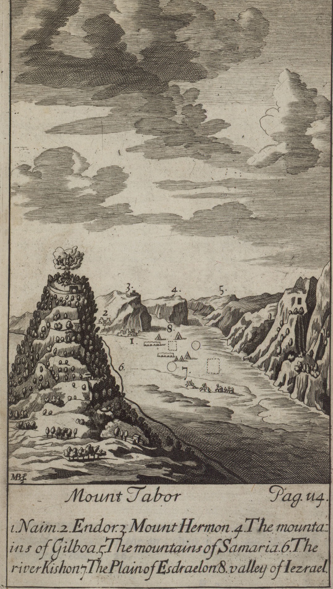
English: A map of Mount Tabor from 1714 עברית: מפה של הר תבור מספרו של הנרי מונדרל, מהדורת 1714 |
| Date | |
| Source | The Eran Laor Collection of the National Library of Israel |
| Author | Maundrell, Henry, 1665-1701 |
Licensing edit
This file is licensed under the Creative Commons Attribution-Share Alike 4.0 International license.
- You are free:
- to share – to copy, distribute and transmit the work
- to remix – to adapt the work
- Under the following conditions:
- attribution – You must give appropriate credit, provide a link to the license, and indicate if changes were made. You may do so in any reasonable manner, but not in any way that suggests the licensor endorses you or your use.
- share alike – If you remix, transform, or build upon the material, you must distribute your contributions under the same or compatible license as the original.
File history
Click on a date/time to view the file as it appeared at that time.
| Date/Time | Thumbnail | Dimensions | User | Comment | |
|---|---|---|---|---|---|
| current | 17:27, 10 December 2014 | | 1,077 × 1,907 (1,017 KB) | National Library of Israel (talk | contribs) | User created page with UploadWizard |
You cannot overwrite this file.
File usage on Commons
The following page uses this file:
File usage on other wikis
The following other wikis use this file:
- Usage on en.wikipedia.org
- Usage on he.wikipedia.org