File:Mountain meadows map5.jpg
Size of this preview: 644 × 599 pixels. Other resolutions: 258 × 240 pixels | 516 × 480 pixels | 909 × 846 pixels.
Original file (909 × 846 pixels, file size: 176 KB, MIME type: image/jpeg)
Captions
Captions
Add a one-line explanation of what this file represents

|
This file has been superseded by Mountain meadows map5.png. It is recommended to use the other file. Please note that deleting superseded images requires consent. Reason to use the other file: "The new version is a copy of this image without whitespace and in the more appropriate en:PNG format."
|

|
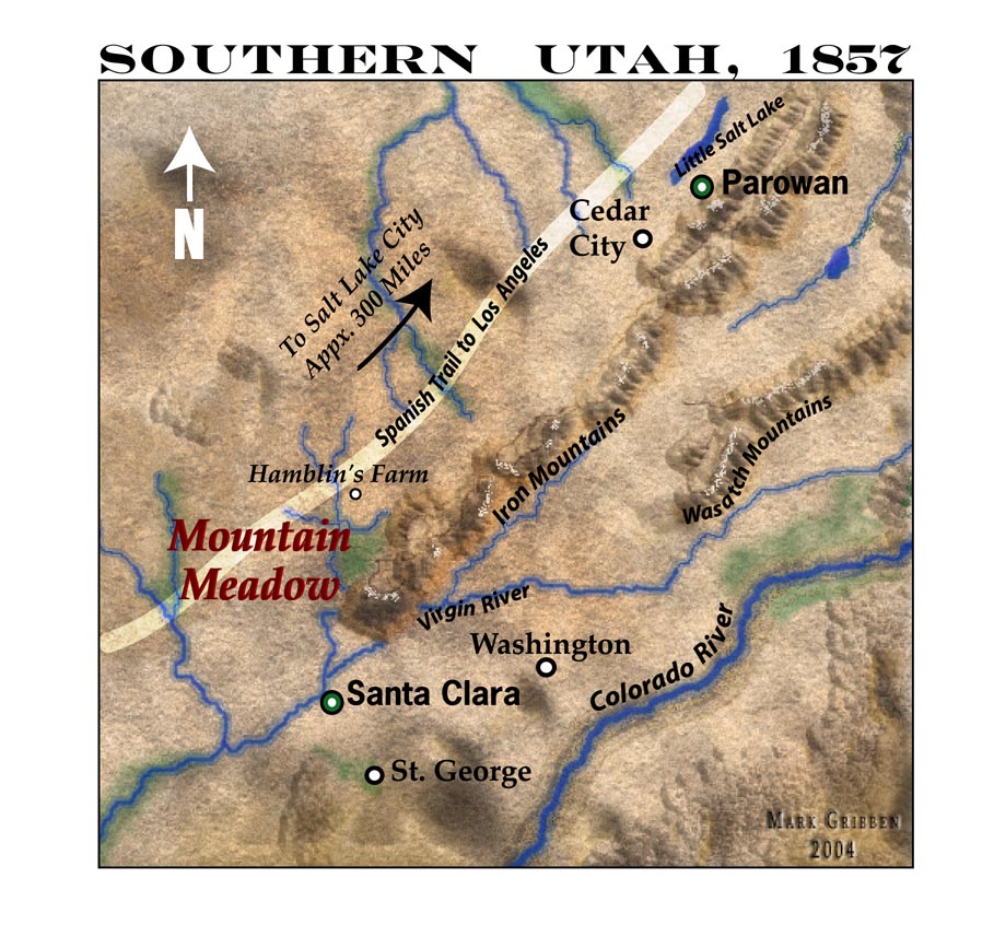
A 150-dpi JPEG Map of Southern Utah in 1857, highlighting the Mountain Meadows area including the Wasatch Mountains and Colorado River.
| This work has been released into the public domain by its author, marklemagne. This applies worldwide. In some countries this may not be legally possible; if so: |
File history
Click on a date/time to view the file as it appeared at that time.
| Date/Time | Thumbnail | Dimensions | User | Comment | |
|---|---|---|---|---|---|
| current | 03:46, 13 May 2005 | | 909 × 846 (176 KB) | Marklemagne~commonswiki (talk | contribs) | A 150-dpi JPEG Map of Southern Utah in 1857, highlighting the Mountain Meadows area including the Wasatch Mountains and Colorado River. {{PD-user|marklemagne}} |
You cannot overwrite this file.
File usage on Commons
The following page uses this file:
File usage on other wikis
The following other wikis use this file:
- Usage on ca.wikipedia.org
- Usage on de.wikipedia.org
- Usage on en.wikipedia.org
- Usage on eo.wikipedia.org
- Usage on fr.wikipedia.org
- Usage on hu.wikipedia.org
- Usage on zh.wikipedia.org