File:Mozambique regions.svg

Size of this PNG preview of this SVG file: 495 × 599 pixels. Other resolutions: 198 × 240 pixels | 396 × 480 pixels | 634 × 768 pixels | 846 × 1,024 pixels | 1,691 × 2,048 pixels | 986 × 1,194 pixels.
Original file (SVG file, nominally 986 × 1,194 pixels, file size: 550 KB)
Captions
Captions
Add a one-line explanation of what this file represents
Summary
edit
| Description |
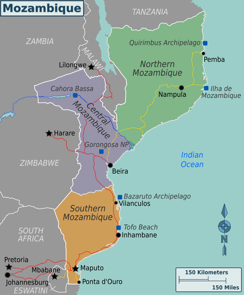
English: Map of Mozambique. SVG version of map - Major cities, other destinations and Wikivoyage travel regions. |
| Date | |
| Source | Drawn by me based on public domain maps from the Perry-Castaneda Library |
| Author | (WT-shared) Shaund (Shaundd) |
| Other versions |
|
| SVG development |
Licensing
edit
This file is licensed under the Creative Commons Attribution-Share Alike Attribution-Share Alike 4.0 International, 3.0 Unported, 2.5 Generic, 2.0 Generic and 1.0 Generic license.
- You are free:
- to share – to copy, distribute and transmit the work
- to remix – to adapt the work
- Under the following conditions:
- attribution – You must give appropriate credit, provide a link to the license, and indicate if changes were made. You may do so in any reasonable manner, but not in any way that suggests the licensor endorses you or your use.
- share alike – If you remix, transform, or build upon the material, you must distribute your contributions under the same or compatible license as the original.
Original upload log
edit
| This file was imported from Wikivoyage WTS. |
The original description page was here. All following user names refer to wts.wikivoyage-old.
- 2009-12-13 18:03 (WT-shared) Shaund archive copy at the Wayback Machine 409×329 (586079 bytes) {{Imagecredit|credit=[[User:Shaund|Shaund]]|captureDate=Dec 13, 2009|location=Mozambique|source=Drawn by me based on public domain maps from (Import from wikitravel.org/shared)
File history
Click on a date/time to view the file as it appeared at that time.
| Date/Time | Thumbnail | Dimensions | User | Comment | |
|---|---|---|---|---|---|
| current | 19:48, 16 March 2019 | | 986 × 1,194 (550 KB) | Shaundd (talk | contribs) | Swaziland > Eswatini, frame SVG and small changes to improve readability |
| 01:30, 18 November 2012 |  | 409 × 329 (572 KB) | MGA73bot2 (talk | contribs) | {{BotMoveToCommons|wts.oldwikivoyage|year={{subst:CURRENTYEAR}}|month={{subst:CURRENTMONTHNAME}}|day={{subst:CURRENTDAY}}}} == {{int:filedesc}} == {{Information |description=Map of Mozambique. SVG version of map - Major cities, other destinations and W... |
You cannot overwrite this file.
File usage on Commons
The following 2 pages use this file:
File usage on other wikis
The following other wikis use this file:
- Usage on el.wikivoyage.org
- Usage on en.wikipedia.org
- Usage on en.wikivoyage.org
- Usage on fr.wikivoyage.org
- Usage on he.wikivoyage.org
- Usage on incubator.wikimedia.org
- Usage on it.wikivoyage.org
- Usage on ja.wikivoyage.org
- Usage on ru.wikivoyage.org
- Usage on vi.wikivoyage.org
- Usage on zh.wikivoyage.org