File:Muhurimap.jpg

Size of this preview: 654 × 600 pixels. Other resolutions: 262 × 240 pixels | 524 × 480 pixels | 838 × 768 pixels | 1,117 × 1,024 pixels | 2,201 × 2,018 pixels.
Original file (2,201 × 2,018 pixels, file size: 351 KB, MIME type: image/jpeg)
Captions
Captions
Muhuri river, Bangladesh
Summary
edit
| Description |
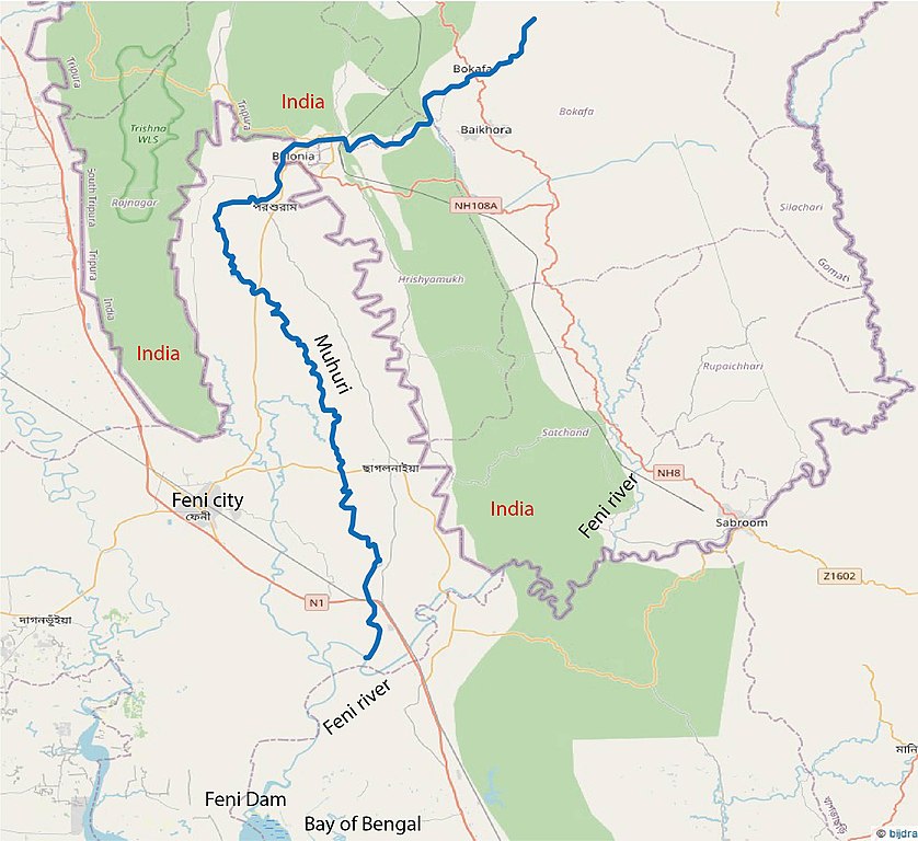
English: The course of the Muhuri river in Bangladesh
Nederlands: De loop van de Muhuri rivier, Bangladesh |
| Date | |
| Source | Own work |
| Author | Henk Jan Verhagen |
| Camera location | | View this and other nearby images on: OpenStreetMap |
|---|
background on Open Steet Map, 2020 “© OpenStreetMap-authors”. (CC BY-SA)
Licensing
edit
I, the copyright holder of this work, hereby publish it under the following license:
This file is licensed under the Creative Commons Attribution-Share Alike 4.0 International license.
- You are free:
- to share – to copy, distribute and transmit the work
- to remix – to adapt the work
- Under the following conditions:
- attribution – You must give appropriate credit, provide a link to the license, and indicate if changes were made. You may do so in any reasonable manner, but not in any way that suggests the licensor endorses you or your use.
- share alike – If you remix, transform, or build upon the material, you must distribute your contributions under the same or compatible license as the original.
File history
Click on a date/time to view the file as it appeared at that time.
| Date/Time | Thumbnail | Dimensions | User | Comment | |
|---|---|---|---|---|---|
| current | 21:31, 6 July 2020 | | 2,201 × 2,018 (351 KB) | HJVerhagen (talk | contribs) | Uploaded own work with UploadWizard |
You cannot overwrite this file.
File usage on Commons
There are no pages that use this file.
File usage on other wikis
The following other wikis use this file:
- Usage on nl.wikipedia.org