File:Mukono District in Uganda.svg

Size of this PNG preview of this SVG file: 589 × 599 pixels. Other resolutions: 236 × 240 pixels | 472 × 480 pixels | 755 × 768 pixels | 1,007 × 1,024 pixels | 2,013 × 2,048 pixels | 1,441 × 1,466 pixels.
Original file (SVG file, nominally 1,441 × 1,466 pixels, file size: 371 KB)
Captions
Captions
Add a one-line explanation of what this file represents
Summary edit
| Description |
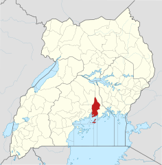
English: The location of Mukono District in Uganda, showing district boundaries as they stood in June 2017. For other districts, see Category:SVG locator maps of Districts in Uganda (location map scheme). This map may be incomplete, and may contain errors. Don't rely solely on it for navigation. In particular, note that this map overlays a spherical pseudo-mercator projection on an equirectangular projection; it is far from technically perfect.
This W3C-unspecified vector image was created with Inkscape . |
|||||||||
| Date | ||||||||||
| Source |
Derivative of:
|
|||||||||
| Creator |
OpenStreetMap contributors, Jarry1250, NordNordWest |
|||||||||
| Permission (Reusing this file) |
This file is licensed under the Creative Commons Attribution-Share Alike 3.0 Unported license. Attribution: © OpenStreetMap contributors, Jarry1250, NordNordWest/Wikipedia
|
|||||||||
| Geotemporal data | ||||||||||
| Map location | Mukono District, Uganda | |||||||||
| Spatial reference system | equirectangular | |||||||||
| Bounding box |
|
|||||||||
| Georeferencing | If inappropriate please set warp_status = skip to hide. | |||||||||
File history
Click on a date/time to view the file as it appeared at that time.
| Date/Time | Thumbnail | Dimensions | User | Comment | |
|---|---|---|---|---|---|
| current | 21:07, 25 June 2017 | | 1,441 × 1,466 (371 KB) | Jarry1250 (talk | contribs) | pattypan 17.05 |
You cannot overwrite this file.
File usage on Commons
There are no pages that use this file.
File usage on other wikis
The following other wikis use this file:
- Usage on de.wikipedia.org
- Usage on en.wikipedia.org
- Mukono District
- Kisoga, Mukono
- Uganda Christian University
- Roman Catholic Diocese of Lugazi
- Namilyango College
- Mukono Town
- Kalagi, Mukono
- Kampala–Jinja Highway
- Sezibwa River
- Namilyango
- Mount Saint Mary's College Namagunga
- Wikipedia:WikiProject Uganda/District templates
- Template:Mukono District
- Nakifuma
- Naggalama Hospital
- Nagalama
- Namanve
- Namanve Thermal Power Station
- Seeta, Uganda
- David Kato
- Koome Island
- Katosi
- Kasawo
- Namataba
- Lwajjali River
- Kampala–Jinja Expressway
- Mukono–Kyetume–Katosi–Nyenga Road
- Kyetume
- Bukeerere
- Mukono–Kayunga–Njeru Road
- Kampala Outer Beltway
- Damba Island
- Mukono Health Centre IV
- Kampala Cement Company Limited
- Mbalala
- Teacher Mpamire
- Sonde, Uganda
- User:Fsmatovu/sandbox1
- Nagojje
- Tondeka Metro Bus Service
- East African Medical Vitals
- Usage on es.wikipedia.org
- Usage on fa.wikipedia.org
- Usage on fr.wikipedia.org
- Usage on he.wikipedia.org
- Usage on id.wikipedia.org
- Usage on ja.wikipedia.org
- Usage on ml.wikipedia.org
- Usage on nl.wikipedia.org
View more global usage of this file.