File:Mundloch Abzuggraben Thelersberger Stolln an Striegis.jpg

Size of this preview: 800 × 600 pixels. Other resolutions: 320 × 240 pixels | 640 × 480 pixels | 1,024 × 768 pixels | 1,280 × 960 pixels | 2,560 × 1,920 pixels | 2,848 × 2,136 pixels.
Original file (2,848 × 2,136 pixels, file size: 1.41 MB, MIME type: image/jpeg)
Captions
Captions
Add a one-line explanation of what this file represents
Summary
edit
| Description |
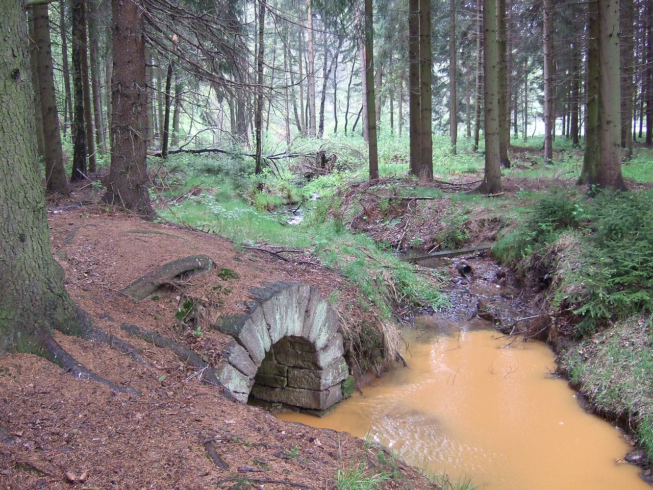
This file was uploaded with Commonist. Deutsch: Mündung der Entwässerung des Thelersberger Stollns in ein Nebengewässer der Großen Striegis mit sichtbarer Ockerfärbung durch ausgewaschene Minerale
English: Trench of the drain of Thelersberger Stolln (Thelersberg Adit) flowing into a minor tributary of the Großen Striegis (Big Striegis) with visible ochre colouring due to washed out minerals
(source name: dscf037132_Mundloch_Abzuggraben_Thelersberger_Stolln_an_Striegis.jpg) |
| Date | |
| Source | Own work |
| Author | malenki |
| Camera location | | View this and other nearby images on: OpenStreetMap |
|---|
Licensing
edit
I, the copyright holder of this work, hereby publish it under the following license:
This file is licensed under the Creative Commons Attribution-Share Alike 3.0 Unported license.
- You are free:
- to share – to copy, distribute and transmit the work
- to remix – to adapt the work
- Under the following conditions:
- attribution – You must give appropriate credit, provide a link to the license, and indicate if changes were made. You may do so in any reasonable manner, but not in any way that suggests the licensor endorses you or your use.
- share alike – If you remix, transform, or build upon the material, you must distribute your contributions under the same or compatible license as the original.
File history
Click on a date/time to view the file as it appeared at that time.
| Date/Time | Thumbnail | Dimensions | User | Comment | |
|---|---|---|---|---|---|
| current | 11:51, 16 July 2015 | | 2,848 × 2,136 (1.41 MB) | Malenki (talk | contribs) |
You cannot overwrite this file.
File usage on Commons
The following 2 pages use this file:
File usage on other wikis
The following other wikis use this file:
- Usage on de.wikipedia.org