File:Munro-colour-contour-map-sec14.png
Size of this preview: 800 × 569 pixels. Other resolutions: 320 × 228 pixels | 640 × 455 pixels | 1,024 × 729 pixels | 1,280 × 911 pixels | 2,395 × 1,704 pixels.
Original file (2,395 × 1,704 pixels, file size: 194 KB, MIME type: image/png)
Captions
Captions
Add a one-line explanation of what this file represents
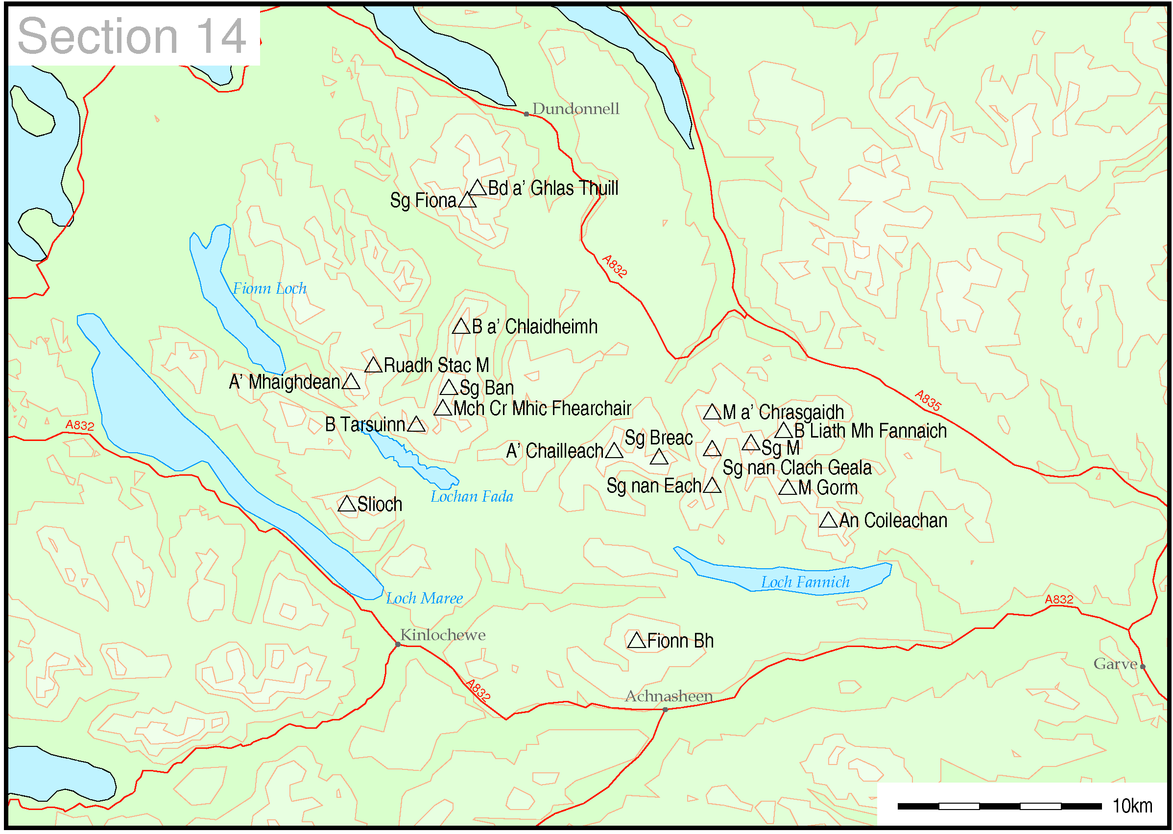
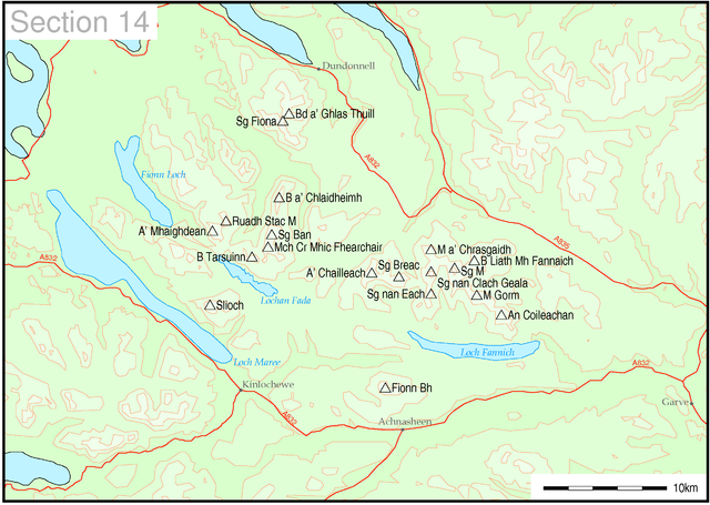
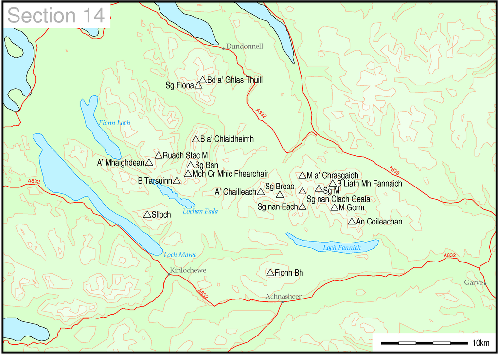
Map of Munro hills in SMC section 14
| This work has been released into the public domain by its author, Thruston at English Wikipedia. This applies worldwide. In some countries this may not be legally possible; if so: Thruston grants anyone the right to use this work for any purpose, without any conditions, unless such conditions are required by law. |
These maps are created by my own Perl scripts from public domain sources. The list of hills and the grid references are from Wikipedia. The coastline is derived from data from the US Govt. "Coast Line Extractor" (web). The contours are derived from data from US Govt. "SRTM Digital Elevation Model" (web).
This image uses high-resolution digital topography data from NASA's Shuttle Radar Topography Mission (SRTM) at JPL-Caltech [1]. It is in the public domain in the United States.
|
 | |
File history
Click on a date/time to view the file as it appeared at that time.
| Date/Time | Thumbnail | Dimensions | User | Comment | |
|---|---|---|---|---|---|
| current | 22:07, 10 May 2005 | | 2,395 × 1,704 (194 KB) | Thruston (talk | contribs) | Map of Munro hills in SMC section 14 |
You cannot overwrite this file.
File usage on Commons
The following 2 pages use this file:
File usage on other wikis
The following other wikis use this file:
- Usage on cy.wikipedia.org
- Usage on de.wikipedia.org
- Usage on en.wikipedia.org
- Usage on nl.wikipedia.org
- Usage on no.wikipedia.org