File:N141b France map fr.svg

Size of this PNG preview of this SVG file: 800 × 563 pixels. Other resolutions: 320 × 225 pixels | 640 × 450 pixels | 1,024 × 720 pixels | 1,280 × 900 pixels | 2,560 × 1,800 pixels | 1,489 × 1,047 pixels.
Original file (SVG file, nominally 1,489 × 1,047 pixels, file size: 45 KB)
Captions
Captions
Add a one-line explanation of what this file represents
| Description |
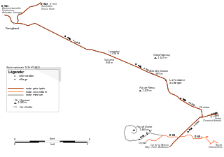
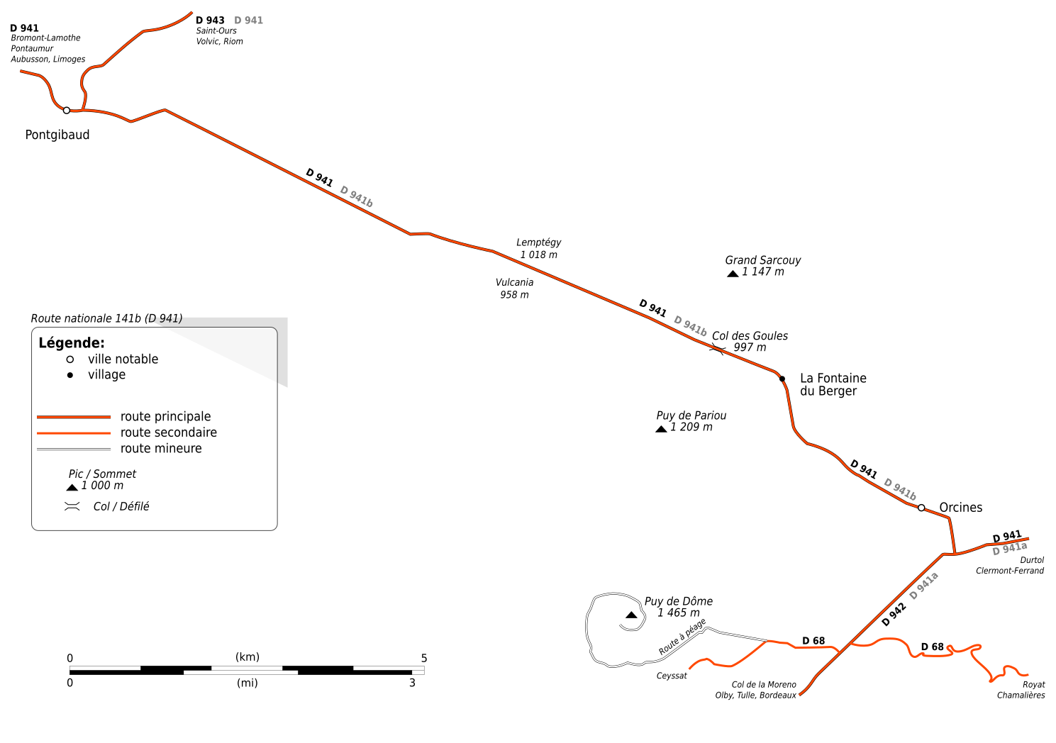
English: Map of N141b Orcines-Pontgibaud. Inspired from OpenStreetMap data (CC-BY-SA 2.0). Made with Inkscape.
Français : Carte de la RN 141b Orcines-Pontgibaud. Inspirée des données OpenStreetMap sous licence CC-BY-SA 2.0. Créé avec Inkscape. |
| Date | |
| Source | Own work |
| Author | Tabl-trai |
| Permission (Reusing this file) |
This file is licensed under the Creative Commons Attribution-Share Alike 2.0 France license.
 |
File history
Click on a date/time to view the file as it appeared at that time.
| Date/Time | Thumbnail | Dimensions | User | Comment | |
|---|---|---|---|---|---|
| current | 15:45, 5 July 2009 | | 1,489 × 1,047 (45 KB) | Tabl-trai (talk | contribs) | {{Information |Description={{en|1=Map of N141b Orcines-Pontgibaud. Inspired from OpenStreetMap data (CC-BY-SA 2.0). Made with Inkscape.}} {{fr|1=Carte de la RN 141b Orcines-Pontgibaud. Inspirée des données OpenStreetMap sous licence CC-BY-SA 2.0. Créé |
You cannot overwrite this file.
File usage on Commons
There are no pages that use this file.
File usage on other wikis
The following other wikis use this file:
- Usage on fr.wikipedia.org