File:N209 map fr.png
Size of this preview: 699 × 599 pixels. Other resolutions: 280 × 240 pixels | 560 × 480 pixels | 896 × 768 pixels | 1,180 × 1,012 pixels.
Original file (1,180 × 1,012 pixels, file size: 208 KB, MIME type: image/png)
Captions
Captions
Add a one-line explanation of what this file represents
| Description |
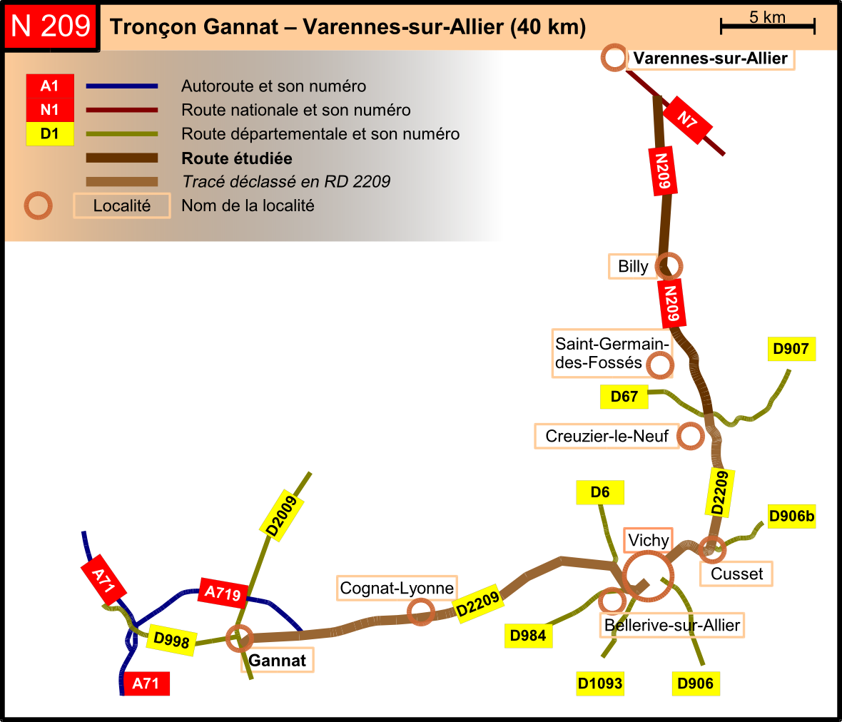
English: Map of the N209 (France), from Gannat to Varennes-sur-Allier via Vichy. Made with OpenOffice.org Draw. (better resolution with Inkscape – 150 dpi) Français : Carte de la RN 209 (France), de Gannat à Varennes-sur-Allier via Vichy. Réalisé avec OpenOffice.org Draw. (meilleure résolution avec Inkscape à partir d'un SVG – 150 ppp) |
| Date |
January 23, 2009 / 23 janvier 2009 (new version) September 26, 2008 / 26 septembre 2008 (old version) |
| Source | Own work |
| Author | Tabl-trai |
| Permission (Reusing this file) |
This file is licensed under the Creative Commons Attribution-Share Alike 2.0 France license.
 |
| Other versions |
|

File history
Click on a date/time to view the file as it appeared at that time.
| Date/Time | Thumbnail | Dimensions | User | Comment | |
|---|---|---|---|---|---|
| current | 15:16, 28 March 2009 | | 1,180 × 1,012 (208 KB) | Tabl-trai (talk | contribs) | larger version |
| 17:28, 23 January 2009 |  | 1,173 × 1,005 (267 KB) | Tabl-trai (talk | contribs) | {{Information |Description={{en|1=Map of the N209 (France), from Gannat to Varennes-sur-Allier ''via'' Vichy. Made with OpenOffice.org Draw. (better resolution with Inkscape – 150 dpi)}} {{fr|1=Ca | |
| 17:18, 27 September 2008 |  | 661 × 567 (28 KB) | Tabl-trai (talk | contribs) | {{Information |Description={{en|1=Map of the N209 (France), from Gannat to Varennes-sur-Allier via Vichy. Made with OpenOffice.org Draw.}} {{fr|1=Carte de la RN 209 (France), de Gannat à Varennes-sur-Allier via Vichy. Réalisé avec OpenOffice.org Draw.} |
You cannot overwrite this file.
File usage on Commons
The following page uses this file:
File usage on other wikis
The following other wikis use this file:
- Usage on fr.wikipedia.org