File:NASA Dryden Flight Research Facility Aerial 1992.jpg
Size of this preview: 697 × 599 pixels. Other resolutions: 279 × 240 pixels | 558 × 480 pixels | 893 × 768 pixels | 1,191 × 1,024 pixels | 2,381 × 2,048 pixels | 3,030 × 2,606 pixels.
Original file (3,030 × 2,606 pixels, file size: 9.73 MB, MIME type: image/jpeg)
Captions
Captions
Add a one-line explanation of what this file represents
Summary edit
| Description |
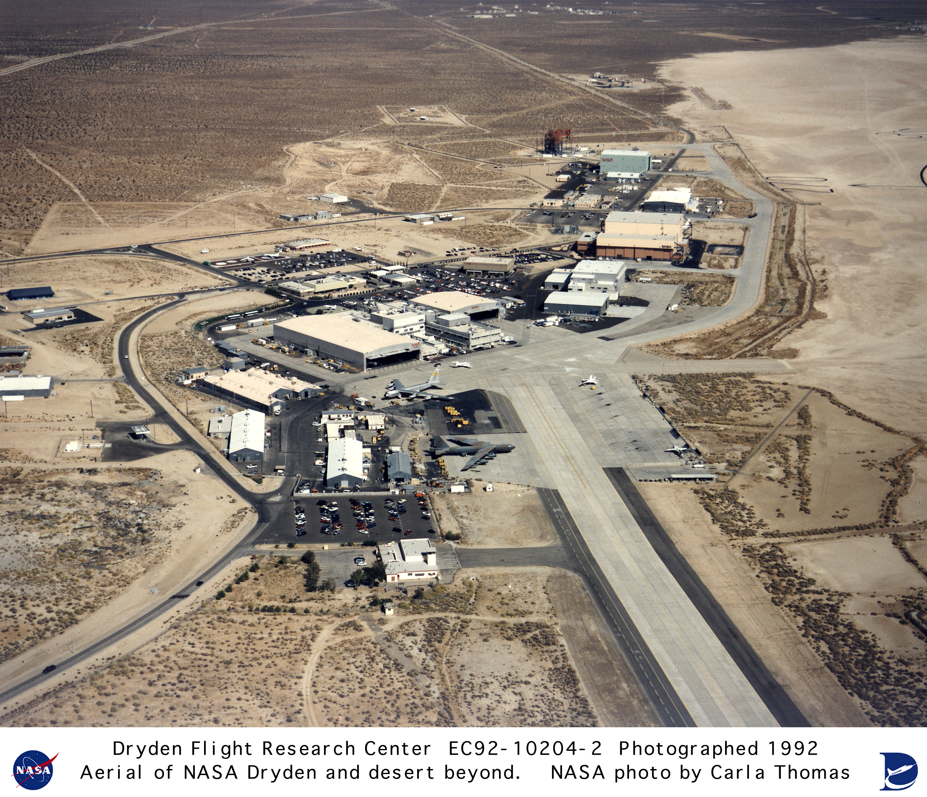
English: The concrete aircraft parking and taxiway facilities show prominently in an aerial photograph of the NASA Dryden Flight Research Center, located on the northwest edge of Rogers Dry Lake at Edwards AFB, California. The complex is built around the original administrative-hangar building (center) constructed in 1954. Since then many additional support and operational facilities have been built. Among the most prominent are the Space Shuttle program's Mate-Demate structure and hangar in Area A (upper right) to the north of the main complex.
The Dryden complex originated at Edwards in support of the X-1 supersonic flight program. As other high-speed aircraft entered research programs, the facility became permanent and grew from an original staff of five engineers in 1947 to a population in 1995 of about 900 full-time government and contractor employees. |
| Date | |
| Source | https://www.dfrc.nasa.gov/Gallery/Photo/Places/HTML/EC92-10204-2.html |
| Author | Carla Thomas |
| Other versions |
 |
Licensing edit
| This file is in the public domain in the United States because it was solely created by NASA. NASA copyright policy states that "NASA material is not protected by copyright unless noted". (See Template:PD-USGov, NASA copyright policy page or JPL Image Use Policy.) | ||
 |
Warnings:
|
File history
Click on a date/time to view the file as it appeared at that time.
| Date/Time | Thumbnail | Dimensions | User | Comment | |
|---|---|---|---|---|---|
| current | 06:39, 15 December 2023 | | 3,030 × 2,606 (9.73 MB) | Schierbecker (talk | contribs) | Uploaded a work by Carla Thomas from https://www.dfrc.nasa.gov/Gallery/Photo/Places/HTML/EC92-10204-2.html with UploadWizard |
You cannot overwrite this file.
File usage on Commons
The following page uses this file: