File:NASPityiluAirfieldmap.jpg

Size of this preview: 610 × 600 pixels. Other resolutions: 244 × 240 pixels | 488 × 480 pixels | 781 × 768 pixels | 1,258 × 1,237 pixels.
Original file (1,258 × 1,237 pixels, file size: 352 KB, MIME type: image/jpeg)
Captions
Captions
Add a one-line explanation of what this file represents
Summary
edit
| Description |
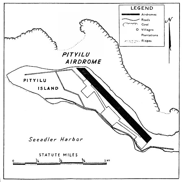
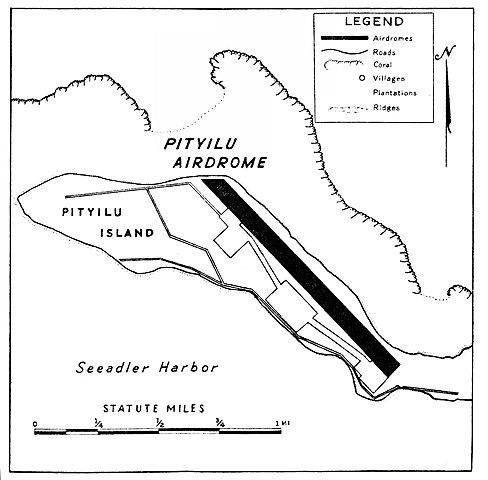
English: NAS Pityilu Airfield, on Pityilu Island Built by US Navy in 1944, 5,500 feet runway. |
| Date | |
| Source | http://www.royalnavyresearcharchive.org.uk/FAA-Bases/Pityilu.htm#.YwqedLTMK71 |
| Author | US Navy |
Licensing
edit
This file is a work of a sailor or employee of the U.S. Navy, taken or made as part of that person's official duties. As a work of the U.S. federal government, it is in the public domain in the United States.
|
 | |
| This file has been identified as being free of known restrictions under copyright law, including all related and neighboring rights. | ||
File history
Click on a date/time to view the file as it appeared at that time.
| Date/Time | Thumbnail | Dimensions | User | Comment | |
|---|---|---|---|---|---|
| current | 22:48, 27 August 2022 | | 1,258 × 1,237 (352 KB) | Telecineguy (talk | contribs) | Uploading a public-domain item using File Upload Wizard |
You cannot overwrite this file.
File usage on Commons
The following 2 pages use this file:
File usage on other wikis
The following other wikis use this file:
- Usage on en.wikipedia.org