File:NATO 1955.jpg

Size of this preview: 602 × 600 pixels. Other resolutions: 241 × 240 pixels | 482 × 480 pixels | 771 × 768 pixels | 1,028 × 1,024 pixels | 2,012 × 2,005 pixels.
Original file (2,012 × 2,005 pixels, file size: 760 KB, MIME type: image/jpeg)
Captions
Captions
Add a one-line explanation of what this file represents
Summary edit
| Description |
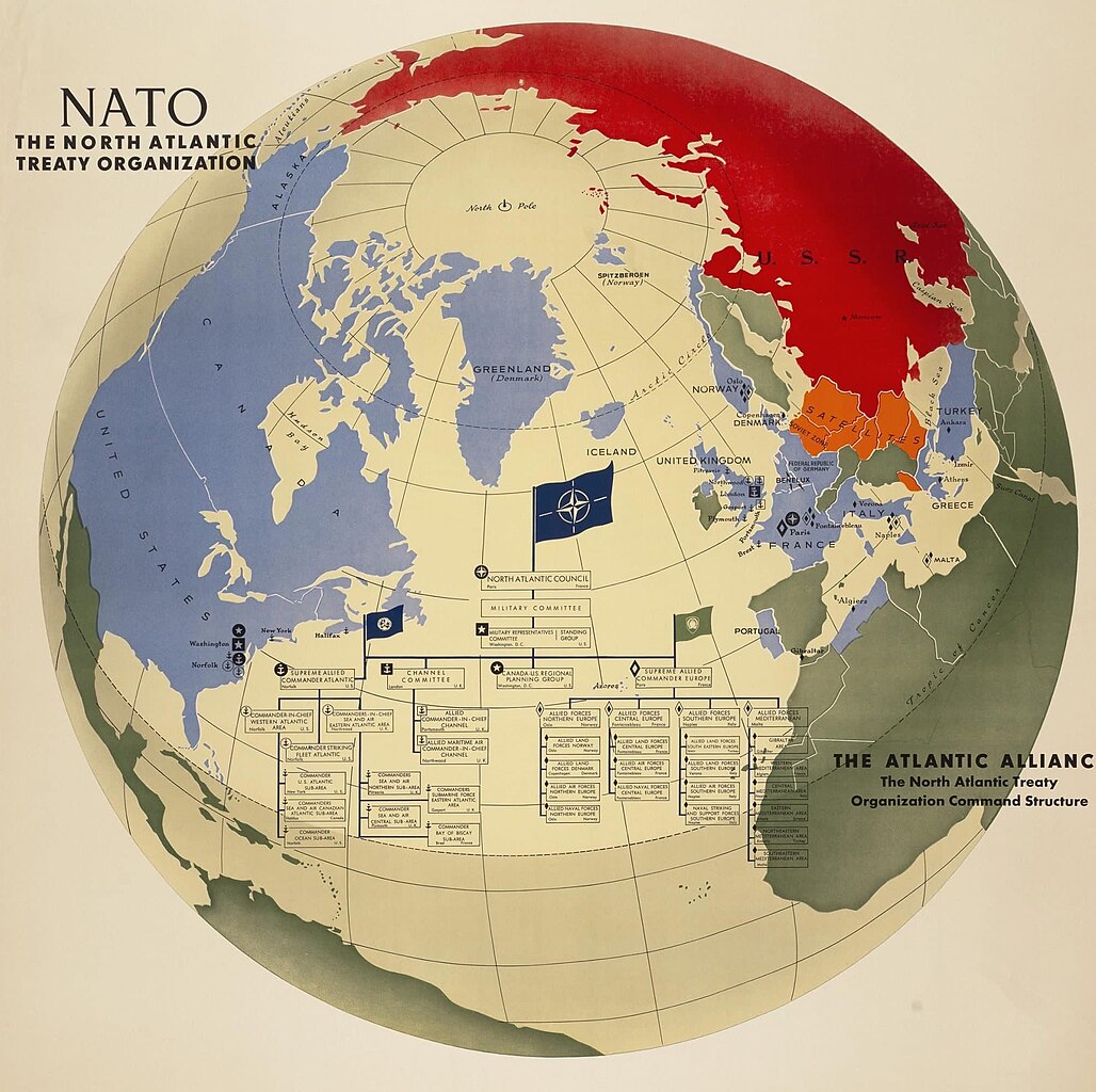
English: Massive map of the Western Hemisphere depicting NATO and the Soviet sphere of influence in Europe, around 1955. At the center of the map is an organization chart of the alliance’s command structure, and symbols locate major NATO headquarters around the hemisphere. |
| Date | |
| Source | bostonraremaps.com |
| Author | NATO |
Licensing edit
This work is in the public domain because it was published in the United States between 1929 and 1963, and although there may or may not have been a copyright notice, the copyright was not renewed. For further explanation, see Commons:Hirtle chart and the copyright renewal logs. Note that it may still be copyrighted in jurisdictions that do not apply the rule of the shorter term for US works (depending on the date of the author's death), such as Canada (70 years p.m.a.), Mainland China (50 years p.m.a., not Hong Kong or Macao), Germany (70 years p.m.a.), Mexico (100 years p.m.a.), Switzerland (70 years p.m.a.), and other countries with individual treaties.
|
 |
File history
Click on a date/time to view the file as it appeared at that time.
| Date/Time | Thumbnail | Dimensions | User | Comment | |
|---|---|---|---|---|---|
| current | 19:51, 4 June 2023 | | 2,012 × 2,005 (760 KB) | Babelia (talk | contribs) | Uploaded a work by NATO from bostonraremaps.com with UploadWizard |
You cannot overwrite this file.
File usage on Commons
There are no pages that use this file.