File:NATO Map Symbol - Symbol Size boundary (APP-6A and APP-6B).svg

Size of this PNG preview of this SVG file: 623 × 599 pixels. Other resolutions: 249 × 240 pixels | 499 × 480 pixels | 798 × 768 pixels | 1,064 × 1,024 pixels | 2,129 × 2,048 pixels | 2,744 × 2,640 pixels.
Original file (SVG file, nominally 2,744 × 2,640 pixels, file size: 23 KB)
Captions
Captions
Add a one-line explanation of what this file represents
Summary edit
.svg&action=edit§ion=1)
| Description |
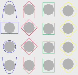
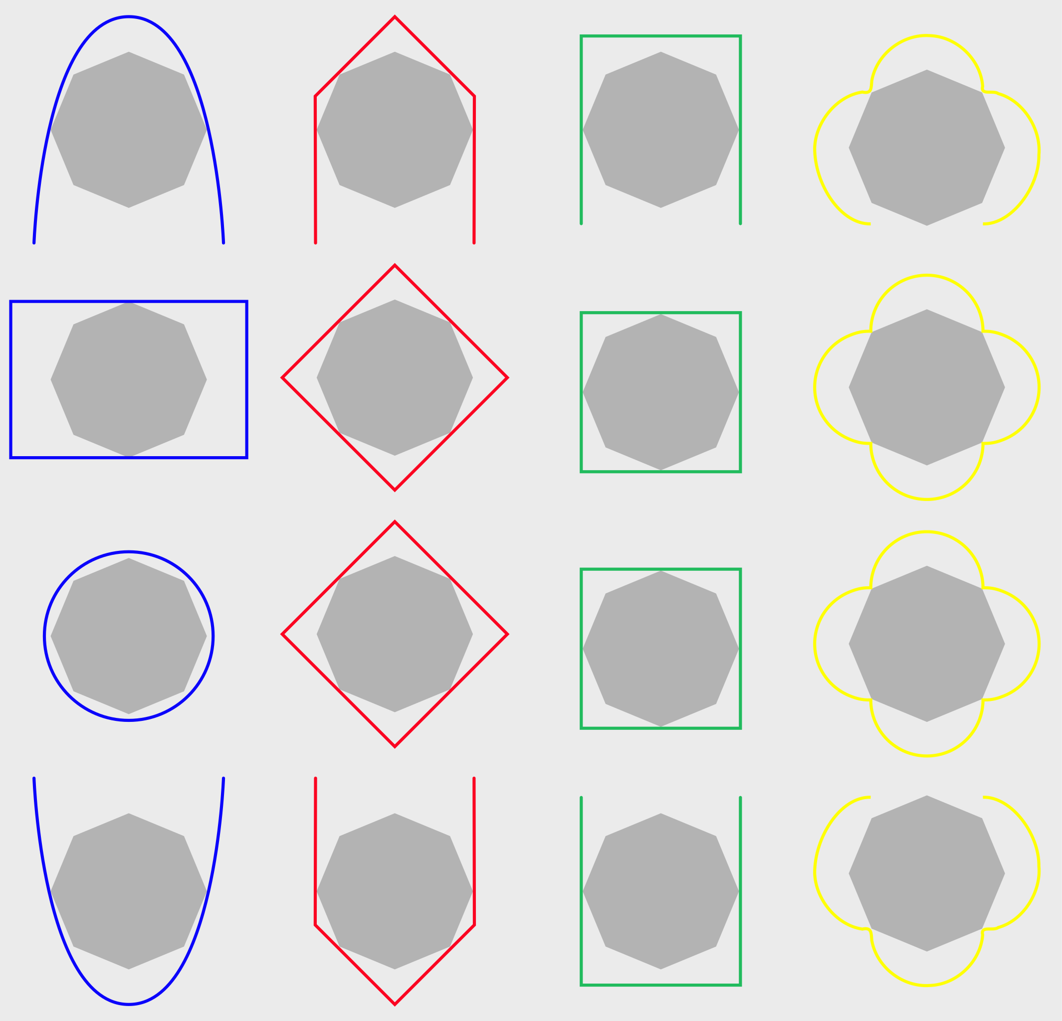
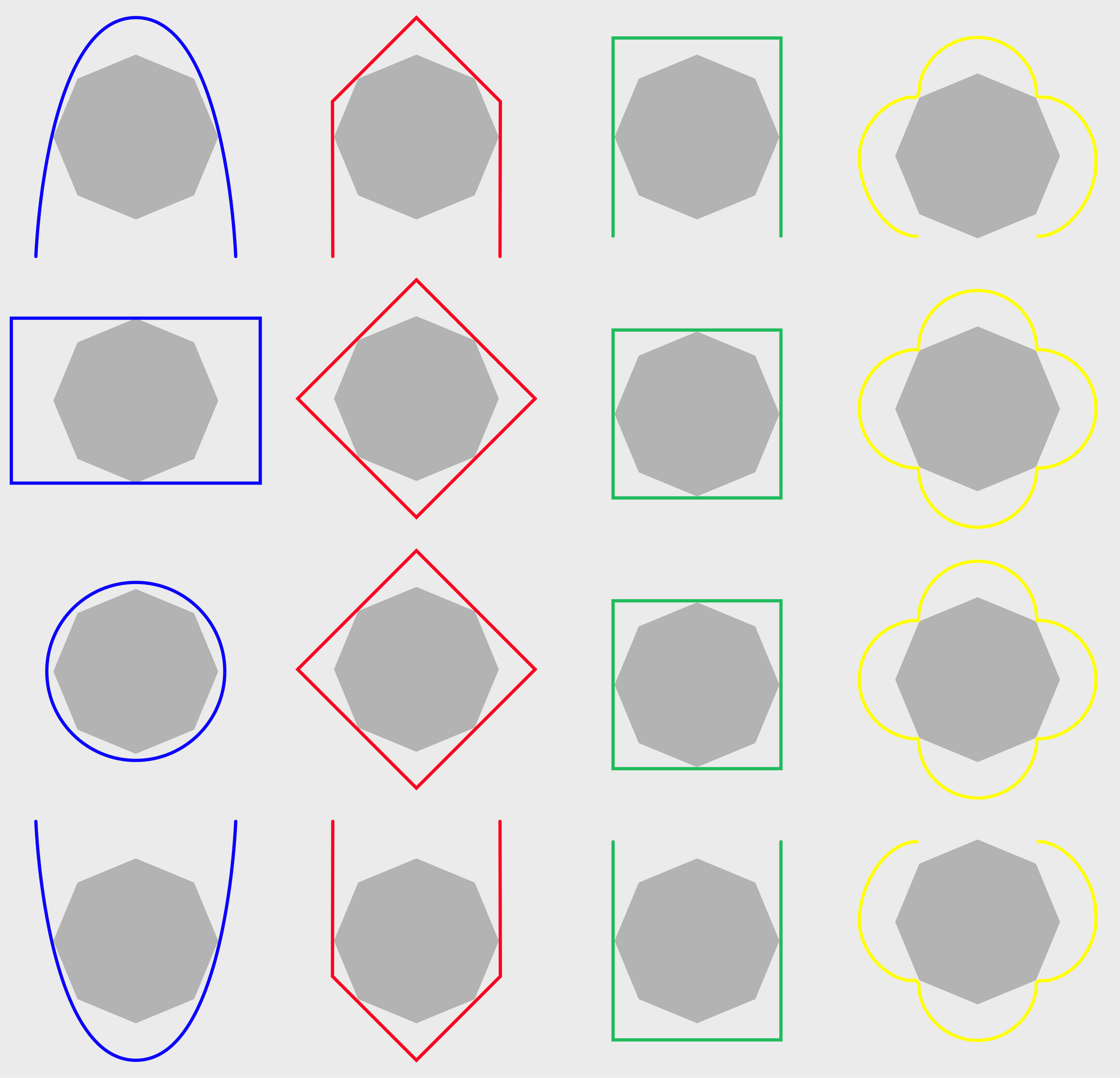
English: APP-6A defined a standard octagon boundary set within each boarder of a map symbol. With a few defined exceptions, all symbols inside the boarder would also fit inside these octagons. From top to bottom, here is the symbol boundary shown inside the boarders of air and space elements, land units, land equipment and sea surface elements, and sub-surface sea elements. This octagon is not actually shown when symbols are drawn or rendered. |
| Date | |
| Source | Own work |
| Author | CdnMCG |
Licensing edit
.svg&action=edit§ion=2)
I, the copyright holder of this work, hereby publish it under the following license:
This file is licensed under the Creative Commons Attribution-Share Alike 4.0 International license.
- You are free:
- to share – to copy, distribute and transmit the work
- to remix – to adapt the work
- Under the following conditions:
- attribution – You must give appropriate credit, provide a link to the license, and indicate if changes were made. You may do so in any reasonable manner, but not in any way that suggests the licensor endorses you or your use.
- share alike – If you remix, transform, or build upon the material, you must distribute your contributions under the same or compatible license as the original.
File history
Click on a date/time to view the file as it appeared at that time.
| Date/Time | Thumbnail | Dimensions | User | Comment | |
|---|---|---|---|---|---|
| current | 03:54, 21 March 2016 | | 2,744 × 2,640 (23 KB) | CdnMCG (talk | contribs) | User created page with UploadWizard |
You cannot overwrite this file.
File usage on Commons
There are no pages that use this file.
.svg&oldid=442423820)