File:NNVL - US Jet Stream 2012-03-02.png

Size of this preview: 800 × 450 pixels. Other resolutions: 320 × 180 pixels | 640 × 360 pixels | 1,024 × 576 pixels | 1,280 × 720 pixels | 1,920 × 1,080 pixels.
Original file (1,920 × 1,080 pixels, file size: 504 KB, MIME type: image/png)
Captions
Captions
Add a one-line explanation of what this file represents
| Description |
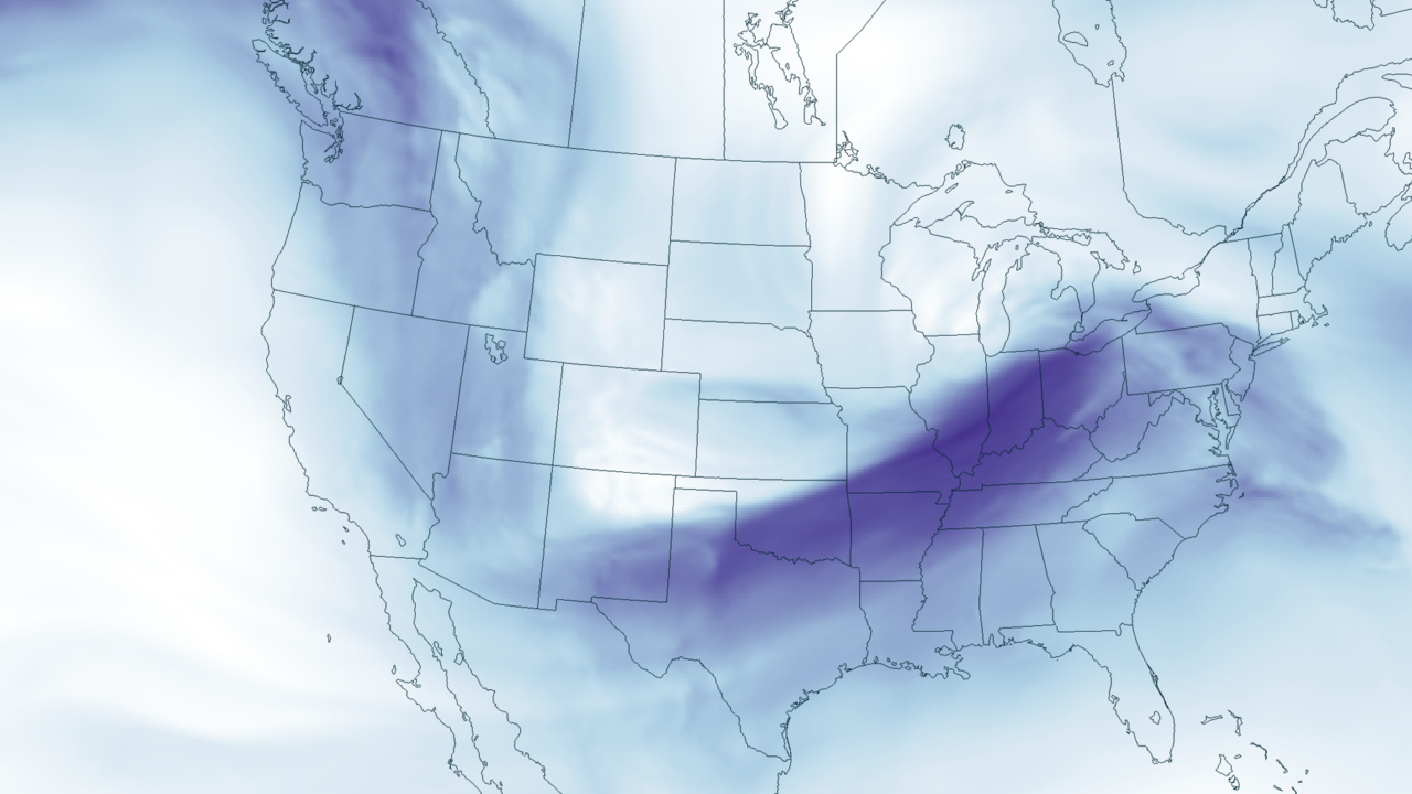
English: The severe weather outbreak predicted by NOAA for March 2 is partially due to a dip in the jet stream, bringing cold air from Canada to mix with warm, moist air from the Gulf of Mexico. Where these two differing air masses meet is often an area of severe weather, hail, winds, and even tornadoes. The position of the jet stream can be clearly seen in this image of wind speed at 500 millibars (18,000 feet) in the atmosphere, taken from output from the NOAA North American Model for March 2, 2012 at 7pm EST. |
|||
| Date | ||||
| Source | http://www.nnvl.noaa.gov/MediaDetail2.php?MediaID=1002&MediaTypeID=1 | |||
| Author | NOAA Storm Prediction Center, North American Model, NNVL | |||
| Permission (Reusing this file) |
|
File history
Click on a date/time to view the file as it appeared at that time.
| Date/Time | Thumbnail | Dimensions | User | Comment | |
|---|---|---|---|---|---|
| current | 14:50, 3 March 2012 | | 1,920 × 1,080 (504 KB) | TheAustinMan (talk | contribs) | {{Information |Description ={{en|1=The severe weather outbreak predicted by NOAA for March 2 is partially due to a dip in the jet stream, bringing cold air from Canada to mix with warm, moist air from the Gulf of Mexico. Where these two differing ai... |
You cannot overwrite this file.
File usage on Commons
There are no pages that use this file.