File:NOAA Weather Radio WNG575 Coverage Map.png
Size of this preview: 436 × 599 pixels. Other resolutions: 175 × 240 pixels | 349 × 480 pixels | 725 × 996 pixels.
Original file (725 × 996 pixels, file size: 104 KB, MIME type: image/png)
Captions
Captions
Add a one-line explanation of what this file represents
Summary edit
| Description |
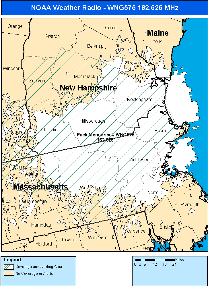
English: A map of the NOAA Weather Radio Station Pack Monadnock, NH WNG575's coverage area. |
| Date | |
| Source | http://www.weather.gov/nwr/Maps/PHP/site.php?State=MA&Site=WNG575 |
| Author | NOAA's National Weather Service (NOAA is a jurisdiction of the Federal gov't of the United States) |
Licensing edit
This image is in the public domain because it contains materials that originally came from the U.S. National Oceanic and Atmospheric Administration, taken or made as part of an employee's official duties.
|
File history
Click on a date/time to view the file as it appeared at that time.
| Date/Time | Thumbnail | Dimensions | User | Comment | |
|---|---|---|---|---|---|
| current | 20:13, 18 August 2011 | | 725 × 996 (104 KB) | EOProductions (talk | contribs) |
You cannot overwrite this file.
File usage on Commons
There are no pages that use this file.