File:NPS alcatraz-1910-map.gif

Size of this preview: 800 × 453 pixels. Other resolutions: 320 × 181 pixels | 640 × 362 pixels | 1,024 × 580 pixels | 1,280 × 725 pixels | 3,094 × 1,752 pixels.
Original file (3,094 × 1,752 pixels, file size: 1.05 MB, MIME type: image/gif, 0.1 s)
Captions
Captions
Add a one-line explanation of what this file represents
Summary
edit
| Description |
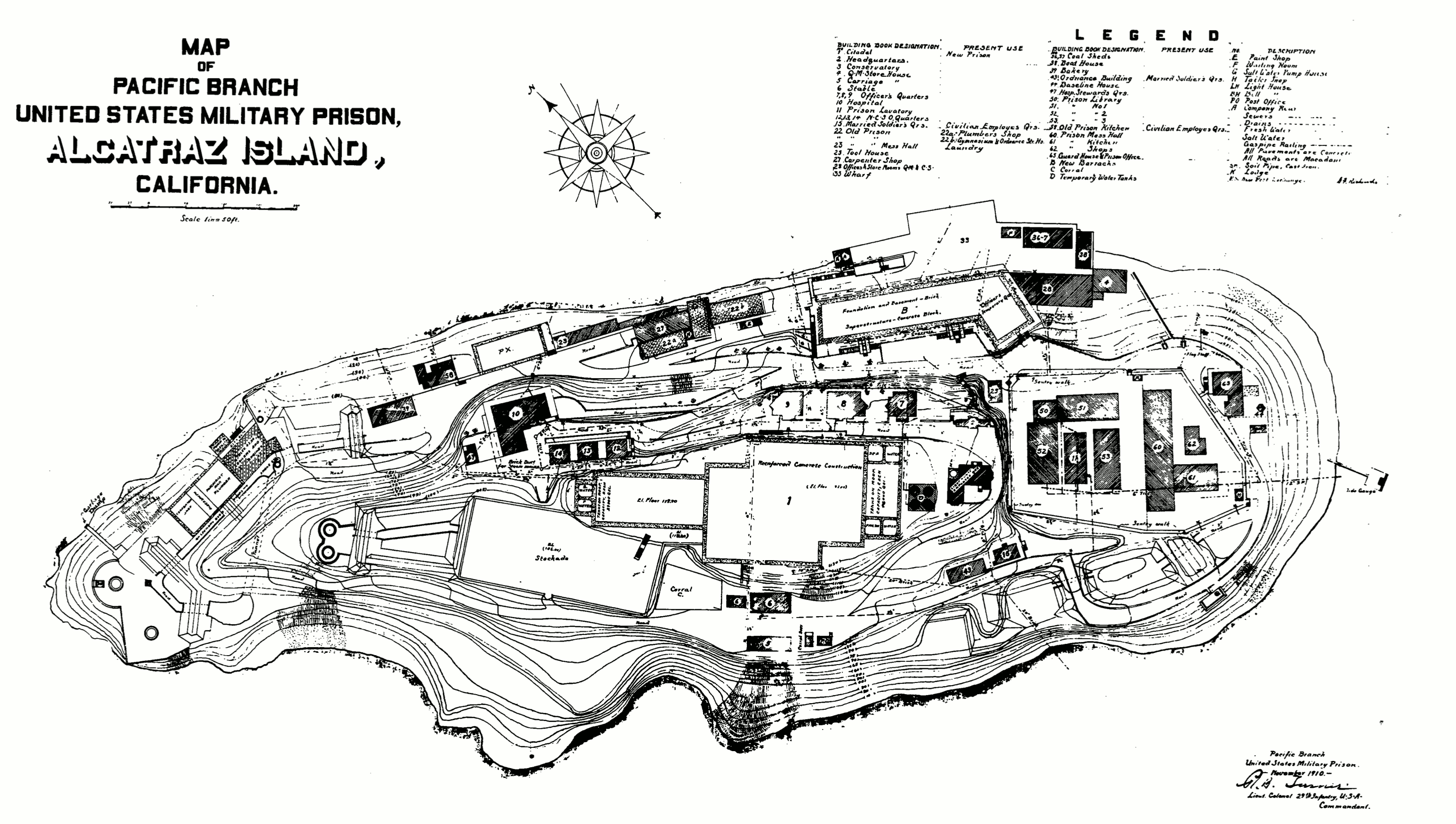
English: The 1910 Alcatraz Island plans map is a little hard to read but includes a legend that labels the various proposed buildings to be built. |
| Date | |
| Source | U.S. National Park Service (http://npmaps.com/wp-content/uploads/alcatraz-1910-map.gif) |
| Author | U.S. National Park Service, restoration/cleanup by Matt Holly |
Licensing
edit
| This image or media file contains material based on a work of a National Park Service employee, created as part of that person's official duties. As a work of the U.S. federal government, such work is in the public domain in the United States. See the NPS website and NPS copyright policy for more information. |
File history
Click on a date/time to view the file as it appeared at that time.
| Date/Time | Thumbnail | Dimensions | User | Comment | |
|---|---|---|---|---|---|
| current | 06:32, 12 May 2017 | | 3,094 × 1,752 (1.05 MB) | RKBot (talk | contribs) | =={{int:filedesc}}== {{Information |description= {{en|1=The 1910 Alcatraz Island plans map is a little hard to read but includes a legend that labels the various proposed buildings to be built.}} |date= 2017-02-07 |source= U.S. National Park Service (h... |
You cannot overwrite this file.
File usage on Commons
The following page uses this file: