File:NPS canyonlands-needles-map.gif

Size of this preview: 397 × 600 pixels. Other resolutions: 159 × 240 pixels | 318 × 480 pixels | 508 × 768 pixels | 678 × 1,024 pixels | 1,290 × 1,948 pixels.
Original file (1,290 × 1,948 pixels, file size: 250 KB, MIME type: image/gif, 0.1 s)
Captions
Captions
Add a one-line explanation of what this file represents
Summary edit
| Description |
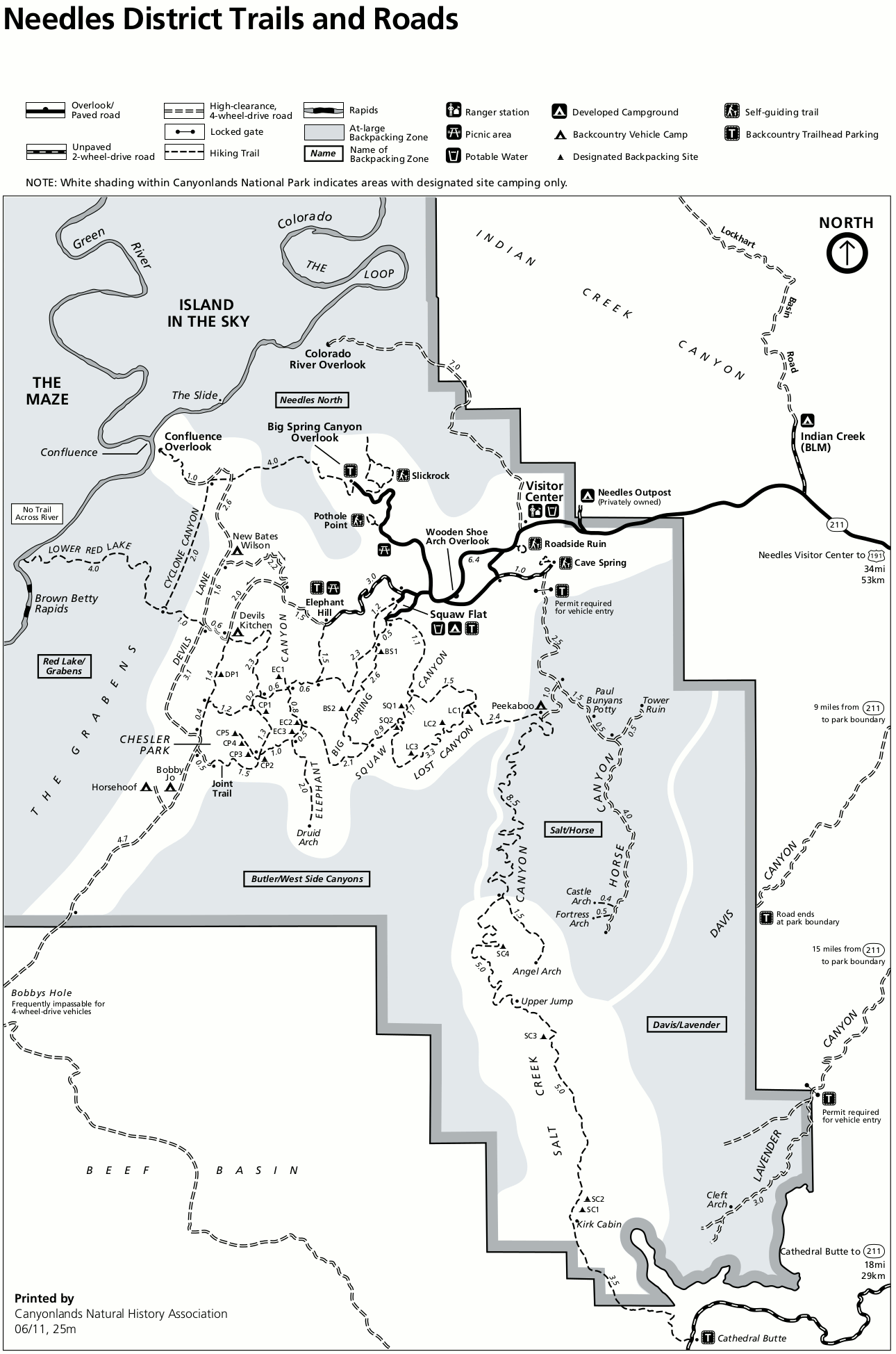
English: Map of the Needles district, a hiker’s paradise. Chesler Park, Druid Arch, and the Colorado/Green River confluence are all accessible on Needles hikes or 4WD adventures. |
| Date | |
| Source | U.S. National Park Service (http://npmaps.com/wp-content/uploads/canyonlands-needles-map.gif) |
| Author | U.S. National Park Service, restoration/cleanup by Matt Holly |
| Other versions |
 |
Licensing edit
| This image or media file contains material based on a work of a National Park Service employee, created as part of that person's official duties. As a work of the U.S. federal government, such work is in the public domain in the United States. See the NPS website and NPS copyright policy for more information. |
File history
Click on a date/time to view the file as it appeared at that time.
| Date/Time | Thumbnail | Dimensions | User | Comment | |
|---|---|---|---|---|---|
| current | 19:49, 16 May 2017 | | 1,290 × 1,948 (250 KB) | RKBot (talk | contribs) | =={{int:filedesc}}== {{Information |description= {{en|1=Map of the Needles district, a hiker’s paradise. Chesler Park, Druid Arch, and the Colorado/Green River confluence are all accessible on Needles hikes or 4WD adventures.}} |date= 2014-03-29 |sou... |
You cannot overwrite this file.
File usage on Commons
The following page uses this file: