File:NPS canyonlands-upheaval-dome-map.gif

Size of this preview: 800 × 502 pixels. Other resolutions: 320 × 201 pixels | 640 × 401 pixels | 965 × 605 pixels.
Original file (965 × 605 pixels, file size: 36 KB, MIME type: image/gif, 0.1 s)
Captions
Captions
Add a one-line explanation of what this file represents
Summary edit
| Description |
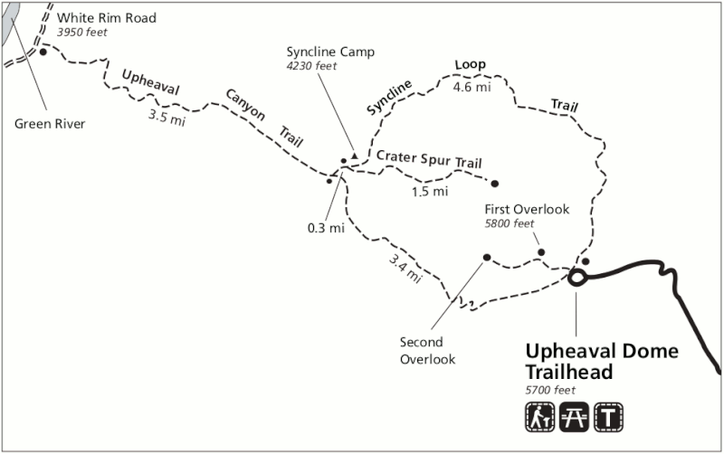
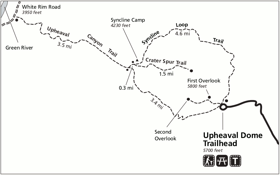
English: Upheaval Dome map, showing the trails surrounding Upheaval Dome in the Island in the Sky district in northern Canyonlands National Park. You can do a short walk to the overlook or full-day hikes. |
| Date | |
| Source | U.S. National Park Service (http://npmaps.com/wp-content/uploads/canyonlands-upheaval-dome-map.gif) |
| Author | U.S. National Park Service, restoration/cleanup by Matt Holly |
Licensing edit
| This image or media file contains material based on a work of a National Park Service employee, created as part of that person's official duties. As a work of the U.S. federal government, such work is in the public domain in the United States. See the NPS website and NPS copyright policy for more information. |
File history
Click on a date/time to view the file as it appeared at that time.
| Date/Time | Thumbnail | Dimensions | User | Comment | |
|---|---|---|---|---|---|
| current | 19:50, 16 May 2017 | | 965 × 605 (36 KB) | RKBot (talk | contribs) | =={{int:filedesc}}== {{Information |description= {{en|1=Upheaval Dome map, showing the trails surrounding Upheaval Dome in the Island in the Sky district in northern Canyonlands National Park. You can do a short walk to the overlook or full-day hikes.}... |
You cannot overwrite this file.
File usage on Commons
There are no pages that use this file.