File:NPS cape-cod-salt-pond-map.gif

Size of this preview: 593 × 600 pixels. Other resolutions: 237 × 240 pixels | 475 × 480 pixels | 696 × 704 pixels.
Original file (696 × 704 pixels, file size: 140 KB, MIME type: image/gif, 0.1 s)
Captions
Captions
Add a one-line explanation of what this file represents
Summary edit
| Description |
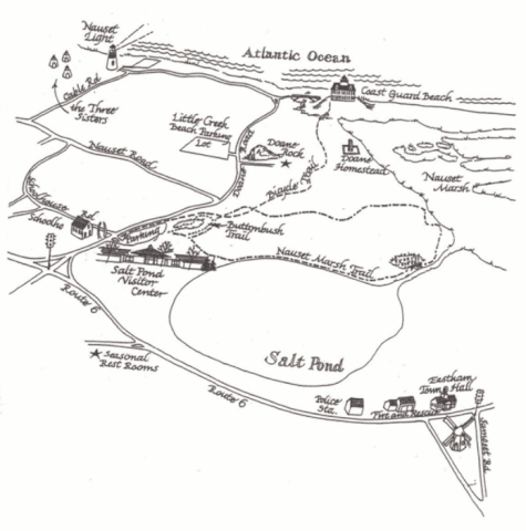
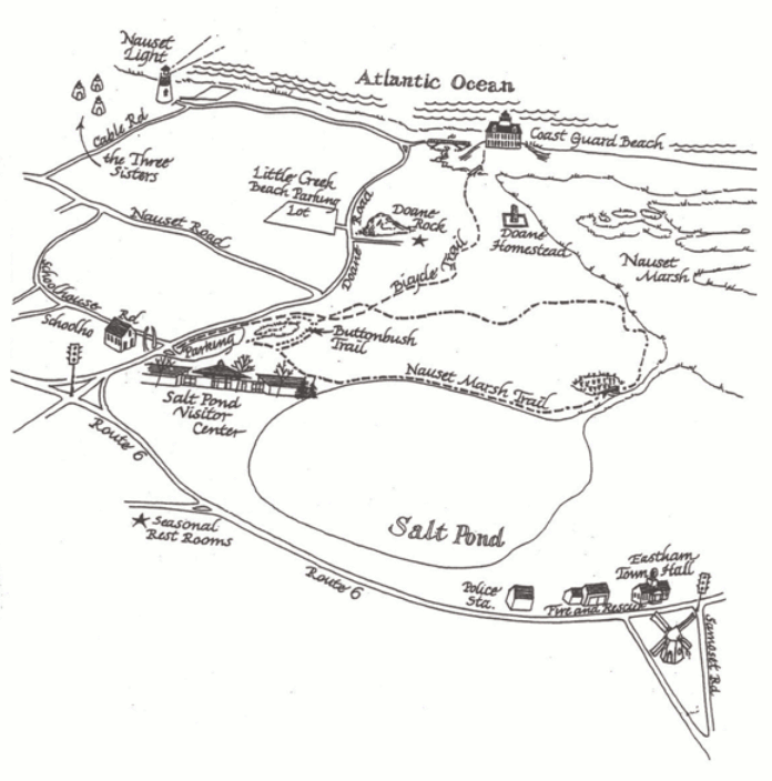
English: Salt Pond and Nauset Marsh map focuses on the features right around Salt Pond Visitor Center and Nauset Marsh: trails, parking, roads, Nauset Light, Doane Rock, and more. |
| Date | |
| Source | U.S. National Park Service (http://npmaps.com/wp-content/uploads/cape-cod-salt-pond-map.gif) |
| Author | U.S. National Park Service, restoration/cleanup by Matt Holly |
Licensing edit
| This image or media file contains material based on a work of a National Park Service employee, created as part of that person's official duties. As a work of the U.S. federal government, such work is in the public domain in the United States. See the NPS website and NPS copyright policy for more information. |
File history
Click on a date/time to view the file as it appeared at that time.
| Date/Time | Thumbnail | Dimensions | User | Comment | |
|---|---|---|---|---|---|
| current | 19:53, 16 May 2017 | | 696 × 704 (140 KB) | RKBot (talk | contribs) | =={{int:filedesc}}== {{Information |description= {{en|1=Salt Pond and Nauset Marsh map focuses on the features right around Salt Pond Visitor Center and Nauset Marsh: trails, parking, roads, Nauset Light, Doane Rock, and more.}} |date= 2016-04-22 |sour... |
You cannot overwrite this file.
File usage on Commons
The following page uses this file: