File:NPS cave-spring-map.jpg

Size of this preview: 800 × 532 pixels. Other resolutions: 320 × 213 pixels | 640 × 426 pixels | 980 × 652 pixels.
Original file (980 × 652 pixels, file size: 107 KB, MIME type: image/jpeg)
Captions
Captions
Add a one-line explanation of what this file represents
Summary edit
| Description |
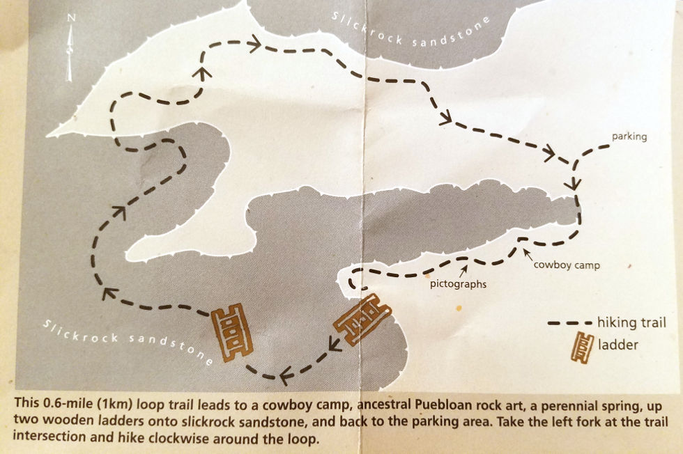
English: The Cave Spring trail map shows this short loop trail located in the Needles District that includes a couple ladders, pictographs, and an old cowboy camp. And, well, Cave Spring naturally. |
| Date | |
| Source | U.S. National Park Service (http://npmaps.com/wp-content/uploads/cave-spring-map.jpg) |
| Author | U.S. National Park Service, restoration/cleanup by Matt Holly |
| Camera location | | View this and other nearby images on: OpenStreetMap |
|---|
Licensing edit
| This image or media file contains material based on a work of a National Park Service employee, created as part of that person's official duties. As a work of the U.S. federal government, such work is in the public domain in the United States. See the NPS website and NPS copyright policy for more information. |
File history
Click on a date/time to view the file as it appeared at that time.
| Date/Time | Thumbnail | Dimensions | User | Comment | |
|---|---|---|---|---|---|
| current | 19:50, 16 May 2017 | | 980 × 652 (107 KB) | RKBot (talk | contribs) | =={{int:filedesc}}== {{Information |description= {{en|1=The Cave Spring trail map shows this short loop trail located in the Needles District that includes a couple ladders, pictographs, and an old cowboy camp. And, well, Cave Spring naturally.}} |date... |
You cannot overwrite this file.
File usage on Commons
The following page uses this file:
File usage on other wikis
The following other wikis use this file:
- Usage on www.wikidata.org