File:NPS cedar-breaks-geologic-map.gif

Size of this preview: 485 × 599 pixels. Other resolutions: 194 × 240 pixels | 389 × 480 pixels | 622 × 768 pixels | 829 × 1,024 pixels | 1,848 × 2,282 pixels.
Original file (1,848 × 2,282 pixels, file size: 405 KB, MIME type: image/gif, 0.1 s)
Captions
Captions
Add a one-line explanation of what this file represents
Summary
edit
| Description |
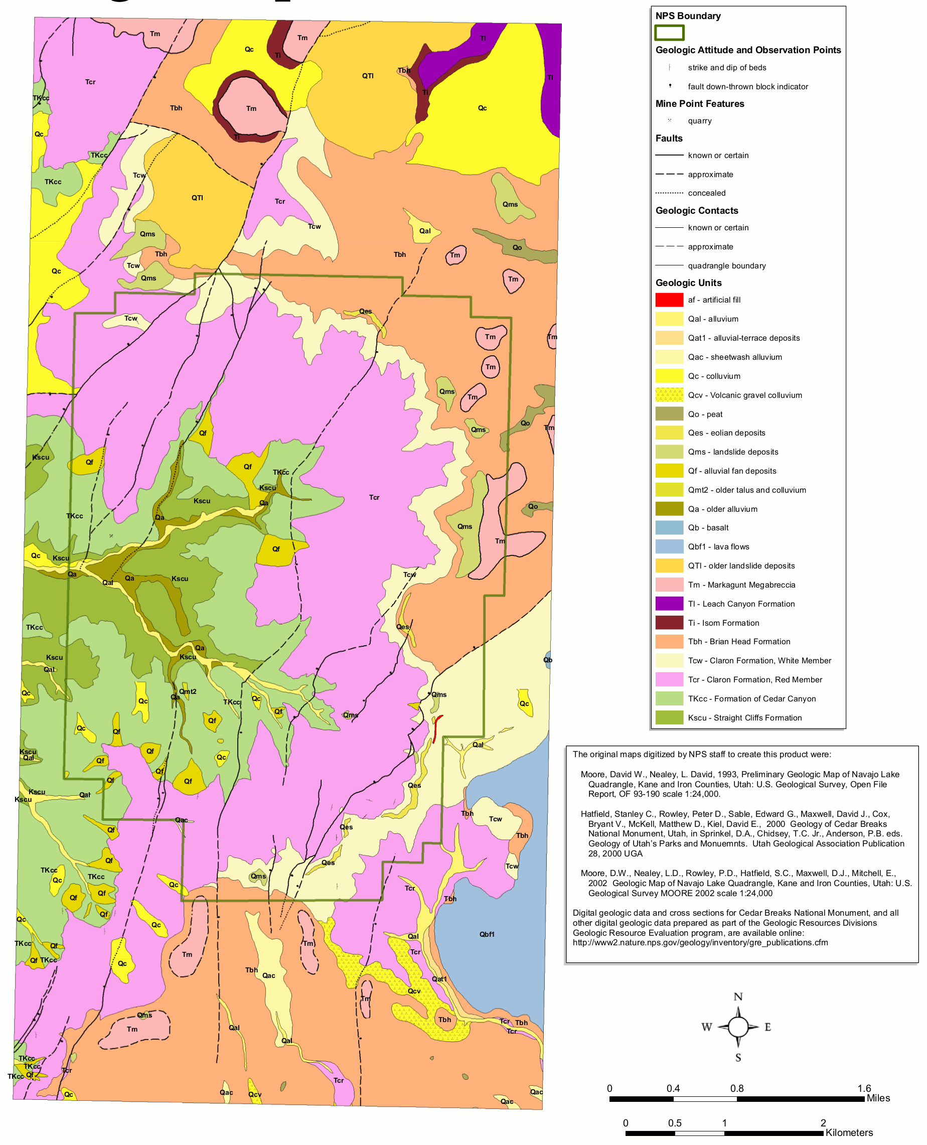
English: The Cedar Breaks geologic map includes both recent surficial deposits and also older bedrock such as the beautiful Claron Formation, which makes up the incredible formations Cedar Breaks is famous for. |
| Date | |
| Source | U.S. National Park Service (http://npmaps.com/wp-content/uploads/cedar-breaks-geologic-map.gif) |
| Author | U.S. National Park Service, restoration/cleanup by Matt Holly |
Licensing
edit
| This image or media file contains material based on a work of a National Park Service employee, created as part of that person's official duties. As a work of the U.S. federal government, such work is in the public domain in the United States. See the NPS website and NPS copyright policy for more information. |
File history
Click on a date/time to view the file as it appeared at that time.
| Date/Time | Thumbnail | Dimensions | User | Comment | |
|---|---|---|---|---|---|
| current | 20:04, 16 May 2017 | | 1,848 × 2,282 (405 KB) | RKBot (talk | contribs) | =={{int:filedesc}}== {{Information |description= {{en|1=The Cedar Breaks geologic map includes both recent surficial deposits and also older bedrock such as the beautiful Claron Formation, which makes up the incredible formations Cedar Breaks is famous... |
You cannot overwrite this file.
File usage on Commons
The following page uses this file: