File:NPS cherry-blossom-map-tidal-basin.jpg
Size of this preview: 797 × 600 pixels. Other resolutions: 319 × 240 pixels | 638 × 480 pixels | 1,021 × 768 pixels | 1,280 × 963 pixels | 2,323 × 1,748 pixels.
Original file (2,323 × 1,748 pixels, file size: 675 KB, MIME type: image/jpeg)
Captions
Captions
Add a one-line explanation of what this file represents
Summary
edit
| Description |
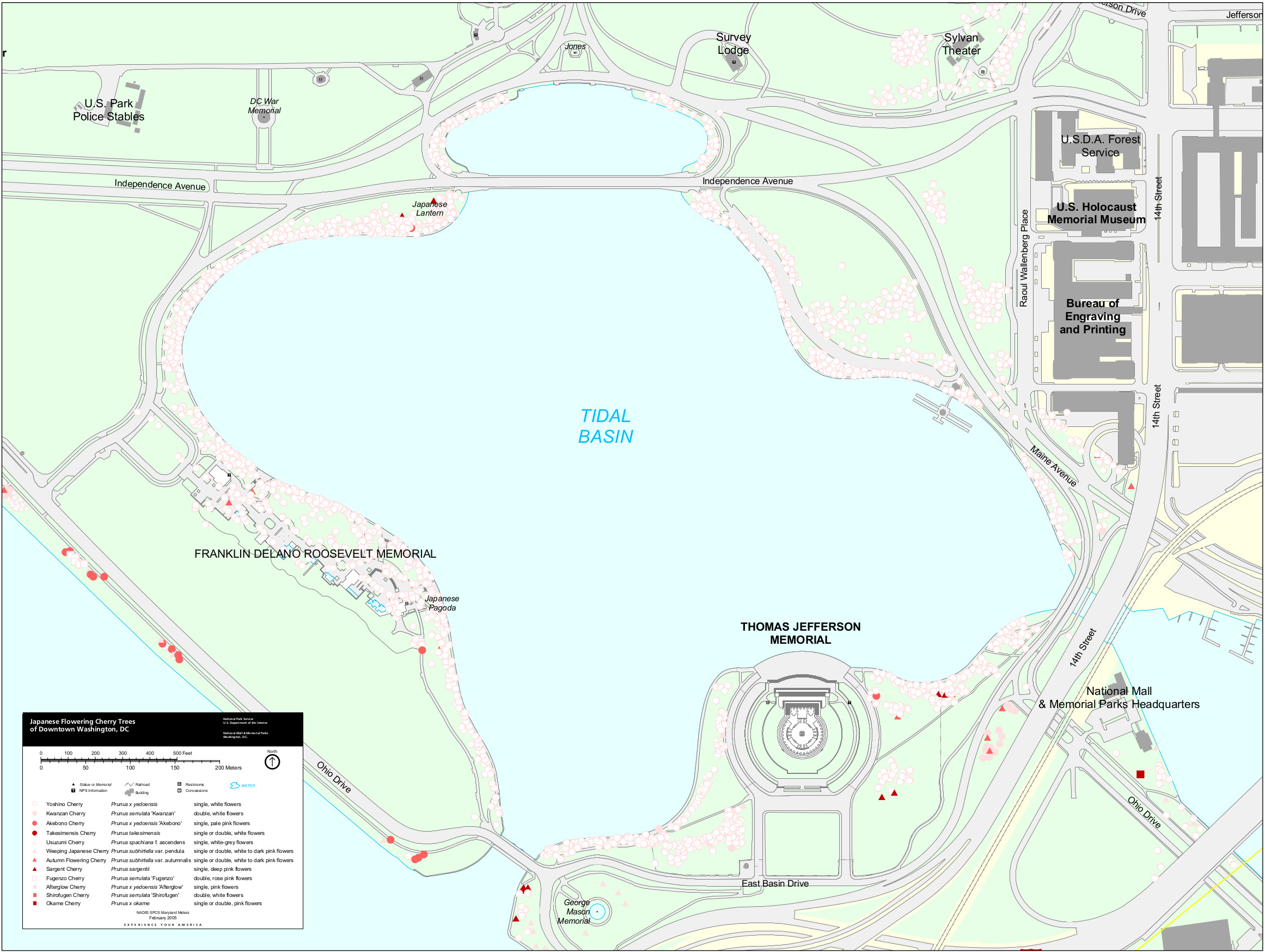
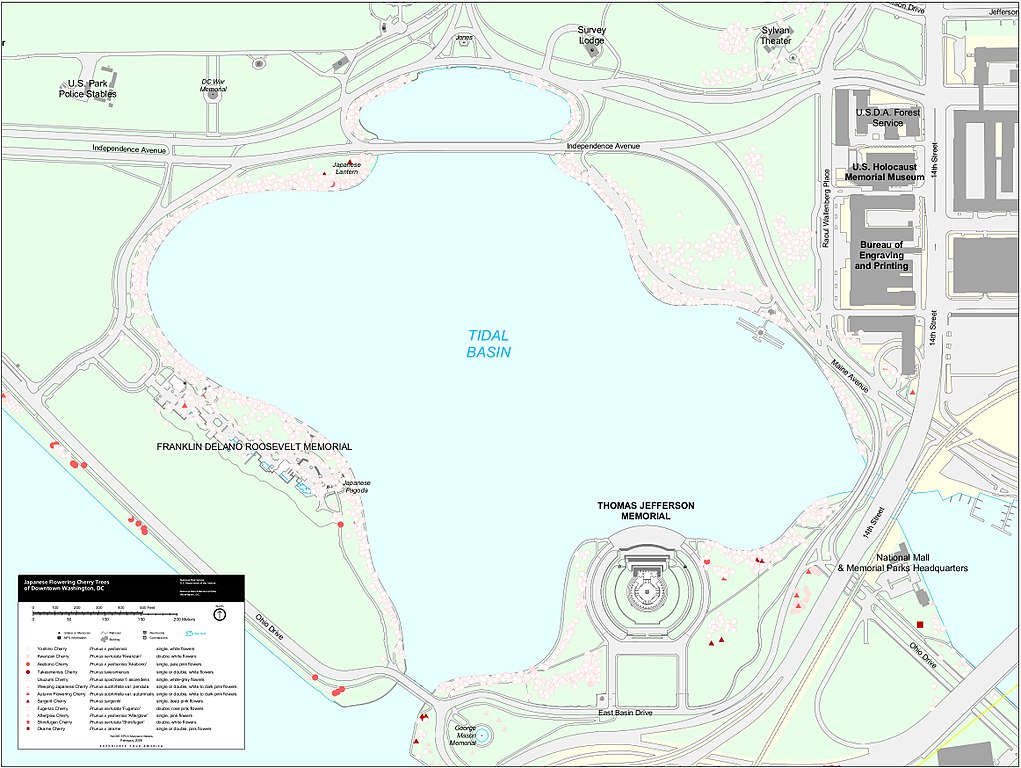
English: Tidal basin cherry blossom map, zooming in on the tidal basin and showing and labeling the individual cherry blossom trees. The map might be less pretty, but it is 100% accurate. |
| Date | |
| Source | U.S. National Park Service (http://npmaps.com/wp-content/uploads/cherry-blossom-map-tidal-basin.jpg) |
| Author | U.S. National Park Service, restoration/cleanup by Matt Holly |
Licensing
edit
| This image or media file contains material based on a work of a National Park Service employee, created as part of that person's official duties. As a work of the U.S. federal government, such work is in the public domain in the United States. See the NPS website and NPS copyright policy for more information. |
File history
Click on a date/time to view the file as it appeared at that time.
| Date/Time | Thumbnail | Dimensions | User | Comment | |
|---|---|---|---|---|---|
| current | 01:23, 17 May 2017 | | 2,323 × 1,748 (675 KB) | RKBot (talk | contribs) | =={{int:filedesc}}== {{Information |description= {{en|1=Tidal basin cherry blossom map, zooming in on the tidal basin and showing and labeling the individual cherry blossom trees. The map might be less pretty, but it is 100% accurate.}} |date= 2016-11-... |
You cannot overwrite this file.
File usage on Commons
The following page uses this file: