File:NPS colorado-national-monument-visitor-center-campground-map.gif

Size of this preview: 747 × 600 pixels. Other resolutions: 299 × 240 pixels | 598 × 480 pixels | 964 × 774 pixels.
Original file (964 × 774 pixels, file size: 121 KB, MIME type: image/gif, 0.1 s)
Captions
Captions
Add a one-line explanation of what this file represents
Summary
edit
| Description |
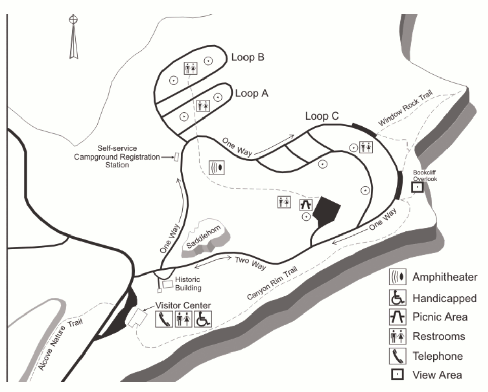
English: This Colorado NM detail map zooms in on the visitor center and Saddlehorn Campground. This area is located up on Rim Rock Drive and is the most visited area of Colorado National Monument. |
| Date | |
| Source | U.S. National Park Service (http://npmaps.com/wp-content/uploads/colorado-national-monument-visitor-center-campground-map.gif) |
| Author | U.S. National Park Service, restoration/cleanup by Matt Holly |
Licensing
edit
| This image or media file contains material based on a work of a National Park Service employee, created as part of that person's official duties. As a work of the U.S. federal government, such work is in the public domain in the United States. See the NPS website and NPS copyright policy for more information. |
File history
Click on a date/time to view the file as it appeared at that time.
| Date/Time | Thumbnail | Dimensions | User | Comment | |
|---|---|---|---|---|---|
| current | 20:07, 16 May 2017 | | 964 × 774 (121 KB) | RKBot (talk | contribs) | =={{int:filedesc}}== {{Information |description= {{en|1=This Colorado NM detail map zooms in on the visitor center and Saddlehorn Campground. This area is located up on Rim Rock Drive and is the most visited area of Colorado National Monument.}} |date=... |
You cannot overwrite this file.
File usage on Commons
The following 2 pages use this file:
File usage on other wikis
The following other wikis use this file:
- Usage on www.wikidata.org