File:NPS congaree-forest-map.gif

Size of this preview: 789 × 600 pixels. Other resolutions: 316 × 240 pixels | 631 × 480 pixels | 1,010 × 768 pixels | 1,280 × 973 pixels | 2,560 × 1,947 pixels | 3,472 × 2,640 pixels.
Original file (3,472 × 2,640 pixels, file size: 557 KB, MIME type: image/gif, 0.1 s)
Captions
Captions
Add a one-line explanation of what this file represents
Summary edit
| Description |
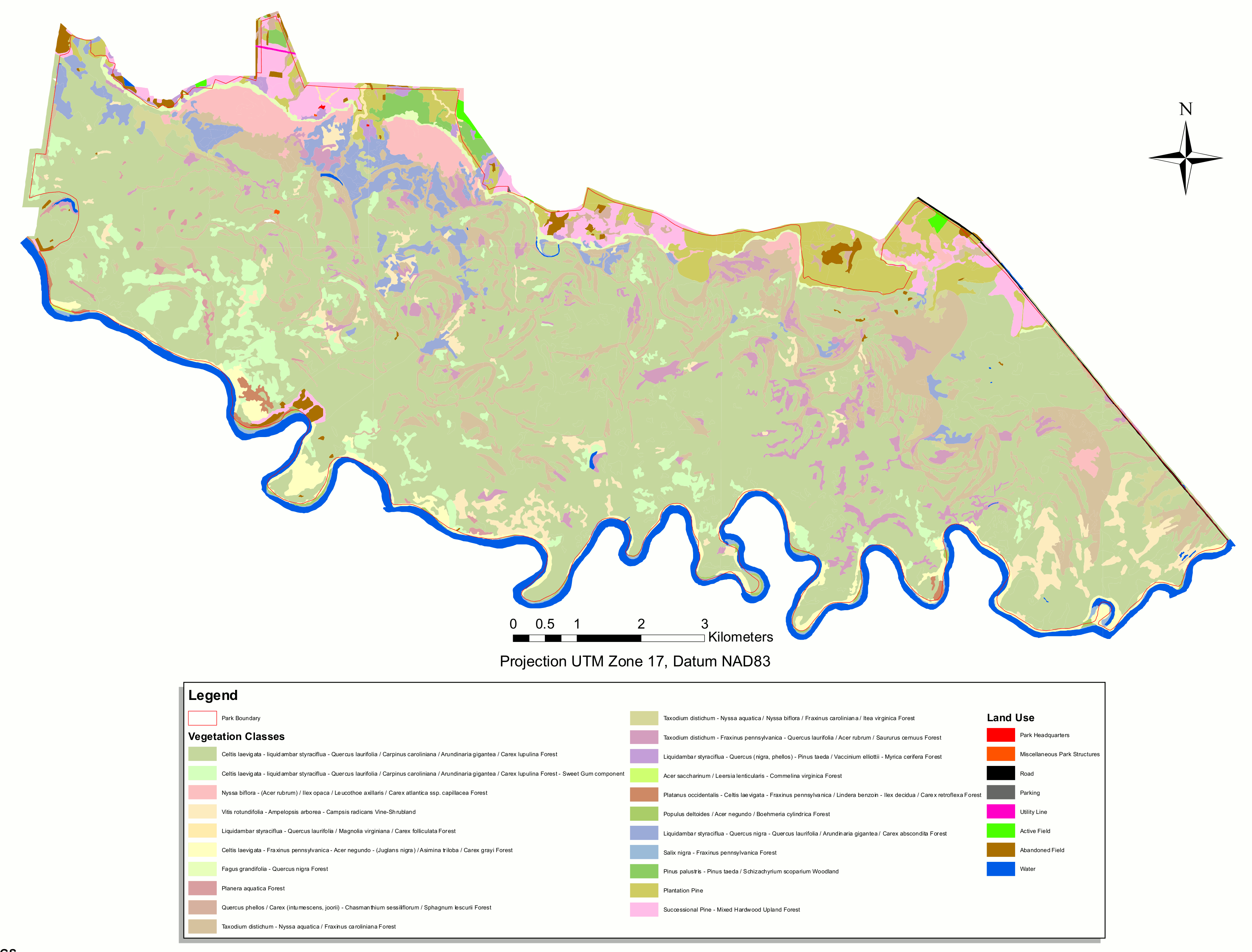
English: For the scientists, here’s a vegetation map of Congaree, identifying the various types of forest found in the park with their Latin names. |
| Date | |
| Source | U.S. National Park Service (http://npmaps.com/wp-content/uploads/congaree-forest-map.gif) |
| Author | U.S. National Park Service, restoration/cleanup by Matt Holly |
Licensing edit
| This image or media file contains material based on a work of a National Park Service employee, created as part of that person's official duties. As a work of the U.S. federal government, such work is in the public domain in the United States. See the NPS website and NPS copyright policy for more information. |
File history
Click on a date/time to view the file as it appeared at that time.
| Date/Time | Thumbnail | Dimensions | User | Comment | |
|---|---|---|---|---|---|
| current | 20:09, 16 May 2017 | | 3,472 × 2,640 (557 KB) | RKBot (talk | contribs) | =={{int:filedesc}}== {{Information |description= {{en|1=For the scientists, here’s a vegetation map of Congaree, identifying the various types of forest found in the park with their Latin names.}} |date= 2017-01-24 |source= U.S. National Park Service... |
You cannot overwrite this file.
File usage on Commons
The following page uses this file: