File:NPS cumberland-gap-geologic-map.jpg

Size of this preview: 800 × 550 pixels. Other resolutions: 320 × 220 pixels | 640 × 440 pixels | 1,024 × 705 pixels | 1,280 × 881 pixels | 2,443 × 1,681 pixels.
Original file (2,443 × 1,681 pixels, file size: 976 KB, MIME type: image/jpeg)
Captions
Captions
Add a one-line explanation of what this file represents
Summary
edit
| Description |
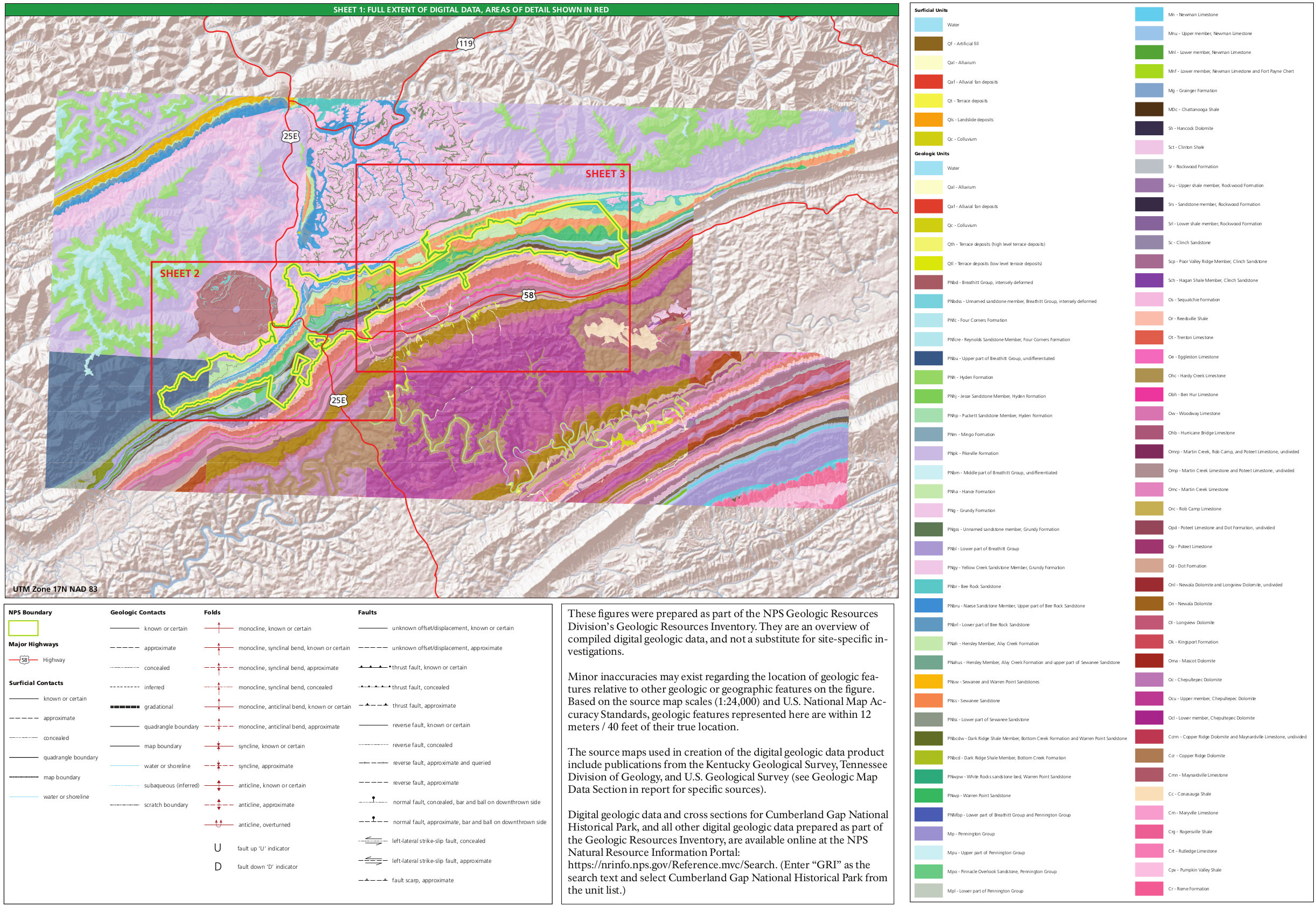
English: Geologic map of Cumberland Gap, showing an overview map and legend identifying the rock layers you’ll find in the two maps below which divide Cumberland Gap into an east and west half. |
| Date | |
| Source | U.S. National Park Service (http://npmaps.com/wp-content/uploads/cumberland-gap-geologic-map.jpg) |
| Author | U.S. National Park Service, restoration/cleanup by Matt Holly |
Licensing
edit
| This image or media file contains material based on a work of a National Park Service employee, created as part of that person's official duties. As a work of the U.S. federal government, such work is in the public domain in the United States. See the NPS website and NPS copyright policy for more information. |
File history
Click on a date/time to view the file as it appeared at that time.
| Date/Time | Thumbnail | Dimensions | User | Comment | |
|---|---|---|---|---|---|
| current | 20:16, 16 May 2017 | | 2,443 × 1,681 (976 KB) | RKBot (talk | contribs) | =={{int:filedesc}}== {{Information |description= {{en|1=Geologic map of Cumberland Gap, showing an overview map and legend identifying the rock layers you’ll find in the two maps below which divide Cumberland Gap into an east and west half.}} |date=... |
You cannot overwrite this file.
File usage on Commons
The following page uses this file: