File:NPS glacier-st-mary-campground-map.jpg

Size of this preview: 606 × 600 pixels. Other resolutions: 243 × 240 pixels | 485 × 480 pixels | 764 × 756 pixels.
Original file (764 × 756 pixels, file size: 92 KB, MIME type: image/jpeg)
Captions
Captions
Add a one-line explanation of what this file represents
Summary edit
| Description |
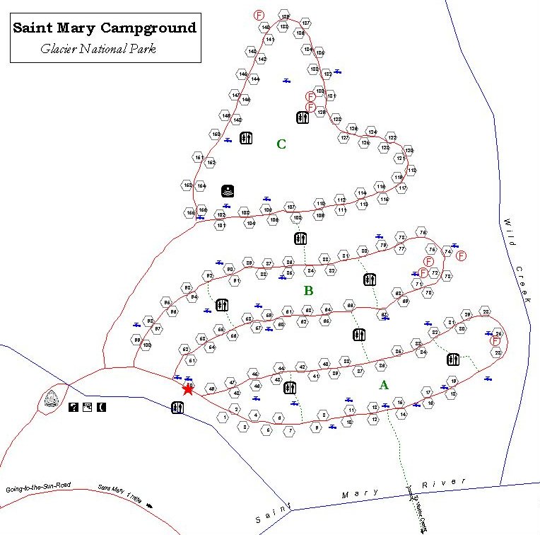
English: This St. Mary Campground map shows the largest campground east of Logan Pass and the only eastside campground open all year. Its located near the St. Mary Visitor Center. |
| Date | |
| Source | U.S. National Park Service (http://npmaps.com/wp-content/uploads/glacier-st-mary-campground-map.jpg) |
| Author | U.S. National Park Service, restoration/cleanup by Matt Holly |
Licensing edit
| This image or media file contains material based on a work of a National Park Service employee, created as part of that person's official duties. As a work of the U.S. federal government, such work is in the public domain in the United States. See the NPS website and NPS copyright policy for more information. |
File history
Click on a date/time to view the file as it appeared at that time.
| Date/Time | Thumbnail | Dimensions | User | Comment | |
|---|---|---|---|---|---|
| current | 21:43, 16 May 2017 | | 764 × 756 (92 KB) | RKBot (talk | contribs) | =={{int:filedesc}}== {{Information |description= {{en|1=This St. Mary Campground map shows the largest campground east of Logan Pass and the only eastside campground open all year. Its located near the St. Mary Visitor Center.}} |date= 2013-10-30 |sour... |
You cannot overwrite this file.
File usage on Commons
The following page uses this file:
File usage on other wikis
The following other wikis use this file:
- Usage on www.wikidata.org