File:NPS mount-rushmore-geologic-map.jpg

Size of this preview: 515 × 599 pixels. Other resolutions: 206 × 240 pixels | 412 × 480 pixels | 660 × 768 pixels | 880 × 1,024 pixels | 2,460 × 2,863 pixels.
Original file (2,460 × 2,863 pixels, file size: 924 KB, MIME type: image/jpeg)
Captions
Captions
Add a one-line explanation of what this file represents
Summary
edit
| Description |
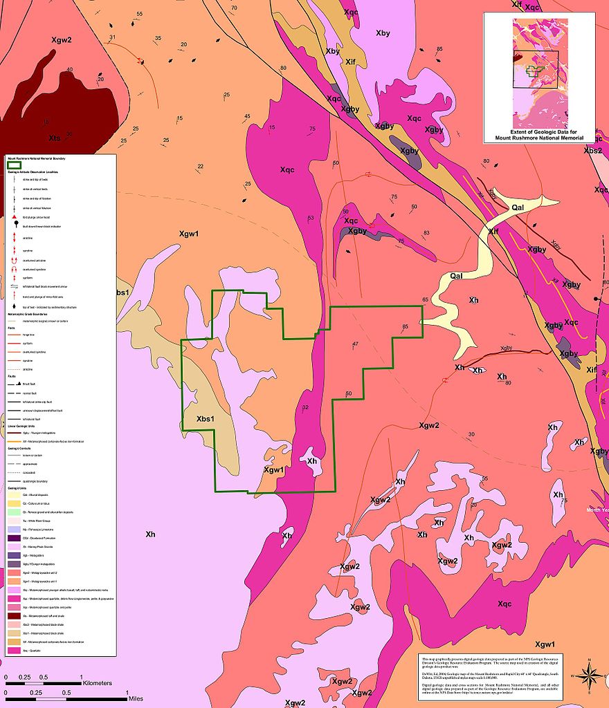
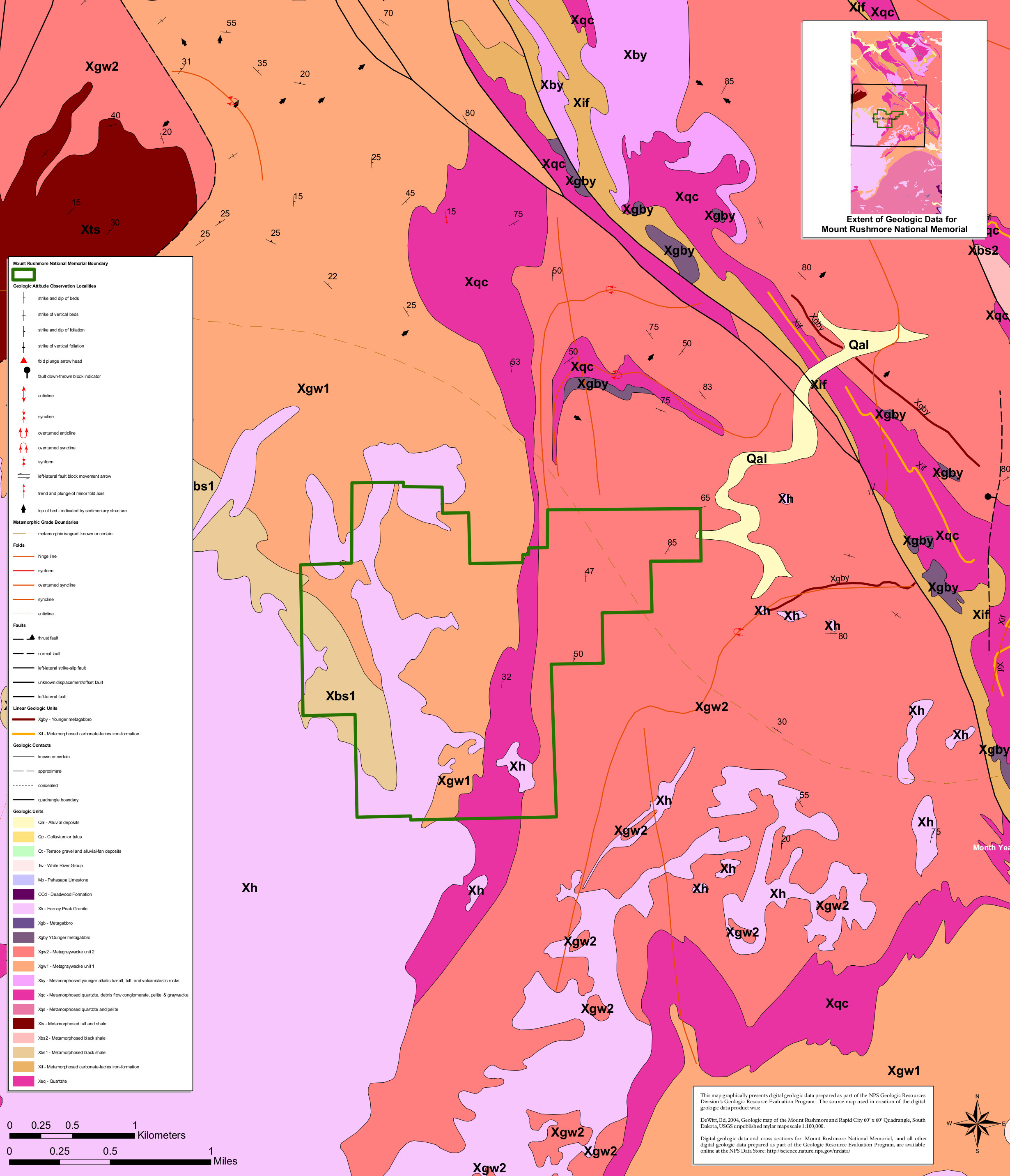
English: The Mount Rushmore geologic map includes the rock layers both inside the park as well as in the surrounding area of the Black Hills. Since it’s the Black Hills, you’ll of course find lots of granite. |
| Date | |
| Source | U.S. National Park Service (http://npmaps.com/wp-content/uploads/mount-rushmore-geologic-map.jpg) |
| Author | U.S. National Park Service, restoration/cleanup by Matt Holly |
Licensing
edit
| This image or media file contains material based on a work of a National Park Service employee, created as part of that person's official duties. As a work of the U.S. federal government, such work is in the public domain in the United States. See the NPS website and NPS copyright policy for more information. |
File history
Click on a date/time to view the file as it appeared at that time.
| Date/Time | Thumbnail | Dimensions | User | Comment | |
|---|---|---|---|---|---|
| current | 01:12, 17 May 2017 | | 2,460 × 2,863 (924 KB) | RKBot (talk | contribs) | =={{int:filedesc}}== {{Information |description= {{en|1=The Mount Rushmore geologic map includes the rock layers both inside the park as well as in the surrounding area of the Black Hills. Since it’s the Black Hills, you’ll of course find lots of g... |
You cannot overwrite this file.
File usage on Commons
The following page uses this file: