File:NPS namekagon-river-map-2-hayward-landing.jpg

Size of this preview: 775 × 600 pixels. Other resolutions: 310 × 240 pixels | 621 × 480 pixels | 993 × 768 pixels | 1,280 × 990 pixels | 2,032 × 1,572 pixels.
Original file (2,032 × 1,572 pixels, file size: 435 KB, MIME type: image/jpeg)
Captions
Captions
Add a one-line explanation of what this file represents
Summary
edit
| Description |
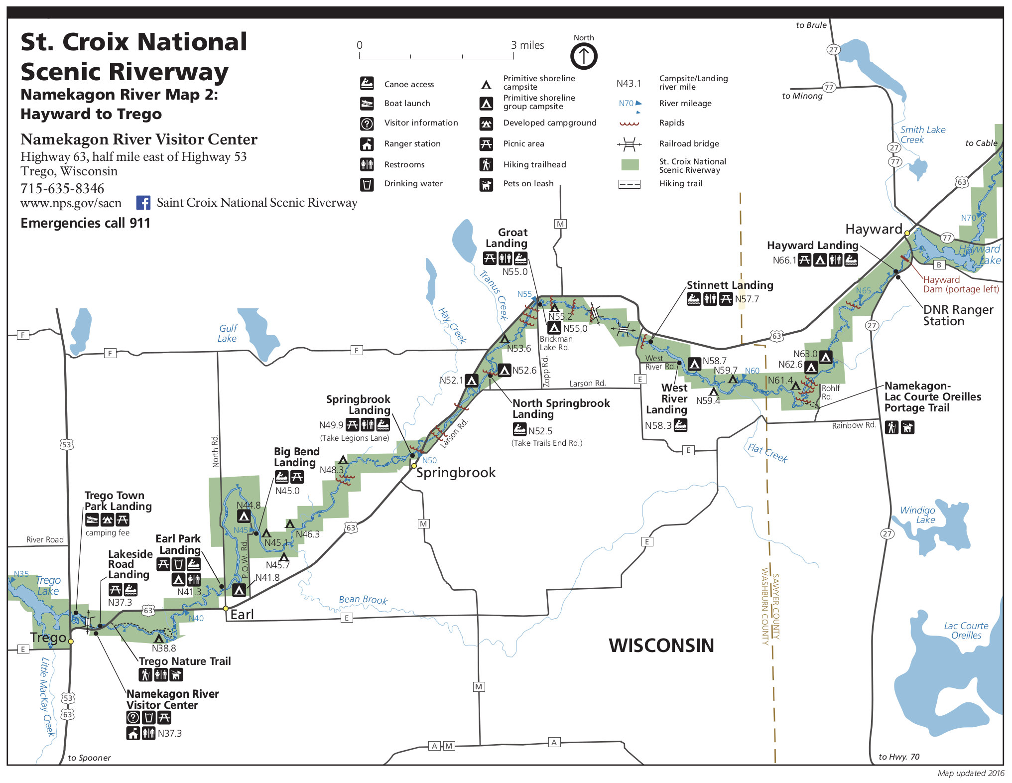
English: Map 2: Here we have another Namekagon River map showing Hayward Landing to Trego, and includes the Namekagon River Visitor Center. This map spans Sawyer and Washburn counties. |
| Date | |
| Source | U.S. National Park Service (http://npmaps.com/wp-content/uploads/namekagon-river-map-2-hayward-landing.jpg) |
| Author | U.S. National Park Service, restoration/cleanup by Matt Holly |
Licensing
edit
| This image or media file contains material based on a work of a National Park Service employee, created as part of that person's official duties. As a work of the U.S. federal government, such work is in the public domain in the United States. See the NPS website and NPS copyright policy for more information. |
File history
Click on a date/time to view the file as it appeared at that time.
| Date/Time | Thumbnail | Dimensions | User | Comment | |
|---|---|---|---|---|---|
| current | 02:10, 17 May 2017 | | 2,032 × 1,572 (435 KB) | RKBot (talk | contribs) | =={{int:filedesc}}== {{Information |description= {{en|1=Map 2: Here we have another Namekagon River map showing Hayward Landing to Trego, and includes the Namekagon River Visitor Center. This map spans Sawyer and Washburn counties.}} |date= 2016-07-01... |
You cannot overwrite this file.
File usage on Commons
The following 2 pages use this file:
File usage on other wikis
The following other wikis use this file:
- Usage on arz.wikipedia.org
- Usage on en.wikipedia.org
- Usage on www.wikidata.org