File:NPS national-park-amercan-samoa-map.jpg

Size of this preview: 800 × 412 pixels. Other resolutions: 320 × 165 pixels | 640 × 329 pixels | 1,024 × 527 pixels | 1,936 × 996 pixels.
Original file (1,936 × 996 pixels, file size: 329 KB, MIME type: image/jpeg)
Captions
Captions
Add a one-line explanation of what this file represents
Summary
edit
| Description |
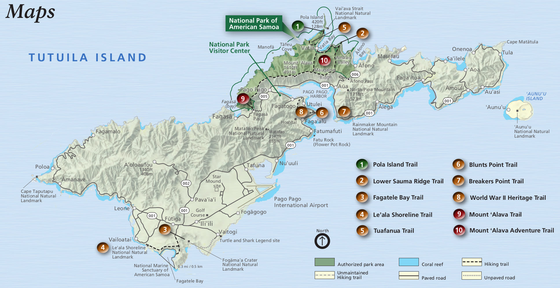
English: This American Samoa map from the newspaper labels points of interest near Pago Pago on Tutuila Island, which is the main part of the park that most visitors go to. |
| Date | |
| Source | U.S. National Park Service (http://npmaps.com/wp-content/uploads/national-park-amercan-samoa-map.jpg) |
| Author | U.S. National Park Service, restoration/cleanup by Matt Holly |
Licensing
edit
| This image or media file contains material based on a work of a National Park Service employee, created as part of that person's official duties. As a work of the U.S. federal government, such work is in the public domain in the United States. See the NPS website and NPS copyright policy for more information. |
File history
Click on a date/time to view the file as it appeared at that time.
| Date/Time | Thumbnail | Dimensions | User | Comment | |
|---|---|---|---|---|---|
| current | 18:35, 13 May 2017 | | 1,936 × 996 (329 KB) | RKBot (talk | contribs) | =={{int:filedesc}}== {{Information |description= {{en|1=This American Samoa map from the newspaper labels points of interest near Pago Pago on Tutuila Island, which is the main part of the park that most visitors go to.}} |date= 2016-02-22 |source= U.S... |
You cannot overwrite this file.
File usage on Commons
The following page uses this file: