File:NPS new-river-gorge-arrowhead-trail-map.jpg

Size of this preview: 800 × 538 pixels. Other resolutions: 320 × 215 pixels | 640 × 431 pixels | 1,024 × 689 pixels | 1,459 × 982 pixels.
Original file (1,459 × 982 pixels, file size: 297 KB, MIME type: image/jpeg)
Captions
Captions
Add a one-line explanation of what this file represents
Summary
edit
| Description |
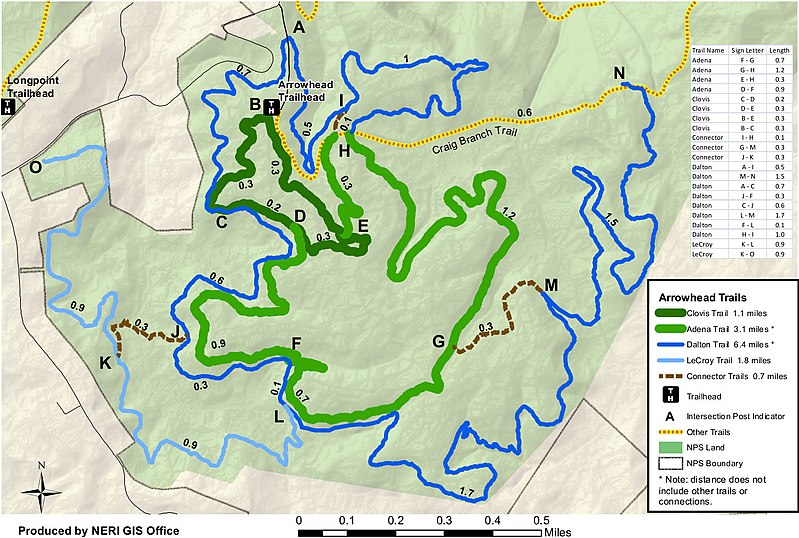
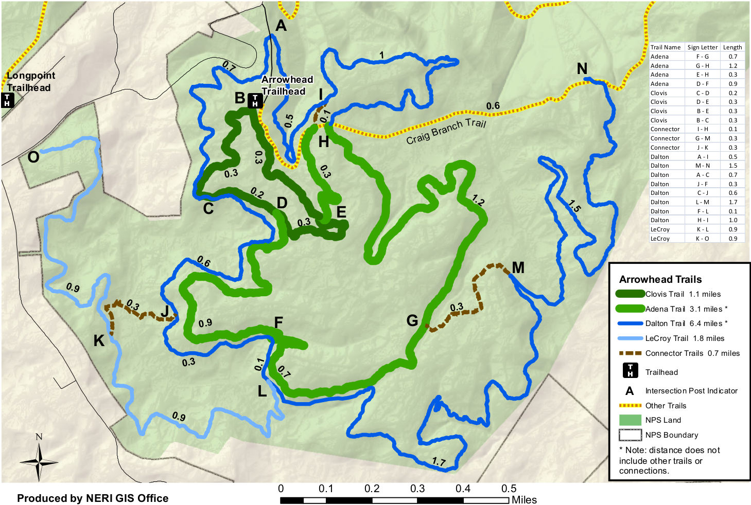
English: Colorful Arrowhead trail map, which I feel is a bit easier to distinguish each of the major loops described in the map above. Distances between each trail intersection are included. |
| Date | |
| Source | U.S. National Park Service (http://npmaps.com/wp-content/uploads/new-river-gorge-arrowhead-trail-map.jpg) |
| Author | U.S. National Park Service, restoration/cleanup by Matt Holly |
Licensing
edit
| This image or media file contains material based on a work of a National Park Service employee, created as part of that person's official duties. As a work of the U.S. federal government, such work is in the public domain in the United States. See the NPS website and NPS copyright policy for more information. |
File history
Click on a date/time to view the file as it appeared at that time.
| Date/Time | Thumbnail | Dimensions | User | Comment | |
|---|---|---|---|---|---|
| current | 01:32, 17 May 2017 | | 1,459 × 982 (297 KB) | RKBot (talk | contribs) | =={{int:filedesc}}== {{Information |description= {{en|1=Colorful Arrowhead trail map, which I feel is a bit easier to distinguish each of the major loops described in the map above. Distances between each trail intersection are included.}} |date= 2017-... |
You cannot overwrite this file.
File usage on Commons
The following page uses this file: