File:NPS new-river-gorge-map.pdf

Size of this JPG preview of this PDF file: 285 × 599 pixels. Other resolutions: 114 × 240 pixels | 228 × 480 pixels | 365 × 768 pixels | 1,279 × 2,687 pixels.
Original file (1,279 × 2,687 pixels, file size: 6.36 MB, MIME type: application/pdf)
Captions
Captions
Add a one-line explanation of what this file represents
Summary
edit| Description |
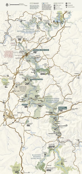
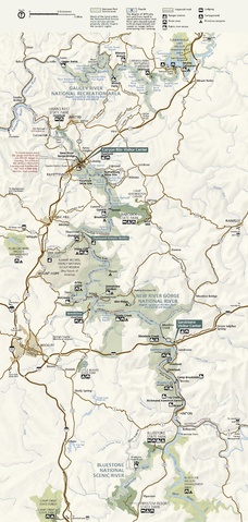
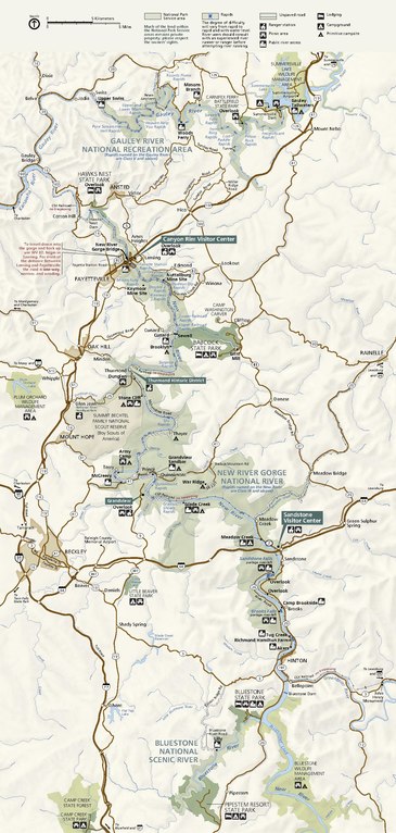
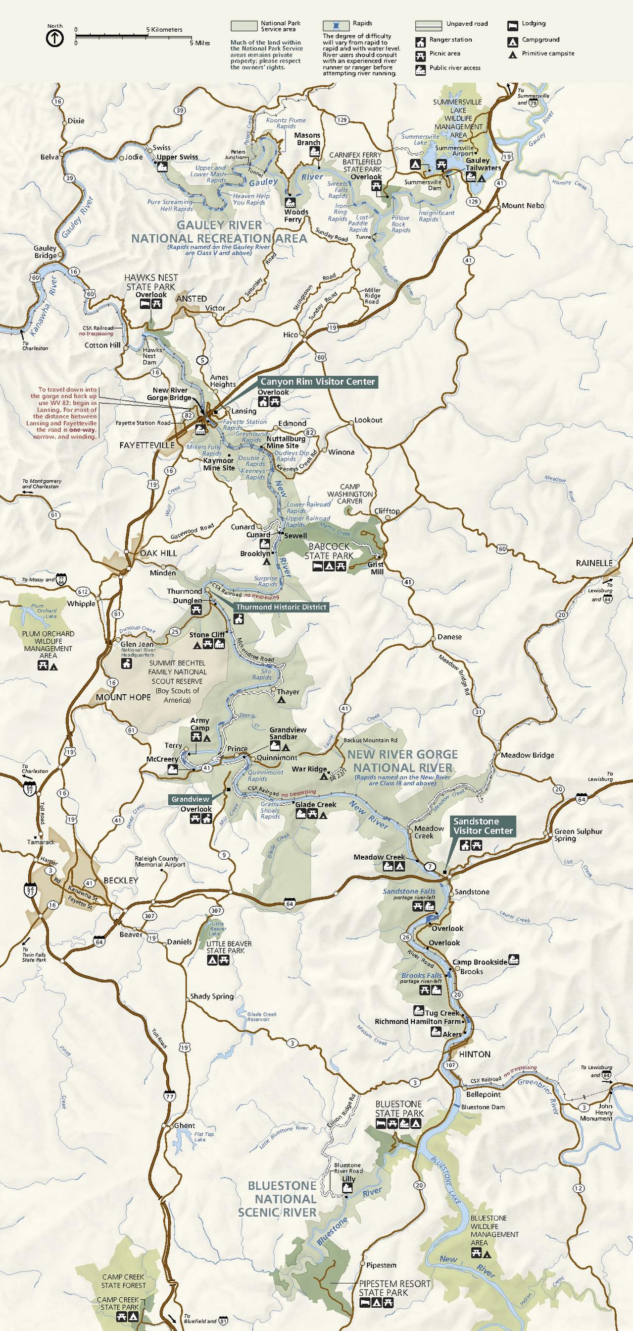
English: Official New River Gorge map, including the park lands as well as surrounding state parks and protected areas. |
| Date | |
| Source | U.S. National Park Service (http://npmaps.com/wp-content/uploads/new-river-gorge-map.pdf) |
| Author | U.S. National Park Service, restoration/cleanup by Matt Holly |
| Other versions |
 |
Licensing
edit| This image or media file contains material based on a work of a National Park Service employee, created as part of that person's official duties. As a work of the U.S. federal government, such work is in the public domain in the United States. See the NPS website and NPS copyright policy for more information. |
File history
Click on a date/time to view the file as it appeared at that time.
| Date/Time | Thumbnail | Dimensions | User | Comment | |
|---|---|---|---|---|---|
| current | 01:31, 17 May 2017 |  | 1,279 × 2,687 (6.36 MB) | RKBot (talk | contribs) | =={{int:filedesc}}== {{Information |description= {{en|1=Official New River Gorge map, including the park lands as well as surrounding state parks and protected areas.}} |date= 2017-04-23 |source= U.S. National Park Service (http://npmaps.com/wp-content... |
You cannot overwrite this file.
File usage on Commons
The following 2 pages use this file: