File:NPS oregon-caves-profile-map.gif

Size of this preview: 776 × 600 pixels. Other resolutions: 311 × 240 pixels | 621 × 480 pixels | 994 × 768 pixels | 1,280 × 989 pixels | 2,560 × 1,978 pixels | 2,860 × 2,210 pixels.
Original file (2,860 × 2,210 pixels, file size: 539 KB, MIME type: image/gif, 0.1 s)
Captions
Captions
Add a one-line explanation of what this file represents
Summary
edit
| Description |
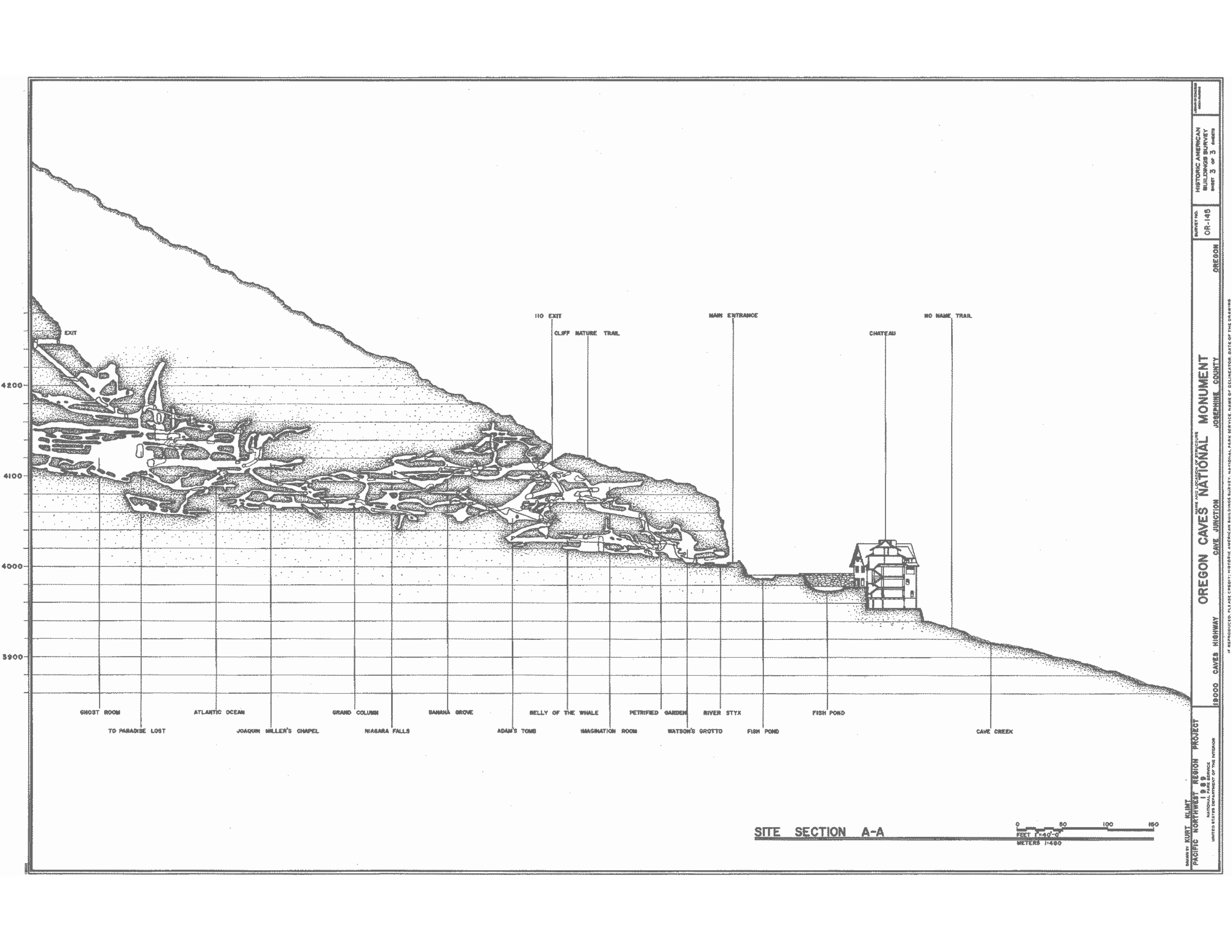
English: This profile map of Oregon Caves500 kb0 is similar to the above map but in much more detail and with more accuracy. It also shows the profile from a different angle than the map above. |
| Date | |
| Source | U.S. National Park Service (http://npmaps.com/wp-content/uploads/oregon-caves-profile-map.gif) |
| Author | U.S. National Park Service, restoration/cleanup by Matt Holly |
Licensing
edit
| This image or media file contains material based on a work of a National Park Service employee, created as part of that person's official duties. As a work of the U.S. federal government, such work is in the public domain in the United States. See the NPS website and NPS copyright policy for more information. |
File history
Click on a date/time to view the file as it appeared at that time.
| Date/Time | Thumbnail | Dimensions | User | Comment | |
|---|---|---|---|---|---|
| current | 01:43, 17 May 2017 | | 2,860 × 2,210 (539 KB) | RKBot (talk | contribs) | =={{int:filedesc}}== {{Information |description= {{en|1=This profile map of Oregon Caves500 kb0 is similar to the above map but in much more detail and with more accuracy. It also shows the profile from a different angle than the map above.}} |date= 20... |
You cannot overwrite this file.
File usage on Commons
The following page uses this file: