File:NPS rocky-mountain-fall-river-trail-map.jpg

Size of this preview: 800 × 486 pixels. Other resolutions: 320 × 194 pixels | 640 × 389 pixels | 1,024 × 622 pixels | 1,280 × 777 pixels | 2,380 × 1,445 pixels.
Original file (2,380 × 1,445 pixels, file size: 462 KB, MIME type: image/jpeg)
Captions
Captions
Add a one-line explanation of what this file represents
Summary
edit
| Description |
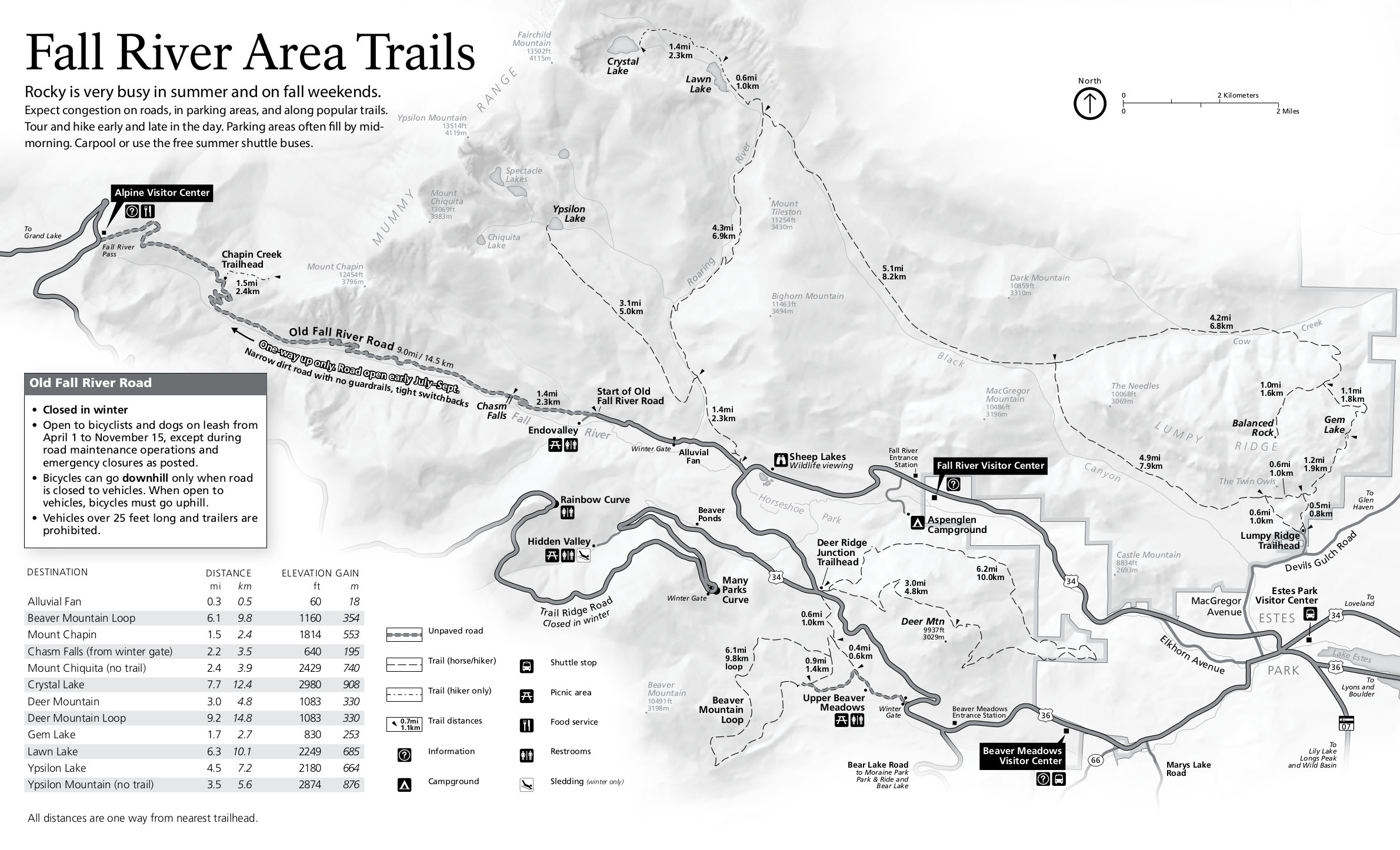
English: The Fall River trail map includes the Old Fall River Road and trails accessed from Upper Beaver Meadows, Deer Ridge, and more. These trails will be less crowded than the ones near Bear Lake. |
| Date | |
| Source | U.S. National Park Service (http://npmaps.com/wp-content/uploads/rocky-mountain-fall-river-trail-map.jpg) |
| Author | U.S. National Park Service, restoration/cleanup by Matt Holly |
| Other versions |
 |
Licensing
edit
| This image or media file contains material based on a work of a National Park Service employee, created as part of that person's official duties. As a work of the U.S. federal government, such work is in the public domain in the United States. See the NPS website and NPS copyright policy for more information. |
File history
Click on a date/time to view the file as it appeared at that time.
| Date/Time | Thumbnail | Dimensions | User | Comment | |
|---|---|---|---|---|---|
| current | 02:02, 17 May 2017 | | 2,380 × 1,445 (462 KB) | RKBot (talk | contribs) | =={{int:filedesc}}== {{Information |description= {{en|1=The Fall River trail map includes the Old Fall River Road and trails accessed from Upper Beaver Meadows, Deer Ridge, and more. These trails will be less crowded than the ones near Bear Lake.}} |da... |
You cannot overwrite this file.
File usage on Commons
The following page uses this file: