File:NPS saint-croix-river-map-9-high-bridge.jpg
Size of this preview: 443 × 600 pixels. Other resolutions: 177 × 240 pixels | 355 × 480 pixels | 567 × 768 pixels | 756 × 1,024 pixels | 1,528 × 2,068 pixels.
Original file (1,528 × 2,068 pixels, file size: 562 KB, MIME type: image/jpeg)
Captions
Captions
Add a one-line explanation of what this file represents
Summary
edit
| Description |
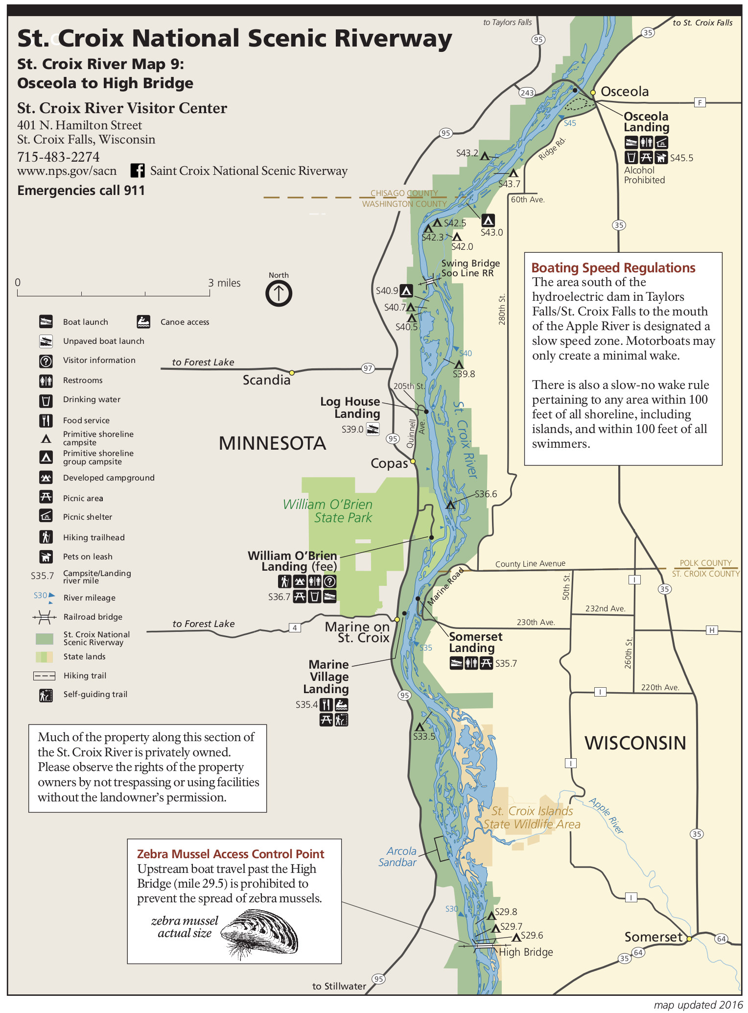
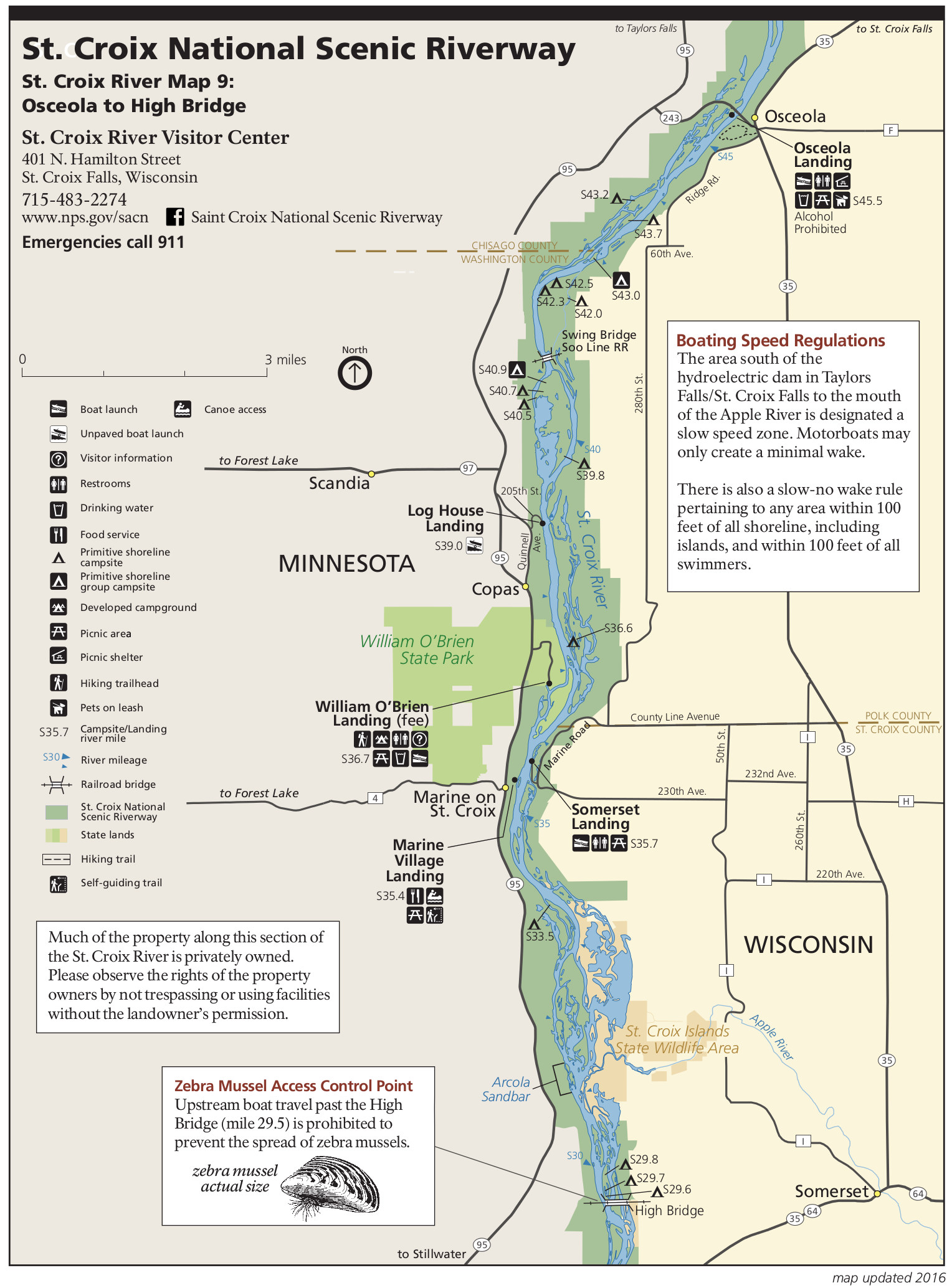
English: Map 9: The Saint Croix River now flows almost completely due south, and this map shows Osceola Landing to the High Bridge, including St. |
| Date | |
| Source | U.S. National Park Service (http://npmaps.com/wp-content/uploads/saint-croix-river-map-9-high-bridge.jpg) |
| Author | U.S. National Park Service, restoration/cleanup by Matt Holly |
Licensing
edit
| This image or media file contains material based on a work of a National Park Service employee, created as part of that person's official duties. As a work of the U.S. federal government, such work is in the public domain in the United States. See the NPS website and NPS copyright policy for more information. |
File history
Click on a date/time to view the file as it appeared at that time.
| Date/Time | Thumbnail | Dimensions | User | Comment | |
|---|---|---|---|---|---|
| current | 02:12, 17 May 2017 | | 1,528 × 2,068 (562 KB) | RKBot (talk | contribs) | =={{int:filedesc}}== {{Information |description= {{en|1=Map 9: The Saint Croix River now flows almost completely due south, and this map shows Osceola Landing to the High Bridge, including St.}} |date= 2016-07-01 |source= U.S. National Park Service (ht... |
You cannot overwrite this file.
File usage on Commons
The following page uses this file: