File:NPS shenandoah-geologic-map.jpg

Size of this preview: 418 × 599 pixels. Other resolutions: 167 × 240 pixels | 335 × 480 pixels | 536 × 768 pixels | 715 × 1,024 pixels | 1,430 × 2,048 pixels | 3,600 × 5,156 pixels.
Original file (3,600 × 5,156 pixels, file size: 5.35 MB, MIME type: image/jpeg)
Captions
Captions
Shenandoah geologic map
Summary
edit
| Description |
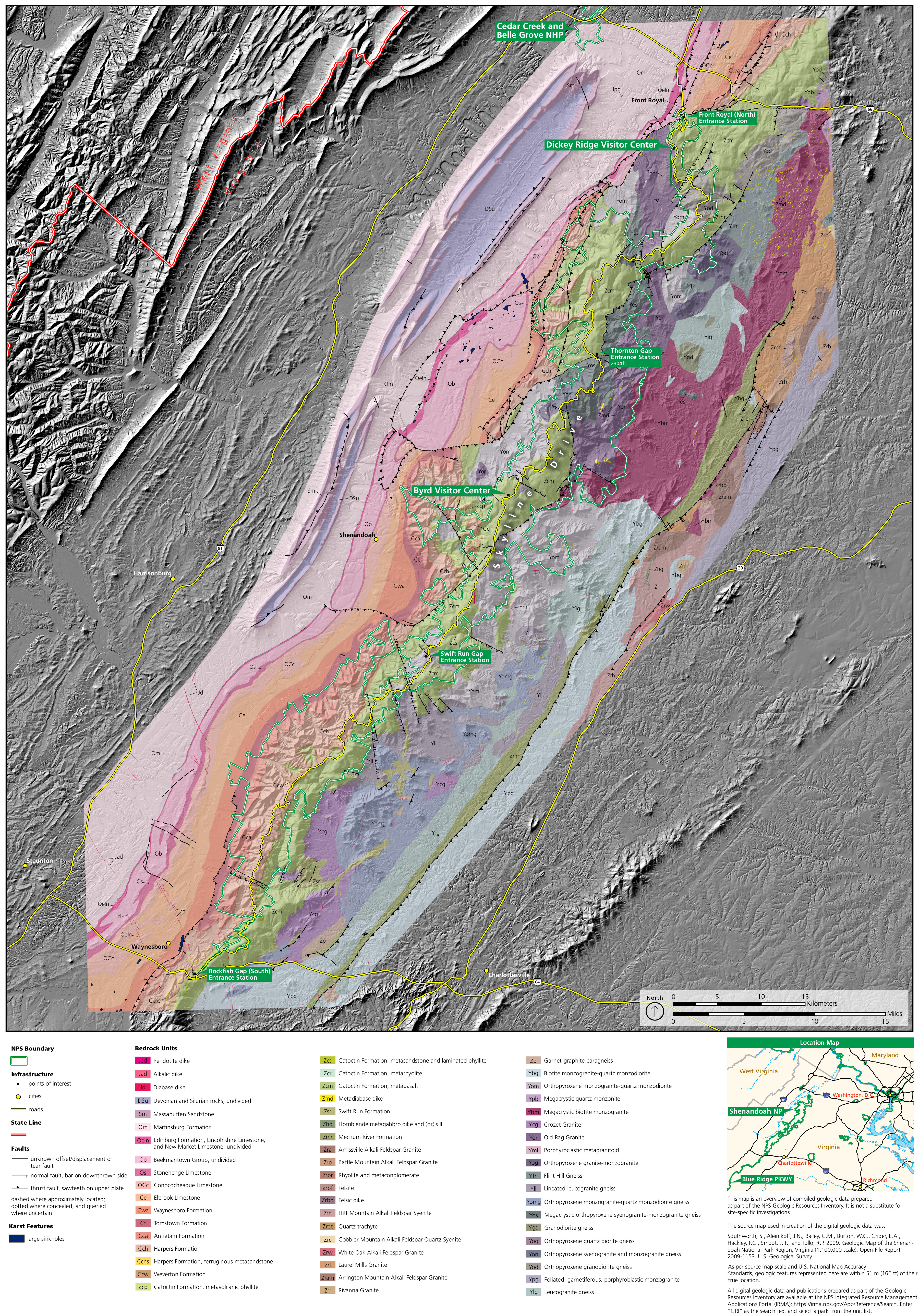
English: Shenandoah geologic map, which helpfully includes Skyline Drive and visitor centers to help orient you to the exposed rock layers labeled on this map. |
| Date | |
| Source | U.S. National Park Service (http://npmaps.com/wp-content/uploads/shenandoah-geologic-map.jpg) |
| Author | U.S. National Park Service, restoration/cleanup by Matt Holly |
Licensing
edit
| This image or media file contains material based on a work of a National Park Service employee, created as part of that person's official duties. As a work of the U.S. federal government, such work is in the public domain in the United States. See the NPS website and NPS copyright policy for more information. |
File history
Click on a date/time to view the file as it appeared at that time.
| Date/Time | Thumbnail | Dimensions | User | Comment | |
|---|---|---|---|---|---|
| current | 09:33, 17 May 2017 | | 3,600 × 5,156 (5.35 MB) | RKBot (talk | contribs) | =={{int:filedesc}}== {{Information |description= {{en|1=Shenandoah geologic map, which helpfully includes Skyline Drive and visitor centers to help orient you to the exposed rock layers labeled on this map.}} |date= 2017-01-20 |source= U.S. National Pa... |
You cannot overwrite this file.
File usage on Commons
The following page uses this file: