File:NPS shenandoah-simple-map.jpg

Size of this preview: 207 × 597 pixels. Other resolutions: 83 × 240 pixels | 166 × 480 pixels | 875 × 2,525 pixels.
Original file (875 × 2,525 pixels, file size: 244 KB, MIME type: image/jpeg)
Captions
Captions
Add a one-line explanation of what this file represents
Summary
edit
| Description |
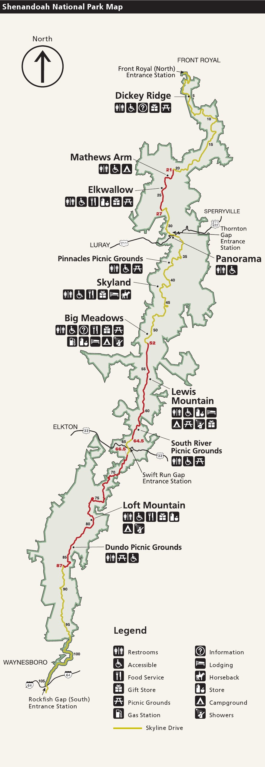
English: Simple map of Shenandoah National Park, showing just Skyline Drive and the major developed areas along its route. This is the simplest map for printing that shows the major park facilities. |
| Date | |
| Source | U.S. National Park Service (http://npmaps.com/wp-content/uploads/shenandoah-simple-map.jpg) |
| Author | U.S. National Park Service, restoration/cleanup by Matt Holly |
Licensing
edit
| This image or media file contains material based on a work of a National Park Service employee, created as part of that person's official duties. As a work of the U.S. federal government, such work is in the public domain in the United States. See the NPS website and NPS copyright policy for more information. |
File history
Click on a date/time to view the file as it appeared at that time.
| Date/Time | Thumbnail | Dimensions | User | Comment | |
|---|---|---|---|---|---|
| current | 09:33, 17 May 2017 | 875 × 2,525 (244 KB) | RKBot (talk | contribs) | =={{int:filedesc}}== {{Information |description= {{en|1=Simple map of Shenandoah National Park, showing just Skyline Drive and the major developed areas along its route. This is the simplest map for printing that shows the major park facilities.}} |dat... |
You cannot overwrite this file.
File usage on Commons
The following page uses this file: